EUROPEAN OIL COMPANY ROAD MAPS
Index to Major Brands
We've moved!As you can see this message you're on the new www.petrolmaps.co.uk URL. If you have any favourites bookmarked or links to pages using www.ianbyrne.free-online.co.uk, you'll need to update them as the old addresses will only work for a few weeks more. |
A
B
C
D
E
F
G
H
I
J
K
L
M
N
O
P
Q
R
S
T
U
V
W
X
Y
Z
LPG Garages Lubricants Hypermarkets with petrol Brands with no known maps
No-one knows how many European Petrol Companies have issued road maps. Over 200 different names are known, but with relatively few collectors - especially in Southern Europe - there may be many more. One thing is certain: there are many fewer than in North America where over 600 different brands of gasoline appear on maps.
Shortcuts directly to the pages for the most popular brands:
Aral | BP | Caltex | Esso | Mobil | Shell | Texaco | Total
The table below lists the brands shown on this site:
MAIN BRAND
|
|
|
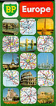
A 1982 BP map of Europe. |
|
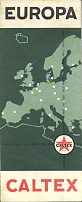
A 1960 Caltex map of Europe by Kümmerley & Frey. The reverse has lists of populations, capital cities, highest mountains & longest rivers as well as more common matters such as grades of Caltex fuel & oil and phrases in 8 main languages. |
|
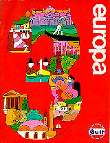
Gulf issued 3 softback atlases covering all of Europe to complement their national map programmes in the early 1970s. |
|
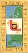
This design was used for 1956-7 Shell maps of Europe. Mairs provided a map at the small scale of 1:5 million, with a mileage chart and route planning map on the reverse for 1957 and list of main Shell touring stations in 1956.
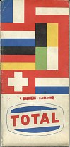
In place of an all-Europe map, Total published a Michelin map covering "8 capitals of Europe". Unusually for a small scale map it marked towns with Total garages, even though it lacked town plans of the capitals. The example shown is from 1963; later issues covered 13 capitals, omitted service station locations and were based on Freytag-Berndt maps. |
Please let me know if you have maps from any other brands!

Text and layout © Ian Byrne, 2000-20
All original copyrights in logos and map extracts and images are acknowledged and images are included on this site for identification purposes only.