Petrol Company Road Maps from Turkey |
Although split between Europe and Asia, Turkey's downstream petrol industry has much in common with the rest of Europe, even though its oil refining industry has been under the control of a de facto monopoly company, Tüpras. Traditionally the market has been led by a local brand, Petrol Ofisi which was for many years associated with Caltex and was sold by the Government to local investors in 1998. In early 2006 the Austrian company OMV took a 34% stake in the company. Shell and BP also supplied chains of service stations, with Mobil representing the former Standard Oil interests as elsewhere in the Eastern Mediterranean. The fifth main player was another local company, Turkpetrol, which was established in 1931 and controlled by the UK's BurmahCastrol for a number of years, before being sold to Tabas, the local affiliate of Conoco (Jet) in 1999. Aksoy bought out ConocoPhillips' interest in 2005, but merged the chain into a joint venture Shell just a year later, leading to its 650 stations switching brand.
As far as maps go, most oil company issues in collections seem to date from the late 1950s through to the early 1970s, when the country was first becoming accessible to self-drive tourists from the main Western European countries. Local cartography predominates, with locally printed maps often being on slightly poorer quality paper than would normally be used elsewhere, although of a distinctly higher quality than in the Eastern bloc countries.
Maps
No maps issued by oil companies are known from before the Second World War.
|
|
The older Petrol Ofisi map dates 1955 and is at the small scale of 1:2,600,000, marking towns with a Petrol Ofisi station by its wolf's head. It appears to have been designed by Zeki Basar, but printed by Apa Ofset Basimevi. Internal panels show typical filling stations as well as a tanker fuelling an aircraft. The later map is from 1963; it celebrates the company's activities since 1941 with a cover design including fighter planes, a tank and road vehicles, as well as a small Caltex logo. |
 |
This undated Türkpetrol booklet map is the only map known from the company, although it is likely that other titles exist. It shows projects planned for 1966-7, and has none pages of low-detail maps, and includes Türkpetrol station locations, lists of cities with mileages, historic places and hotels. It is in Turkish with some info in English, German & French and has an advert for Castrol on the back. |
 |
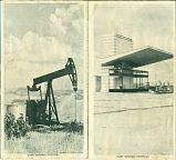 |
The TPAO (Türkiye Petrolleri A.O.) map above right is dated 1964. Again it is in Turkish, but the legend has an English translation. TPAO was the state-owned petroleum company, and although it is not known to have supplied service stations directly, the photographs inside appear to show a TPAO petrol station, so it may had a limited or short-lived operation before concentrating on refining and production.
Possibly the oldest known Mobil map of Turkey is this 1963 issue which marks all Mobil Stations with a red Pegasus. Printed locally by Morova Ofset Basimevi at a scale of 1:2 million it is in Turkish and English, but with a the rear devoted to English-only descriptions of main tourist sites, illustrated by attractive watercolours. The map carries a printing tax stamp for 1 kuruş. |
 |
|
|
|
|
|
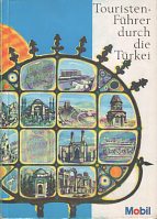
The next Mobil map (above left) is undated, but broadly follows the international style for the early 1960s. Next comes a January 1965 issue that almost loses the Mobil logo through the highly unusual use of a transparent background. This map, at 1:2.2mn, was printed by Apa Ofset Basimevi but credits no cartographer; the reverse side is called "Turkey Land of Sunshine and History", and has large colour photos above English descriptions of key tourist attractions. A 1972 A5 book (centre) is known in both English and German versions. It has 64 pages printed in colour on glossy paper describing the main tourist regions; this is followed by 32 pages of maps, a list of towns with Mobil service stations and a climate chart. The guide was sold for TL 28 or US$2 (English edition) or DM7 (German edition).
The Istanbul issues are unusual in that no Mobil logo appears on the front cover, though like the BP Istanbul map below there is a Mobil logo on the rear. The white cover issue marks Mobil stations on the map; the blue cover issue has a pictorial map inside that would be of little use for drivers and describes principal sights in German.
White cover Mobil Istanbul image courtesy of Dave Leach; early 1962s issue courtesy of Jon Roma
|
|
|
|
|
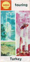
The Shell map (above left) dates from 1960 and represents a slight variation from the normal international cover style: the cover itself is of light card pasted over a locally produced map. My copy has two postage-style stamps on the rear to show local taxes have been paid on the map.
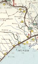
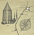
The next two images come from the December 1961 map of Turkey, showing how the cover design wrapped round onto the rear cover (which carried the name in Turkish). Internally, a good quality map at 1:1,850,000 marked all Shell stations (which were quite dense near Mersin) and coloured roads according to condition: note how the Eastern branch of E5 is white, signifying a graded or unimproved road. Turkish road signs (which followed the US not European pattern) were shown, as well city plans for Istanbul and Ankara, and a summary of main tourist sights in Turkish and English.
The final map of the entire country shown dates from 1963, and follows the general international cover style, although it was printed locally on relatively poor quality paper using the same cartography as in 1961. The reverse cover had different images and carried the country name in Turkish.
In the mid or late 1960s, Turkish Shell issued a number of strip maps showing main tourist routes. Apart from selected tourist facilities and Shell service stations, these maps showed almost no detail!
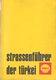
These images below are taken from a Shell guide, that appeared as "motorist guide to turkey" in English (in khaki covers), and "strassenführer der türkei" in German (in yellow covers, as shown).
|
|
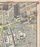
Each paperback consisted of 196 pages of gazetteer, illustrated by line drawings, then 30 pages of town maps (in a semi-pictorial style, as can be seen from the Ankara extract) and 32 pages of regular maps, both marking Shell stations. Both my copies have a rubber stamp indicating the information is accurate as at 1969, and the covers are printed with a price of TL17.50, although the German version is over-stickered "for free distribution" (in English!). My copy of the latter also has a printing error, with several pages unintentionally blank. |
|
|
|
|
|
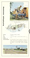
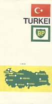
Almost uniquely in Europe, BP maps are among the most commonly found ones of Turkey. This is partly due to the relatively small number of companies operating there in the 1960s, but also due to BP's Mocamps. These were large, modern camping sites owned and operated by its subsidiary Kervanseray A.S. (= caravanserai, in English) which had a reputation among European campers for luxury unrivalled almost anywhere else on the continent. BP's road maps gave over the entire reverse side to panels advertising Mocamps, illustrated with colour and black & white photos. A surprising number of tourists drove the long distances across the generally unwelcoming Balkans to reach these fabled Eastern outposts of tourism in the days before cheap air travel made Turkey a commonplace destination. To allow for the maximum space to be given over to describing Mocamps, BP uniquely prepared versions of its Turkish maps in different languages including English and German. The examples are from 1964, 1965 (Mocamp advertising),1966 and 1967. The first map was at 1:2.25mn, with the newer ones at 1:1.85mn - note how the cover size increased twice.
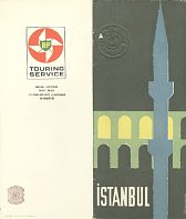
The final map is possibly from 1960 and limited to just Istanbul. Here the descriptions of the city (no mention of Mocamps) are again in English, although the map is in 4 languages and marks BP stations. All the BP maps were prepared locally by M. Kerim Çalapverdi.
|
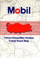
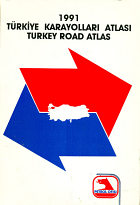
The only relatively recent petrol company maps of Turkey known both take the format of road atlases. Mobil sold the first example shown (left) in 1990.
|
|
In recent years, there has been something of an explosion in car numbers, with numbers almost trebling since the late 1980s. This has led to a rapid growth in the number of service stations, many supplied by independent names, of which OPET, Petline, Turkuaz/Turquoise (Tuta), MOil, Alpet and formerly Bolunmez are among the largest. Several of these have grown substantially by using Iraqi oil imported across Turkey's Southeastern land border. The Aytemiz group used its own name from 1963 on a rapidly growing chain, before switching its 700 stations to the Akpet brand in March 2006, then selling the chain to Russia's Lukoil just over two years later. The French companies Total and Elf (now merged) have also entered the retail petrol market. A local company started using the Delta brand on filling stations in 1999, but has now become the local licensee of the Gulf brand. |
|
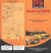
The nearest to a recent map that I can find is this leaflet from Kartaltepe Petrol Ticaret A.S. which operates two Petrol Ofisi branded service stations to the West of Istanbul; the rear cover has a rudimentary map showing their locations. It was probably printed around 2008.
It is far from certain whether other companies have issued maps. If you have a map from any of the more recent entrants to the market and could send me a scan of such a map, or - better still - the map itself, then please send me an e-mail!
Text and layout © Ian Byrne, 2004-13
All original copyrights in logos and map extracts and images are acknowledged and images are included on this site for identification purposes only.


