MOL
Brief History
MOL Magyar Olaj- és Gázipari Rt. was set up in 1992 to take over the bulk of the Hungarian oil industry, including many of the service stations previously under the state-owned Áfor brand, which was finally phased out in 1997. It soon moved into neighbouring countries including Slovakia, Romania, Croatia and the Ukraine, and in 2000 bought 49% of Slovnaft, the Slovak oil company. MOL retains around 40% of its domestic market through a network of over 370 filling stations. MOL also owns 25% (plus one share) of INA, the Croation oil company. In 2007 the Austrian company OMV attempted to acquire MOL, but it was rebuffed and sold its stake two years later.
Maps

|
|
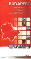
In December 1997 Híd Marketing prepared the map (far left) for free distribution by MOL. Drawn to a scale of 1:550,000 using good modern cartography, it marks all places with MOL stations and has 24 town plans on the reverse, again locating MOL outlets. Addrersses and hours of opening are given for all MOL locations, including those in Romania, Slovakia and the Ukraine. Budapest map image courtesy Michal Okonek |
|
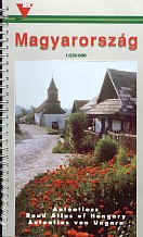
The spiral-bound atlas (above centre left) is the second edition of 2000 by DIMAP of Budapest. It has 82 pages of detailed maps at 1:250,000, followed by town plans and an extensive index. | |||
|
|
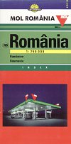
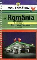
In Romania, MOL is the largest new entrant, having expanded by buying Shell's operations in 2004. Its 1999 sheet map at 1:750,000 has good detail, including relief shading for mountains, and locates MOL's service stations with its logo. There is a booklet of place names stapled inside a high gloss card cover. Like its Hungarian counterpart, the road atlas is spiral-bound without locating MOL sites. However it is at the smaller scale of 1:500,000 and includes 16 pages of general European maps and 12 of Romanian city plans. Both were prepared by the largest Hungarian map-maker, Cartographia. |
|
Maps: ÁFOR
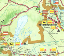
ÁFOR did sometimes issue maps of its own, as in this 1974 map example. 100,000 copies of this map were printed by Kartográfia Vállalat which marked both Áfor and Áfor-Agip stations of which there were just 8, including the two shown on the map extract near the Austrian border, 3 in Budapest and 2 by Lake Balaton. Áfor stations servicing cars had a red triangle and those selling Agip lubricants also had a red disc. The rear cover advertised both Áfor's Multiszuper oil and Agip's F.1 Supermotoroil. |

|
|
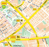
By 1987 Áfor was printing its maps on a low quality glossy paper that scuffs easily. A map by Merényi Tibor covered Hungary at around 1:825,000 on one side; the reverse carried a large map of Budapest, from which a small extract is shown. In addition to Áfor and Áfor-Agip stations, it now marked Áfor-BP locations but, significantly, not Shell sites, which had expanded rapidly in number. The size of the logos indicated whether stations were open 24 hours or not. Selected stations were listed inside if they accepted Diesel-coupons or sold 95 octane (unleaded?) fuel. |
 |
 |
No MOL branded maps are known from other countries,
Text and layout © Ian Byrne, 2001-13
All original copyrights in logos and map extracts and images are acknowledged and images are included on this site for identification purposes only.

