AVIA
Brief History
AVIA is a brand co-operatively owned by around 100 independent oil companies in nine or more European countries. It was established in Switzerland in 1927 as a response to aggressive competition by the majors, and the concept has been gradually extended to most main European markets. Many independent names have disappeared into AVIA, although there have also been a few start-ups carrying the brand from day 1, particularly in newly liberalised markets such as Spain or Eastern Europe. AVIA has been most successful in Germany, Switzerland and France; in contrast the UK operation remained very small and was ended before 2000. The brand is co-ordinated by AVIA International, based in Zurich, and there are national AVIA organisations in each country where it operates. This link is used as an indicator of quality on the 2005 Belgian map shown midway down the page, where the strapline "The swiss label" is used next to a small Swiss flag.
Maps
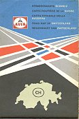
Road maps are generally issued by the national organisations. Thus maps of Germany, Switzerland and France are not uncommon, whereas the British operation never produced a road map. An AVIA map of Britain does exist, but it is a cross-border issue from the German national organisation. Earliest maps carry a "propeller" logo; later ones the classic "space rocket" logo and the most recent maps carry simplified logos. As each national organisation is responsible for its own maps, there are a wide variety of styles and cartographers.
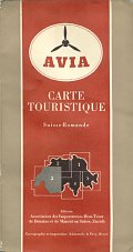
In 1953, Avia was still then known as the Association des Importateurs Hors Trust de Benzine et de Mazout en Suisse when it issued the map shown below as part of a set of 5 covering Switzerland.
|
|
Sold in the unusual format of a three panel loose card cover with adverts inside and on the rear, including ones for service station equipment and JSO scooters, with a 16 page brochure detailing sites of touristic interest in the Suisse Romande. The map itself - specially printed for Avia - was loose inside the cover, and printed on the reverse with a gazetteer for other cantons. Prepared by Kümmerley & Frey at 1:200,000 it is the only petrol company map known to show contours, at 100m intervals. |
|
|
|
|
|
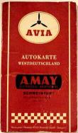
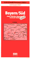
(L-R) A mid 1950s Avia map of Germany (West) shows the older AVIA logo and was issued by A May of Schweinfurt, one of the largest German AVIA participants. Next is a mid-1960s JRO sectional map of West Germany; there were 10 small format sheets at the generous scale of 1:300,000 sold in a vinyl wallet. Finally AVIA maps in Germany were still on sale as late as 1990, this section 7 has an AVIA card cover pasted over a Kümmerley & Frey stock map. |
|
Three of the four maps shown cover half of France at 1:1 million, using standard Michelin cartography and retaining their section numbers (996 for the North, 999 for the South). The first dates from 1958, and the other two from 1970 and 1977, although the pale blue design was used throughout the 1960s. The second map is an exception as it covers all of France on a single sheet at the very small scale of 1:2,666,666 and was created by Gaston Maillet. |
|
|
|
|
|
The cover design was similar (but not the typeface), being chosen by AVIA not the cartographer, and it is undated, but from around 1959. The blue cover maps sometimes have a pre-printed price, but this is not found on the later ones. Note how the 1977 AVIA logo had been modernised, with France using a red & green symbol - most other countries had a red bar in lieu of the green. |

|

|
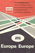 |
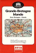
In the 1980s the AVIA co-ordinating body in Switzerland retained Hallwag to produce maps covering most of Europe, including the continent as a whole (left, date uncertain). These were continued as late as 1988, when the map right was produced showing Britain and Ireland. By then AVIA had 5 participants supplying just over 100 outlets in the UK, but these maps were never sold there. Indeed the example shown was bought from an AVIA station in Linz, Austria as late as March 2002, fourteen years after it had been printed. |
 |
|
|
 |
 |
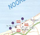 |
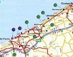
By January 2008, the date of the map above right, all had disappeared, possibly to the new brand Heite, and one of the Octa+ stations had closed. The map, by de Rouck Geocart, now showed several Power locations - at which Avia cards could be used - with green blobs. |
 |
|
|
This A5 booklet of Germany was issued in November 2004 and is described as being the 2004/2005 AVIA Tankstellenverzeichnis (filling station network). But it is actually a high quality road map in booklet format at the scale of 1:800,000, with 40 pages of maps by GeoGraphic Media (based on Digital Wisdom). AVIA locations are marked by the company logo, and there is a complete address listing of their outlets in rear. This reveals how AVIA is unevenly split across the country - so although there are over 30 stations within a 30km radius of Papenburg (near the Dutch border) there are none in Berlin, Hamburg or Köln. |
|
This booklet exists in at least two versions; one with generic AVIA advertising on all the covers, and a second version where the inside and rear covers advertise Knittel Mineralöle; it is not known if versions exist for other AVIA participants. Knittel trace their origins back to 1877, but have been supplying service stations for over 50 years, at various times using DEA, BP and their proprietary Fulmin brand. A 1990s DEA-Knittel town plan of Fulda is shown on the DEA page. These days they supply over 60 AVIA stations, 20 under Shell colours (mentioned in the Knittel version as accepting AVIA cards) plus a BFT and an unbranded station. |
|
|
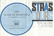
There are very occasional maps from individual AVIA participants (independent companies carrying the brand). Ste Propetrol issued a simple map of its home town, Strasbourg, in the late 1970s, shortly before being sold to Aral. |
|
|
Although not strictly a road map, this 1950s (?) sliding Distance Indicator of Switzerland comes from Ernst Hürlimann, one of the Big 3 Swiss Avia participants (click to enlarge). The rear carries an advert for Hürlimann's Rollsynol motor oil. |
As a relatively small brand in most of its countries of operation, AVIA sometimes advertised on commercial map issues instead of producing its own maps. This website has examples from Dutch and German maps.
The next page shows a selection of pre-war German maps from predecessor brands to AVIA produced before World War II.
Text and layout © Ian Byrne, 1999-2013
All original copyrights in logos and map extracts and images are acknowledged and images are included on this site for identification purposes only.




 The AVIA map left was issued to its credit card holders in Belgium in February 2000. As one AVIA participant (nv Brouw sa) had recently merged with Octa+ and acquired the former Burmah chain, the map shows stations from both brands. The map by Geocart-Claus below left was quite basic. Comparing this extract with the one on the