 German independents from the 1950/60s: A-G
Autol | Bolco | Cidisol/Disolin | Esslin Tank | GD
Several smaller German brands issued maps in the 1950s and 1960s, sometimes in partnership with Uniti. This pages looks at examples from A to G; the next two pages cover the letter H and the rest of the alphabet. As well as the examples shown on these three pages, Eller Montan is understood to have sold its own branded maps and there are ones from larger names such as Deltin, Montan Union, Stinnes Fanal, Rheinpreussen, Rückwarth and Westfalen.
AUTOL
Brief History
Autol was established in 1901 and by the 1950s had its head office in Hannover, with domestic branch offices in Würzburg, Haltingen, München and overseas branches in Switzerland, Italy, France and Luxembourg. Its most important product was "Desolite", an additive for the petrol/oil mixtures commonly used at the time in motorcycles and two-stroke cars. However it also sold a full range of lubricants, and supplied a small number of filling stations with petrol under the Autol brand. In common with many other small petrol distributors, it was permitted one autobahn service station, at Würzburg Sud, which later became Autol-Ufrol. It is thought that it continued to supply as many as 70 filling stations right up to the time it was acquired by Agip in the early 1990s. Agip continues to use the Desolite name in Switzerland on its fuel additives.
|
|
Maps
|
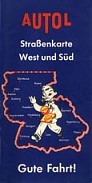
 Autol is best known for its sunburst logo and its long running series of colourful calendars. Its maps are hard to find, and little information is known about the one shown here, other than it probably dates from the 1950s and covered just the Southern half of West Germany.
BOLCO
|
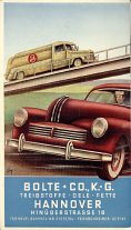
Nothing is known about Bolco other than the information on this map. Bolte + Co., K.-G. was based in Hannover and sold fuels, oils and fats. No mention is made of any links to the Uniti trade association. |
|
|
CIDISOL/DISOLIN
|
|
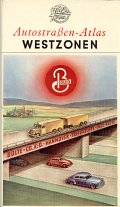
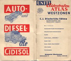
C.J. Diederichs Söhne of Wuppertal-Oberbarmen were a member of the Uniti association when they published this map around 1953. From the information on the cover, Diederichs were wholesalers, importers and suppliers to petrol stations; their main brand name for motor oils - advertised on the rear cover - was CIDISOL, and their petrol probably used the name Disolin (or may have been unbranded, or under the Uniti identity, or some combination of names). The map itself was the 19th edition of the patent folded Falk-Plan of West Germany at 1:650,000 pasted into laminated light card covers. |
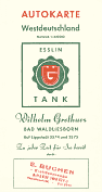
ESSLIN TANK
Brief History
Esslin Tank is only known today by the map shown here. It was based in Bad Waldliesborn, just North of Lippstadt in Westphalia, although the copy of the map shown here appears to have been given away by a dealer in Ahlen, about 40km to the West. Esslin Tank appears to have been a trading name of Wilhelm Grothues, and the Grothues name is still used at an unbranded filling station on the Eastern edge of Lippstadt (which now focuses on car care) and a BP station in Bad Waldliesborn until at least the mid-2000s. Note how the logo in the shield is made up from the initials WG.
|
MapsThe map was produced by JRO of München in the early 1960s, like many for the very smallest petrol companies. Despite saying "Westdeutschland" on the cover, the actual map is one of JRO's sectional titles, covering an area from Essen in the West to Hameln in the North-east corner at a scale of 1:300,000. This conveniently places Lippstadt in the centre of the map, which extends around 75km from the town. The map is printed on one side only, and only one panel on the reverse carries the two colour printed panel advertising the issuer; unlike many JRO maps, there are no card covers. |
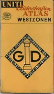
GD
Brief History
Nothing is known about GD other than the information that can be gleaned from the map below. The company's name was Gebrüder Didillon and it was based at Wuppertal-Barmen. A member of the Uniti trade association, it had 14 filling stations in 1953.
MapsThis atlas of Germany was prepared by Falk-Plan for Uniti in 1953, and carries the logo for GD (Gebrüder Didillon) on its cover. The rear cover carries an advertisement for Veedol motor oil. Image courtesy of William Phillips. |
|

Text and layout © Ian Byrne, 2000-7
All original copyrights in logos and map extracts and images are acknowledged and images are included on this site for identification purposes only.