ELF
Antar, La Mure, Serco
Brief History
The French Government created Elf-Erap in 1967 as a second national champion in the oil industry. Downstream its principal assets came from Caltex and the smaller chain of RAP, which had been formed by the Government in the late 1930s to exploit gas finds in South West France as Régie Autonome des Petroles. Elf soon added small retail chains in Germany and the low countries and in late 1974 acquired Occidental's VIP and OXY chains in Britain and Germany. In 1976 Elf was merged with Antar-Pètroles de l'Aquitaine to form the Société National Elf Aquitaine which with over 6,000 outlets became France's second largest petrol retailer. Smaller purchases have included La Mure, Lacq, Nervol, Glorex and Miroline in France, retail networks in Switzerland and Italy, Amoco and Heron in Britain and BP's service stations in North and West Africa. In 1991 Elf acquired a near half-share of the Spanish firm Cepsa, and in 1992 it was the surprise purchaser of the old East German Minol monopoly operation.
In 2000, Elf was itself acquired by TotalFina, to form the triple-barrelled company TotalFinaElf, and plans were soon drawn up to withdraw the Elf name. Soon after 2003 the Elf name had almost completely disappeared from its core markets but the fuel brand was repositioned in France as a discount chain under a new blue and yellow image - it now has around 300 service stations, mainly on the outskirts of cities. Total also rationalised Elf's secondary brands, with only Elan remaining in use in France (and on a small scale in selected other markets), and names such as Antur Fuels being abandoned in the UK.
Maps: Elf
|
|
|
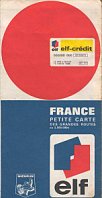
Elf and its affiliates have never been prolific map issuers and the most commonly found maps are the series (left) of four sectional maps of France from 1967-8. Cartography is by Foldex France and station locations are marked with blobs. Also from 1967, but rarer, is a single "Petite Carte des Grandes Routes" at 1:2,500,000 produced by Michelin. This locates the 1,300 sites accepting Elf credit cards, with the confident prediction that there will be 3,000 such stations by 1969. |
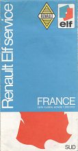 |
French petrol companies developed close links with car manufacturers, and Elf chose to work with Renault. This map (right) was produced for them as a Selection of the Reader's Digest, using IGN base cartography in 1972. North & South were on reverse sides. | |||
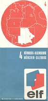 |
A set of four maps with a similar cover design to the French sectional maps was issued in West Germany (left) in 1969, using cartography by Ravenstein at 1:400,000. |
|
|
|
This Elf map of the Netherlands is much later, dating from Spring 1993. Typically for Dutch maps, it is a tall format Falkplan map at 1:300,000 pasted into custom card covers; the black covers used by Elf to match its filling stations often show white crease marks. |
|
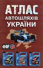
An Elf map is known from Luxembourg and examples may also exist from other countries. As late as May 2002 a map was produced in Germany carrying both the Elf and Total logos and showing the location of all their service stations; this is shown on the Total page.
Maps: Antar
Antar's origins go back to 1745 (!) in the region of Alsace as Merkwiller-Pechelbronn and it is thought that this company marketed before World War II using the brands Socaline for petrol and Antar for lubricants. After it acquired Serco, the formal name changed to Antar Pétroles de l'Atlantique and the Antar name was used on fuels. Antar was a wholly domestic brand, although an affiliate had a Swiss joint venture (Socal Fina) which issued maps shown on the Fina page. At one time Antar also owned a small Belgian chain (Bricout) but this did not issue maps. Antar remained in use as a secondary brand until the mid 1990s, when it was largely replaced by the Elf Contact image.
|
|
|
|
|
|
Antar issued the first three maps of France shown here (L-R) in 1960-62, 1963 and 1964: in each case one side covered France Nord and the reverse France Sud. Drawn by Blondel La Rougery at 1:1,000,000, Antar locations were marked and - for major cities - indicated also by an alphabetic key. An accompanying booklet gave addresses and facilities for Antar stations. The reverse (France Sud) side of the 1963 map almost reverses the colours so that the cogs are on a red background. One unusual feature was an inset of the "Région de Donges" in Brittany, where the Antar refinery was located. The 1961 version of the earlier map carried a special panel promoting 28 years of success for Antar oils.
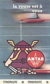
The final two images show how around 1966 Antar published a light card folder "la route est à vous" containing 25 cards described as "Itinoroutes". Some 46 route maps were printed on these cards, along with an index, instructions and two advertising panels. Most route maps had two routes, so that on the card shown here, Itinoroute 35A is PARIS-Rouen-LE HAVRE in red and 35B PARIS-DIEPPE in blue. The sets were designed by Cofirel, and gave kilometrage distances in the red/blue side bands as they were not to a uniform scale.
Maps: La Mure
La Mure traces its origins to an anthracite mine opened in 1808 in the village of La Mure, South of Geneva. By 1900 it was a regionally important distributor of coal, and in 1924 separated its distribution activities from the mines. La Mure soon added fuel oil, lubricants and petrol to its product line and its service stations started spreading across South-East France from its headquarters in Grenoble. In 1961 it became part of the UGP group as part of the restructuring of the French petrol industry, along with Caltex, and so switched to the Elf brand in 1967. La Mure continued to trade as a regional distributor for Elf, merging with another Elf subsidiary, Bianco, in 2001 to form La Mure Bianco. It remains as one of eight regional distribution companies within the Total group, and now supplies some 300 independent service stations carrying the Elan brand.
|
This 1965 map has cartography by Foldex. The cover says (in French) "This map of the South-East is in two parts, you have the 1st in your hands, don't forget to claim the 2nd at the next LA MURE station". |
|
No maps are known from RAP, the other main domestic element from which Elf was formed, or from Glorex/Miroline (les Pétroles de l'Ouest) which was acquired by Elf in the 1990s.
Maps: Serco
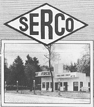
Serco was the brand name of la Société Les Consommateurs de Pétrole, which although based in Paris operated a refinery at Donges on the West Coast. Serco was subsequently acquired by Antar, probably soon after World War II. |
|

|
|
||
Text and layout © Ian Byrne, 1999-2011
All original copyrights in logos and map extracts and images are acknowledged and images are included on this site for identification purposes only.


