 AGIP
AGIP
Brief History
AGIP was formed in 1926 as the Azienda Generale Italiana Petroli to provide an Italian company to compete with
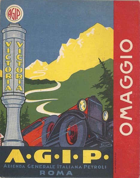
Shell and Esso which dominated fuel distribution in Italy at that time. Its initial assets included APIA, a producer of oil in Romania previously owned by the state railways. By 1939 it was one of the three leading brands in Italy, with service stations selling its Victoria and Littoria petrols. In 1953 it was incorporated into the state owned ENI group and expanded greatly under the charismatic leadership of Enrico Mattei. Over the next three decades it moved into Germany, Switzerland, Austria, the UK (but only for a few years, selling out to Esso in 1966) and finally France.
Agip acquired Shell's Italian operations in 1973, and switched them to the IP brand, but this was eventually sold to API in 2005.
Since 1990 ENI has been progressively privatised and the Agip brand has been expanded into newly liberalised markets in Southern and Eastern Europe such as Spain and Romania. In 2012 it started a gradual changeover of branding on service stations from Agip to eni, but this process was still incomplete by late 2016. In 2014, ENI sold its operations in the Czech and Slovak Republics and Romania to MOL.
Bibliography: Mattei Oil & Power Politics, Faber & Faber, London 1966
Around 2011 AGIP to ENI.Maps: Italy
|
|
|
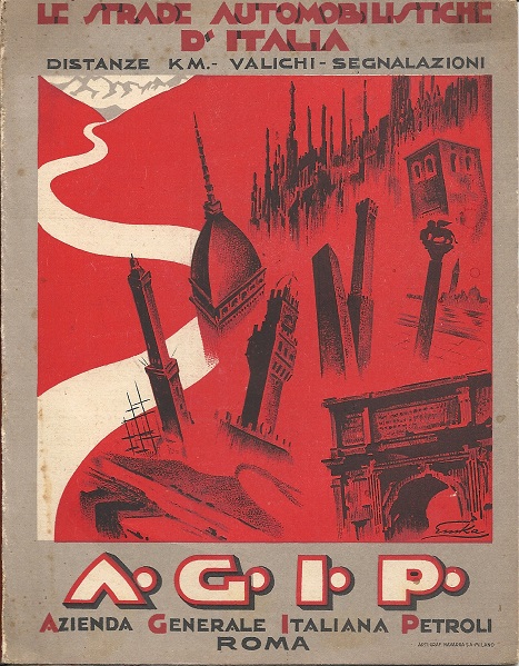
The oldest known Agip map of Italy dates from 1933 and was prepared for them by Arti Graf Navarra SA of Milan. A fairly basic map of the country is spread across both sides of a sheet measuring just 318x420mm when unfolded - no scale is indicated. Distances, but no road numbers, are marked on the map. Light card front and rear covers were pasted to the map, with one inside cover carrying an advert for Agip's five main products (including Miscela B.A., not otherwise seen on maps) and the other road signs. |


Up to the Second World War, Agip more frequently advertised on RACI (the Royal Automobile Club of Italy) maps, and an image of a 1937 Agip autostrada station can also be found on a map issued by the Pirelli tyre company.
|
|
The 1952 road atlas of Italy is the earliest known post-war map from Agip; at this stage it still carried a small additional logo for ROMSA - Raffineria Olii Minerali SpA of Rome & Trieste, acquired by AGIP in the early 1950s. Published by Istituto Geografico de Agostini of Novara (IGDA) it has 22 pages of maps and advertises Energol motor oil. The same basic atlas design was used for a number of years the 1954 version has a redrawn cover placing more light onto the AGIP name on the signpost, and without the additional logos at the bottom. This version also has a red plastic comb binding, which with age has tended to become quite brittle. |
|


1952 images above/left courtesy of Jon Roma
|
This is an undated booklet map of Italy, probably issued in the 1950s, with cartography by Vallardi of Milan and measuring just 124 by 97mm when folded. There was a small advert for BP Energol oils inside. |
 |
|
By the mid 1950s it issued a single sheet map of Italy, initially by Clementi with BP Energol also on the covers (left: ) at the scale of 1:1,000,000. By 1958, the adverts for BP Oils and Agipgas for camping had moved onto the inside cover, but the name SUPERCORTEMAGGIORE was prominently displayed to appeal to nationalistic Italian interests after a small oil find was made near the village of Cortemaggiore. The 1961 version (right) listed Agip motels, restaurants, snack-bars and camping grounds on the advertising panel. Both 1958 and 1961 maps are by Agostini at the smaller scale of 1:1,200,000. |
|
|


|
|
In the mid 1960s Agip started issuing a series of 8 numbered sectional maps of Italy, also by Agostini, at a scale of 1:550,000. Peninsular Italy required six sheets with no.7 for Sicily and no.8 Sardinia. |
|
|
")


|
|
|
|
Also in the mid-1960s, Agip issued motel road atlases (1966 left and 1967 centre). At first sight they cover all of Italy with detailed plans of the area surrounding each motel. |


The motel atlases use cartography by Vallardi. The example shows Livorno, with the smaller scale map of the area facing a town plan, both marking the motel's location. Closer inspection reveals that only around two thirds of the country was included - in a rough 100km radius from each motel, with significant gaps towards the South of the country where there were fewer motels. Agip was an early leader in establishing motels in Italy, although Shell worked closely with the rival Jolly chain.
|
|
Vallardi also produced a large format booklet (left) of both conventional and strip maps showing the Italian autostrade in 1971. This was similarly overprinted to show locations of Agip motels, restaurants and campsites. |
|

")
|
|
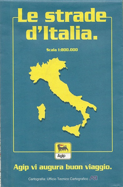
Later sheet maps generally used the A.C.I. cartography service. A.C.I.'s own maps show selected Agip service station locations, and later Agip maps return the compliment showing A.C.I. service points. |
|


|
|
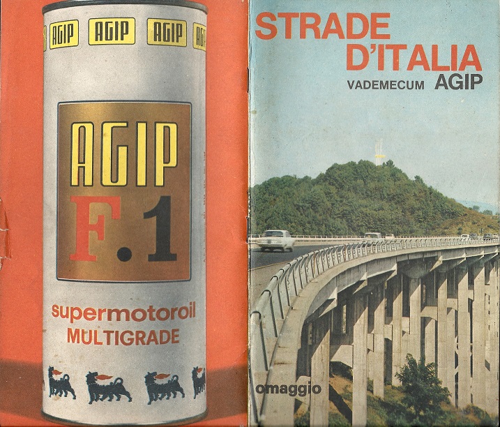
In late 1987, AGIP printed 1,000,000 copies of this map folder. A glossy cover held a 32 page booklet, mainly of motorway strip maps (right), but also listing Agip motels and sites with LPG. |
|
| In a pocket at the rear were 8 loose sheets on stiff paper, including six of maps by Mencattini at 1:800,000, one locating AGIP stations with video travel information screens and an index sheet. | ||


|
|
The camping map of Italy is recent (1999) but unusual in that the road network takes second place to the physical geography, as can be seen from the extract (right). No numbering or distances are used, with only autostrade distinguished in red. Insets are used for Corsica (France) and the Lake Garda region, although the latter is not named! RenzoMatino is credited as the graphic designer and the map was produced in association with Editoriale Eurocamp. |
|
")

Non-Italian Maps
AGIP also issued maps for Germany, Austria & Switzerland using cartographers such as Kümmerley & Frey and Hallwag in Europe and for some African countries such as Nigeria. Agip sold its small British chain to Esso in 1966 and so probably never issued maps there. Its French interests were very small until the 1980s and no French maps are known.

|

|
 |

|
 |
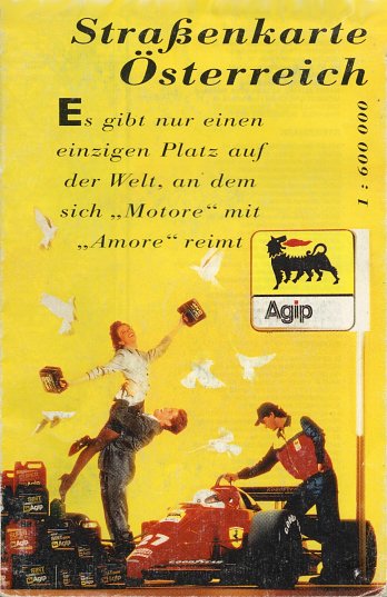
In 1978 Hallwag printed a map of Austria at 1:1,000,000 showing the Brenner autobahn on the cover, listing all Agip's Austrian sites. Nearly 20 years later in 1996 Freytag-Berndt prepared low cost maps on relatively poor paper at 1:600,000, again listing all Agip sites. The examples shown above (centre & centre right) date from ca1994 (undated) and 1996.
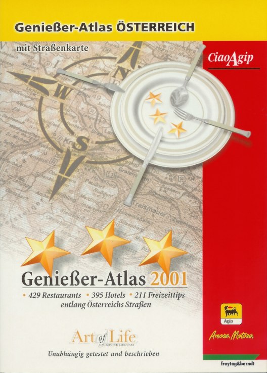
Agip plays heavily on its Italian origin in non-domestic markets, with its Ciao'Agip shops and a tendency to promote other Italian products including olive oil and Lavazza coffee. A 2001 A5 format atlas of Austria (Genießer-atlas - above right) lists 429 restaurants and 395 hotels, across 30 tours. At the back are 31 map sections by Freytag-Berndt, mainly at 1:500,000 (but with larger scale city plans) marking Agip locations. Amazingly this high-quality production was given away to customers, unlike an Agip Italian cookery book which was sold for €22.

|
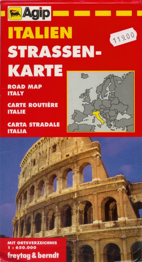
This 1995 Freytag-Berndt map of Italy (at a generous 1:650,000 scale) was pasted into a special Agip cover for the Austrian market - it is not known which other countries were included in this series, or if these maps were also sold into the German or Swiss markets, but it is probable that they were unique to Austria. |

|

|
This AGIP atlas of Germany was issued in 1998, primarily to promote use of its Pan Europe Card amongst truck drivers. All stations accepting the card are listed: not just those selling AGIP fuels, but also Elf, Minol and Westfalen outlets. After 72 pages listing sites with facilities, there is a 64 page map section drawn by GeoData on a Falkplan-Verlag base map. |

|
|
|
|
|
|


")
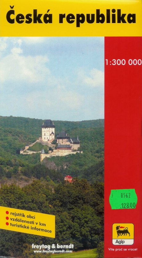
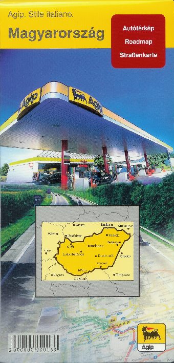
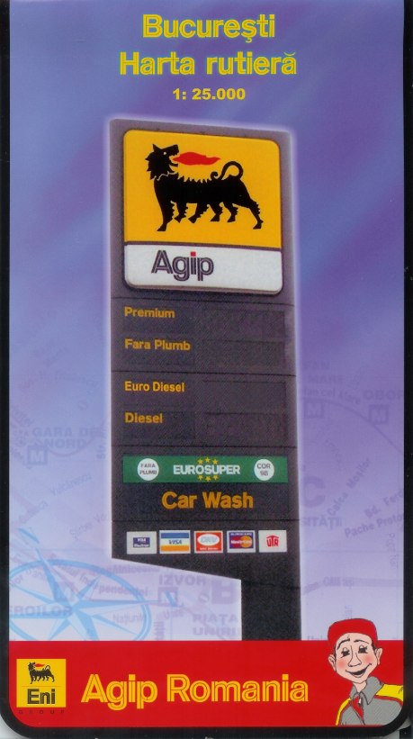
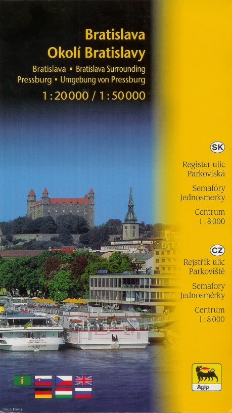
As one the three main Western brands in Eastern & South-Eastern Europe (along with Shell and OMV), Agip sold a number of maps in these newly liberalised markets. The examples here are, with their year and cartographer, from (left to right) the Czech Republic (2002, Freytag & Berndt), Hungary (2006, Cartographia), Bucharest in Romania (2003, Amco Press) and Bratislava in Slovakia (2005, Shocart). All are essentially stock maps with custom glossy covers. Agip withdrew from all these markets except Hungary in 2014.
And outside Europe...
 |
|
 This is the only known pre-war Agip map and it was published by the Italian company in Rome, possibly for distribution to schools soon after Italy annexed Ethiopia (Abyssinia). It prominently marks "Le nuove strade tracciate dal Duce" - the new roads planned by the leader (Mussolini). These are simply marked as thick straight black lines - solid for those due for immediate construction, and dashed for those due to be built next. These are printed on a relief map of Ethiopia which does however also include the few existing roads (which all appear to be in the region of Asmara) and tracks. No cartographer or date is shown; it is drawn at the odd scale of 1:2,960,000. Underneath the map Agip lists its main brands: Robur and Victoria for petrol, Petrolina for heating oil and Petrolio Sole for lamp oil (kerosine).
|
Finally, another map from outside Europe, but included as it is still Mediterranean. Agip's Tunisian subsidiary produced this French language guide in 1974. Inside light card covers it contains a page of town plans and brief descriptions of major sights; inside that is a fold-out map of the Northern two-thirds of country. Prepared locally at a scale of 1:1,000,000, it also marks AGIP stations. The only Arabic script is in the AGIP logo on the rear cover. AGIP later sold its chain in the country to the local company AGIL. |

Text and layout © Ian Byrne, 1999-2017
All original copyrights in logos and map extracts and images are acknowledged and images are included on this site for identification purposes only.