 TEXACO
Brief History
Texaco first started operations in Europe in September 1905 when it established a terminal at Antwerp, Belgium. By the 1920s it had a strong market position in the low countries and before the Second World War sold gasoline and oils in most European countries. After the war, with effect from 1-1-1947 it sold half of its operations to Standard Oil Company of California (Chevron) and the Texaco name was replaced by Caltex everywhere except Britain which used the name Regent.
This joint venture was dissolved in 1967. Chevron took the largest share of downstream activities in West Germany, Switzerland, Italy, Benelux and Denmark, although Texaco gained some outlets in each country. Texaco obtained the larger chain in Britain (as it had owned more than 50% of Regent) and all the marketing assets in other countries, including the rest of Scandinavia and Ireland. Texaco rapidly added to these operations by acquiring Deutsche Erdöl AG (DEA) which had an extensive network of service stations in West Germany, Switzerland and Western Austria. |
 1968 Texaco map of Europe by Bootsma |
Texaco had been weakened following its controversial takeover of Getty Oil in the 1980s, and in response to the mega-mergers of the late 1990s, it agreed to be bought by its old Caltex partner to form ChevronTexaco in 2001. However the remaining European marketing (mainly in UK/Ireland and Benelux) remained under the Texaco brand; in 2007 the Benelux chains were sold to the Israeli company Delek, although they continue to licence the Texaco name from what was now Chevron. In 2014 these stations were sold to venture capital firm TDR Capital LLP, now part of Intervias, which also owns the French BP chain and part of the French Esso chain and EuroGarages in the UK. Finally in March 2011 Texaco's remaining European operations in Britain and Ireland were sold to US firm Valero after more than a century of business in Europe; however the name remains in use in both countries and Benelux.
Maps - to 1947
 |
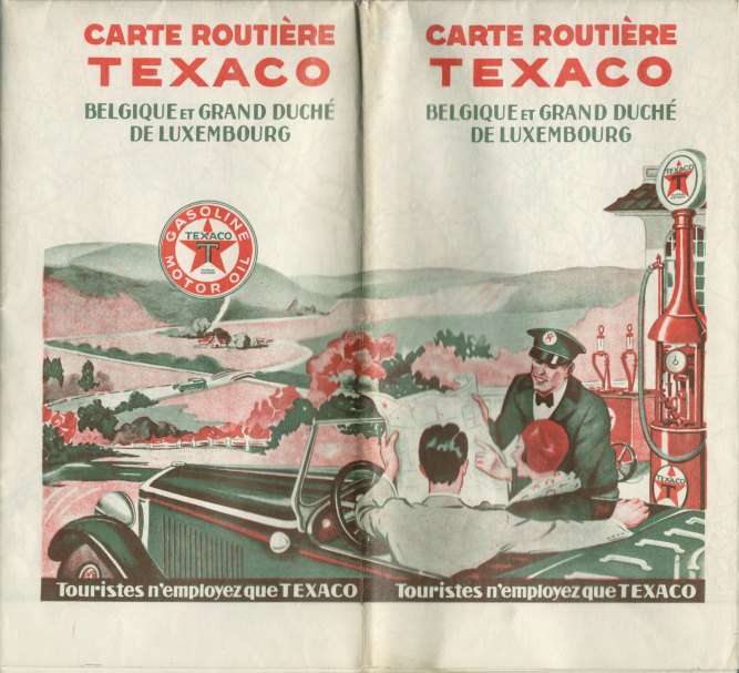
The oldest known Texaco maps from Europe are of Belgium and share the 1929-31 USA cover design, but are in entirely in French and backed with 12 town plans. Although three year variants are known, they probably cover a longer period than their US equivalents. The oldest carries the slogan "Touristes n'employez que TEXACO" (Tourists only use Texaco on the cover; the later ones "Pour la vitesse: TEXINE" (or Souplesse on the back cover), and mark the Waaslandtunnel in Antwerp that was opened in 1933. The youngest has a panel advertising Texaco motor oil in bottles (right). |
 |
 |
The same design was used on Netherlands maps, but the 1939 issue (left) has a cover design unique to the country. This must be one of the last European Texaco maps issued before the war and the almost 30 year long gap until after the breaking up of Caltex. |
 |
Texaco was also active in Scandinavia, and in Sweden started a tradition of selling branded softback, spiral-bound road atlases of the country. The one shown here dates from 1938 and cost 1kr.50, but the format changed little through its years as a Caltex atlas, its continuation under the revived Texaco identity from the 1960s to the 1990s, and its subsequent transfer to Preem. |
 |
 |
In common with some other countries, such as Sweden, Texaco initially published an undated small format atlas of Ireland with a metal spiral binding, folded into two. The atlas marked all places where Texaco products were available by a red star, and was produced by George Philip & Son of London at 8 miles to the inch, with 10 pages of maps facing gazetteer entries. The inside rear cover advertises Insulated Texaco Motor Oil, understood to have been introduced in 1938, suggesting a date between then and 1947 when Caltex replaced Texaco in Europe. No Texaco stations are shown in Northern Ireland, so it may have been post-war when the UK had a single unbranded "Pool" spirit on sale. |
Maps - from 1967
Germany
 |
 |
 |
 |
 |
 |
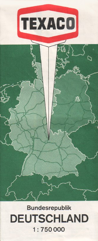
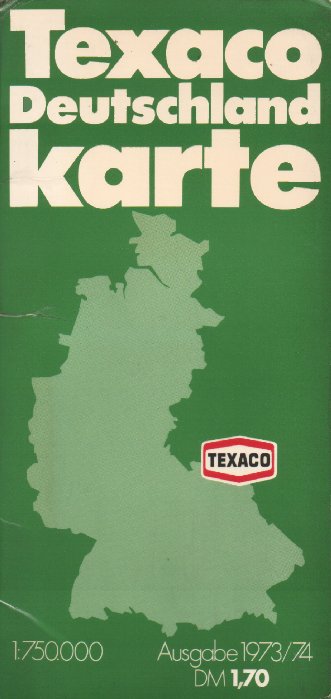
Texaco's German subsidiary would have been quite small following the Caltex break-up had it not bought the local distributor DEA in 1966. The first Texaco map is an issue covering West Germany at 1:750,000 dating from 1968 (above left) and still show a strong influence of the Caltex design. The next two West German maps are typical sectional maps issued in the 1970s. Both are from series of 8 maps produced by Falk-Verlag of Hamburg at 1:250,000. The earlier example (second left), section 8, has a laminated card cover and eight pages of scenic tours (numbered 57 to 64!) stapled inside the cover. The map itself was also Texaco branded and offers an alternative photo cover (centre). The national map was also available in a card cover, as can be seen on the next map, dating from 1973. The final map green shown comes from 1975 and was purely a paper sectional issue. All the maps above were prepared by Falk-Verlag.
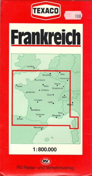
The final map, with red covers, dates from 1983 and was prepared for Texaco by RV Reise- und Verkehrsverlag. This came from a series of 5 sectional maps at 1:300,000, 13 national maps at varying scales and two atlases (Germany and Europe). The national maps not only included neighbouring countries such as France, shown here, but also popular holiday destinations such as Yugoslavia and Spain/Portugal. Card Texaco covers were added to stock RV maps, and not all RV titles received covers in this manner so that, for example, Great Britain & Ireland was omitted from the Texaco series.
A 1970s or 1980s Texaco map of Austria is shown on the Austrian country page.
Britain & Ireland
 |
 |
 |
Texaco issued maps for nearly twenty years in Britain, but with few variations in cover design. |
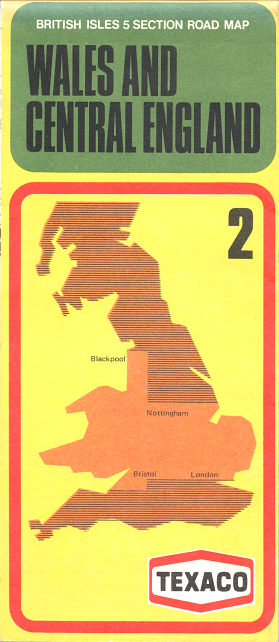
There appears to have been a short gap in maps in the early 1980s before a new design incorporating the Texaco "system 2000" red and black colours was introduced in 1987. The cartographer was changed to George Philip & Son and Britain now needed six sections with section names not found on any other oil company maps: number 5 was described as being "Yorkshire and the North".
|
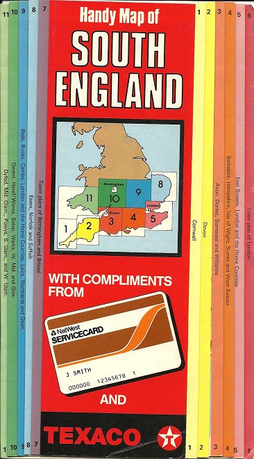
A year earlier Texaco had joined forces with NatWest Bank to promote the 10 locations in West London and the Thames valley where the NatWest Servicecard could be used. They were marked on Handy Map of South England - it's not known if any other parts of the country were produced. Cartography was by John Bartholomew at 10 miles to the inch; the map was dissected into 11 sections using the same system as the Scandinavia Quick Maps; the paper was laminated on both sides and folded in a skew. All the participating service stations were on section 4, shown here. |
|
|


 |
 |
 |
The hardback atlas (centre) uses the same Geographia cartography as the earlier sheet maps and dates from 1978. In 1988 Texaco issued a mid-format softback road atlas with a very plain cover using an older design of George Philip cartography than the short-lived series of sheet maps. Finally, in 1999 they again sold a Road Atlas of Britain, moving to the common large format and scale of 1:250,000. |
| All atlases shown 2/3rds relative size | |||
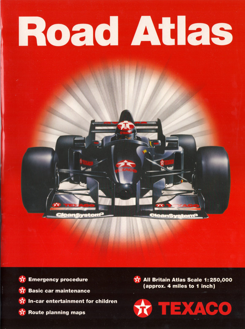
The 1999 atlas was produced by West One, although used Ordnance Survey mapping under licence. Unusually the first and last 4 pages were unique to Texaco and included suggested games for children to play on long journeys.
|
|
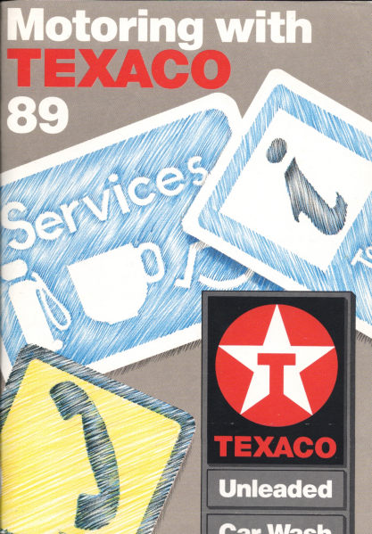
In 1989 Texaco commissioned IMP Ltd to create an 80 page booklet (left) called "Motoring with Texaco 89". Although sold for £2.95 it was quite promotional in nature with 20 pages of fairly basic maps at 16 miles to the inch marking all Texaco sites in the UK. Former F1 racing driver James Hunt wrote the introduction, and the booklet contained an eclectic mix of useful and offbeat information, as well as a full listing of all Texaco service stations taking up 26 pages - more than the maps. It is not surprising that this appears not to have been repeated. |
|


Next, in 2004, Texaco published an A5 spiral atlas for its FastFuel commercial card holders, using AA cartography (above right). Over 1,000 outlets were listed and marked on the maps; Texaco stations in red and diesel outlets from other companies accepting the UK Fuels card in blue. 15 pages of rather basic maps were followed by 14 pages of better maps of the main conurbations. Texaco reissued the FastFuel atlas for 2006/07 using cartography by Collins and a virtually identical cover. The main maps were slightly more detailed, showing more place names, and clearer through the use of smaller ovals with site location numbers; essentially though the format was the same. The atlas fell from 96 to 88 pages by omitting a site index by town (and renumbering sites in alphabetical order, rather than based on geography). The larger scale map of the East Midlands was also dropped.
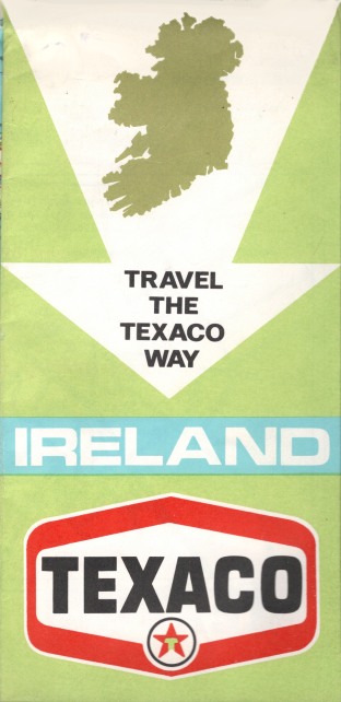
Texaco's Irish subsidiary published maps of Ireland independently of those in the UK series, and continued to issue maps after the UK ones were discontinued; they can be distinguished by the US-style star in the hexagon logo.
 |
 |
Early Texaco maps of Ireland (such as that shown far left: ) retained the Swiss Orell Fussli cartography used on the Caltex/Tourist Board issues (and 1958 copyright date), even though the logo means that the map can be no earlier than 1967. |
 |
 |
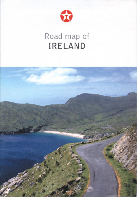
This also meant that it failed to show the new motorways built in Northern Ireland. A 1982 example has an attractive watercolour scenes cover on an Ordnance Survey of Ireland map at 1:575,000 which also carried plenty of product advertising. Maps continued to be sold later in Ireland than most other countries. The 1997 example right used AA cartography and listed all Texaco service stations in both the Republic and Northern Ireland (although it does not appear to have been sold in the North). The final example shows a design used twice - for 2006 and 2009 maps, with cartography by Collins Bartholomew at the strange scale of 1:617,780 (which is neither a simple metric nor imperial scale).
Benelux
 |
 |
 |
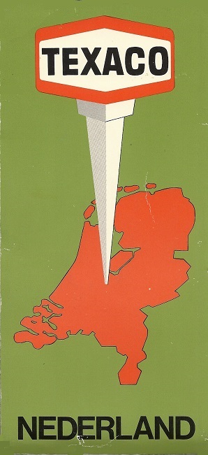
With a strong position in the Low Countries, it is no surprise to find a range of Texaco maps. The 1976, 1982 and 1998 Netherlands maps (left) used typical Falkplan/Bootsma cartography pasted into card covers; with time the map size and scale increased. |
 |
 |
Belgian petrol companies have moved in recent years to issuing some very small format maps - just 10cm by 8 cm when folded. Texaco Belgium SA issued this map of neighbouring Netherlands around 2000 for free issue jointly with Group Vlan publications - De Streekkrant and De Weekkrant. Inside, Geocart provided a serviceable map at 1:450,000, by splitting it over both sides of the paper. |
 |
 |
A more normal size for Belgian maps is 15.8cm by 10cm. Several firms have issued maps by Geocart-Claus in this format on glossy paper, principally to locate their service stations. The Texaco example shown here is dated 1.1.04, and has a serviceable map at around 1:525,000. Dutch maps of the same format are less common, but this undated example is probably also from 2004 and uses Wegener-Falkplan cartography at a similar scale. Both maps list all Texaco stations on their reverse. |
A station locator map of Benelux is shown on the page dedicated to 2006 maps. The final Texaco branded map was probably an atlas of Benelux produced in 2012 in both French and Dutch language versions; this is shown on the Netherlands page. The Texaco chain in Benelux was sold in 2007 to the Israeli company Delek, and then re-sold to the EG Group in 2014; they retained the name until 2018 when it was replaced by Esso. | ||
Scandinavia
 |
 |
 |
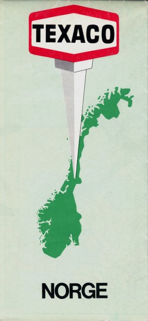
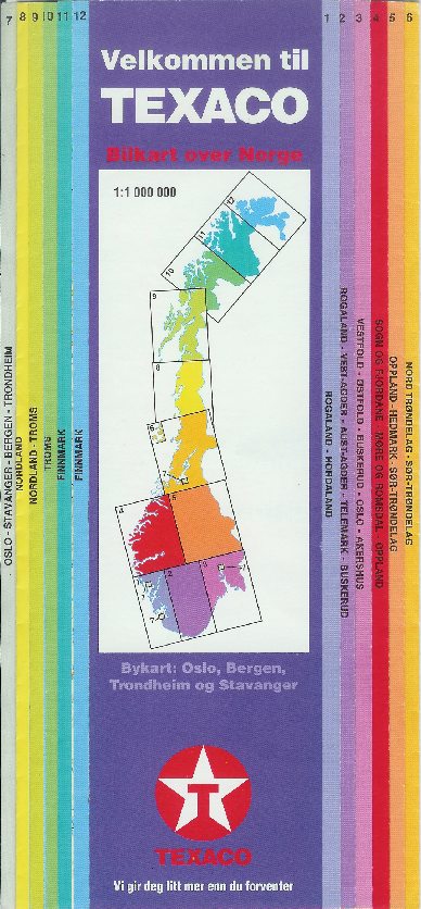
These three maps of Norway date (L-R) from 1973, 1982 and the 1990s, showing how the folded size grew larger with time. The oldest has a typical Texaco cover of the era; it is printed on cheap gloss paper, and has a reasonable (anonymous) tourist map of the country at 1:1.45mn. The 1983 edition is on better paper at 1:1mn; it was prepared by Fabritius and includes selected tours and tourist information in 4 languages. By the mid 1990s, shortly before the merger with Norsk Hydro, Folia/Legindkort had taken over the map production and used their patented Quickmap system to divide the country into sections. The scale remained at 1:1mn, but with no space for additional information |
 A 1983 Texaco map can be seen on the Denmark page. |
Here are two of the last Texaco maps from Scandinavia. The Danish map is a Folia/Legindkort production at the common Danish scale of 1:510,000 (widely used since the 1950s). The 1994 Swedish vägkarta is in fact a spiral bound folded atlas by Liber Kartor with 11 double pages of sectional maps and 9 of town plans. Both maps mark service station locations with a small Texaco star. |
 |
Southern Europe
") |
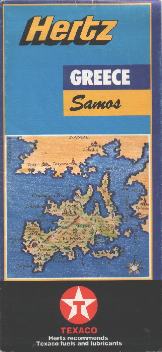
Texaco maps are less commonly found from Southern Europe, even though the company was present in Italy, Switzerland and Austria. Its strongest market was in Greece, in which it co-sponsored this map of Samos , prepared primarily for Hertz in the mid-1990s. I. Mathioylakis & Sia produced the map at 1:100,000 with town plans & tourist information in 5 languages on the reverse; inside it carried adverts for Texaco's CleanSystem3, and listed Hertz locations. |
 |

Text and layout © Ian Byrne, 2000-20
All original copyrights in logos and map extracts and images are acknowledged and images are included on this site for identification purposes only.