Petrol Company Road Maps from Hungary |
Before World War II
After the dissolution of the Austro-Hungarian empire in 1918, Hungary was still one of the more developed economies of central Europe, although national Governments gave greater priority to recovering lost lands than to economic development. Nonetheless there were enough private motorists for there to be a thriving Hungarian automobile club:
The touring club produced maps for Vacuum Oil Company R.T. (Mobiloil and Sphinx Benzin) in at least 1934 and 1937, which can be considered as petrol company issues, even though they carried advertising from other car related businesses as well. Image CTO!/Dave Leach
|

|
 |
The Magyar Touring Club map did not just work with Mobiloil/Sphinx; in 1937 it also published a two-colour map of Hungary with Shell advertising internally. It locates towns with Shell petrol or motor-oil sales by a red triangle or disc, and the reverse is devoted to a large promotion for Budapest in English, French, German and Italian (but not Hungarian), with large b/w photos. The main map side carries many small adverts for banks, hotels, garages and other facilities, as well as for Shell Motor Oil. |
From 1948 to 1989
After the Second World War, Hungary soon fell under the control of the Communist party, which established a one-party state in 1948. After the failed revolution of 1956, the Hungarian Government permitted a greater degree of economic freedom, for example through the New Economic Mechanism of 1968. Shell had for many years been permitted to operate a single station in central Budapest, and under the N.E.M. this was extended to allow Agip and BP to develop small chains of service stations alongside Shell and the former state monopoly company Áfor.

|
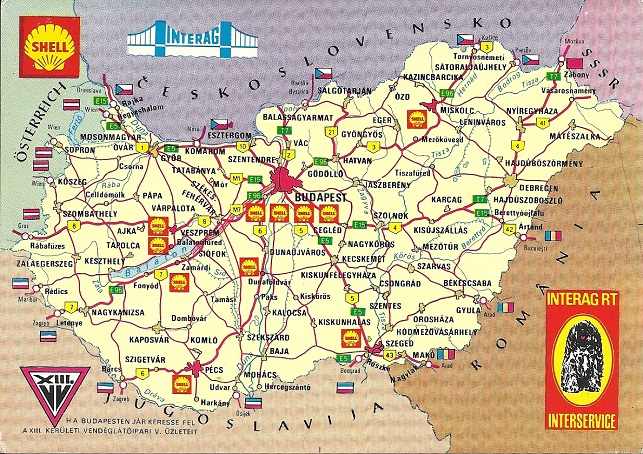
Shell's operation was in a joint venture with Interag RT. In 1971 the partners produced a postcard showing where the ten Shell petrol stations were, superimposed on a map of the country drawn by the noted artist Gyula Barta, but based on a Cartographia map. Although 50,000 copies were printed, it's not known whether they were distributed locally through service stations or through Shell's international touring service. (Image left at 150% relative scale; ) |

|
In the early 1970s BP invited potential tourists to write in for a map of Hungary showing their 8 filling stations. I have never seen the map they sent, but this BP Touring Service (left) map dates from ca1965, a few years before they started selling fuel in the country. No cartographer is credited on a fairly basic map at 1:1.5 million, which also covers Czechoslovakia. |

|
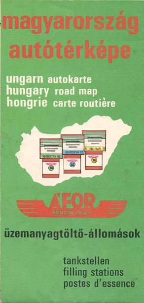
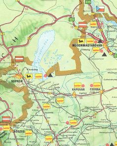
ÁFOR did occasionally issue road maps, as in the 1974 map shown here. The cover shows pumps for Áforextra 98, Áforsuper 92 and Áfornormal 86, showing how much lower octane ratings were in Eastern Europe (a typical Western Super grade would have been 99 octane at the time). Inside it marked both Áfor and Áfor-Agip stations of which there were just 8, including the two shown on the map extract near the Austrian border and three in Budapest. Áfor stations servicing cars had a red triangle and those selling Agip lubricants also had a red disc. 100,000 copies of this map were printed by Kartográfia Vállalat. |

|

|
Since 1990
In 1989 the Communist Government was defeated in the first free elections since the 1940s, and the market gradually became fully liberated. In 1992 MOL Magyar Olaj- és Gázipari Rt. was set up to take over the bulk of the Hungarian oil industry, including many of the service stations previously under the state-owned Áfor brand, which was finally phased out in 1997.
|
In December 1997 Híd Marketing prepared the map (near right) for free distribution by MOL. Drawn to a scale of 1:550,000 using good modern cartography, it marks all places with MOL stations and has 24 town plans on the reverse, again locating MOL outlets. Addresses and hours of opening are given for all MOL locations, including those in Romania, Slovakia and the Ukraine. |

|

|

|
The spiral-bound atlas (above centre right) is the second edition of 2000 by DIMAP of Budapest. It has 82 pages of detailed maps at 1:250,000, followed by town plans and an extensive index. | |||

|

|
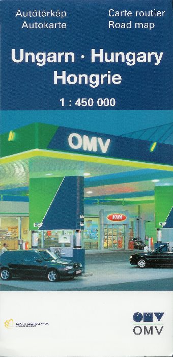
The Austrian company OMV was among the first new entrants into the Hungarian market. This OMV atlas of Hungary dates from 1991, about the time that it first started operating service stations in Eastern Europe. Although the front cover is in German, on the inside covers there are adverts for OMV service stations in both German (front) and Hungarian (rear). The atlas was assembled by Freytag-Berndt u. Artaria, but appears to use maps drawn by the large Hungarian firm Cartographia. |

|
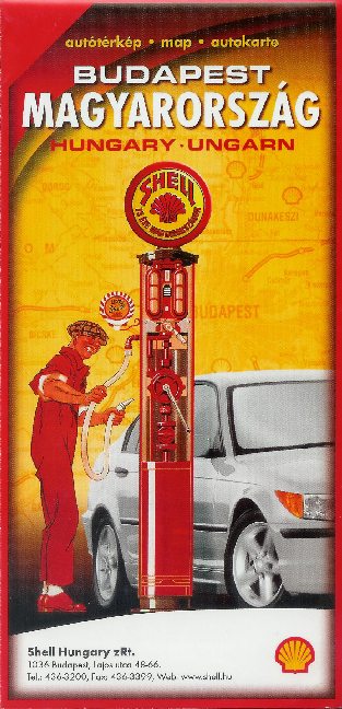
Shell consolidated its position as the second largest brand in the Hungarian market after its liberalisation. The first map shown here is something of a curiosity as it has no real cover, and was funded by advertising from businesses based in the region SW of Lake Balaton. These were mainly from hotels and independent garages - including an Avanti garage and the Fan Fan filling station shown here! The anonymous map itself, and inset city plan of Budapest, mark all Shell locations including those planned to open during 1993. The other map (right) was an official Shell issue dating from 1998. Cartography was by GS-Hister (Top-O-Gráf) at 1:1,000,000 with a large plan of Budapest and a station list on the reverse. |

|

|
Although Aral also started a Hungarian chain, it soon sold out (as has BP, Aral's new owner, which sold its locations to OMV in 1998). The map on the left is a local Cartographia production at the relatively large scale of 1:500,000, marking and listing all 31 Aral locations. (It also marks all other towns with filling stations using a simple T symbol.) |

|
2000s Maps
The maps shown below were all on sale in Hungarian service stations in 2007:
 |
 |
 |
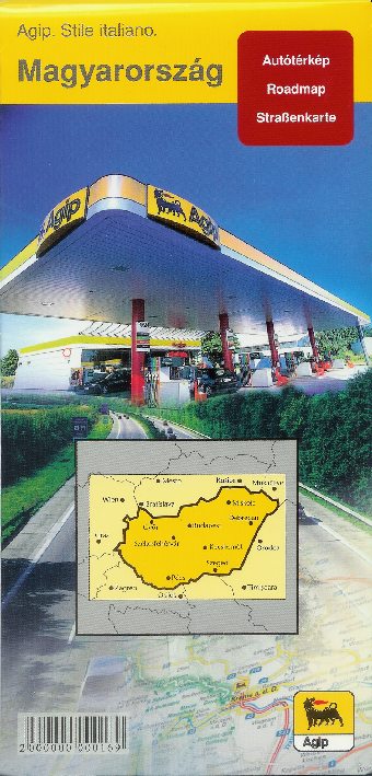
Agip only sold a 2006 Cartographia map of Hungary at 1:450,000, pasted with an index into its own card covers. |
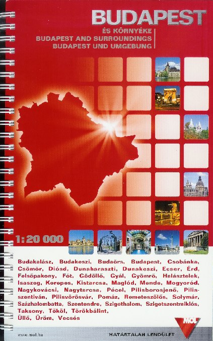
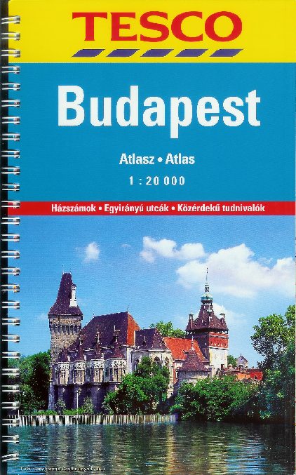
MOL, Tesco and Shell all sold three atlases, of Budapest, Hungary and Europe. All were medium format and spiral-bound, except for a larger hardback edition of Europe from MOL (not shown). MOL's were produced by Dimap; Tesco's by Cartographia; and Shell's by Freytag-Berndt of Austria. |
 |
 |
 |
Among other recent brands, it is known that Jet published branded maps before they sold out to Russia's Lukoil in 2007 and likely that BP (which sold out to OMV 2003), Esso (which sold out to Agip in 2007) and Total (which swapped its chain for some German Shell outlets in 2004) have as well. The Austrian independent firm Avanti may have had its own maps before it sold its outlets to Lukoil in late 2004. Please send me an e-mail if you can help me with these, or with any other brands of petrol shown on Hungarian road maps.

Text and layout © Ian Byrne, 2004-18
All original copyrights in logos and map extracts and images are acknowledged and images are included on this site for identification purposes only.