Road maps from Romania and Bulgaria |
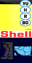
| Romania and Bulgaria are grouped together as from around 1948 until the 1990s, both had state petrol distribution monopolies. Most road maps that can be found were issued by the tourist boards, but mark all non-urban petrol stations. However Shell did issue a map covering the entire Balkans as part of its Mairs series in the 1970s (right); this was sold through Shell stations and booksellers in most Western European countries, but not in Romania or Bulgaria. |
 |
|
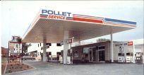 |
The tiny Belgian independent, Pollet, also put its own cover onto this 1991 map of Romania & Bulgaria. Inside the card covers (front & rear were identical) was a standard Ravenstein issue at 1:1,000,000, with a place name index pasted to the inside of the cover. | |
 |
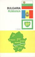 |
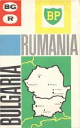
The BP Touring service grouped Bulgaria and Rumania (sic) as seen on these 1964 and 1965 maps. The unusual spelling, to English eyes, may be due to it having been prepared for BP by Freytag-Berndt in Vienna (although the rear cover carries the standard German spelling of Rumänien). Printed on just one side of the paper, it was at the scale of 1:1,700,000. |
 Romania
Before 1939 Romania had an active oil industry with Shell, Steaua Romana and other companies present. However no petrol branded maps are known from this period. After nationalisation in 1948 all service-stations took the brand "PECO" and it was not until the 1990s that Shell and other Western brands began to return to the market.
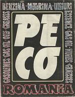 |
The map shown on the left dates from 1974 and locates all Peco filling stations classified into three categories: those open round the clock (blue), open 6am - 10pm (red) and from 7am to 3 pm (green). There are six city maps on the back of Bucuresti, Timisoara, Brasov, Iasi, Cluj and Constanta. |
 |
In the early 1990s progress with privatisation was slow, but some private service station operators decked out their stations in the colours of their favourite oil, to the extent that they could easily be confused with an official petrol station of the brand - an apparent "Aral" station was operating for a number of years near Bucharest airport, and there was a chain of "Mobil Lubricants" stations.
|
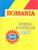
Peco attempted to bring its stations up towards international standards. It issued the road map shown here in 1993. |
|
|
Since the mid-1990s, Shell, MOL, OMV, Agip, Avanti and Lukoil have entered the Romanian petrol market, along with a large number of very small domestic brands. However, the largest share of the market remains with Petrom, the main successor to Peco (and to Competrol in the capital, Bucharest). In July 2004, the Romanian Government agreed to sell a 51% stake in Petrom to Austria's OMV. Shell sold its 60 stations to MOL in November 2004, making the latter the largest wholly owned foreign brand. ENI (Agip) sold its 42 service stations to MOL in 2014, taking its chain to 189 locations. The former national exploration company Rompetrol has also developed a retail chain, and has expanded its operations into Bulgaria, Albania and France, the latter by buying the Dyneff chain in 2006. No maps are known from Rompetrol, OMV, Lukoil or Avanti.
|
|
|
|
|
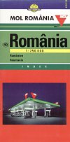
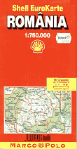
The MOL issue has greater detail, including relief shading for mountains, and locates MOL's service stations with its logo. Cartographia of Budapest prepared the map for their fellow Hungarian company at 1:750,000 and there is a booklet of place names stapled inside. The Shell map is at the same scale but at even greater detail as it comes from the German cartographer, Mairs (Marco Polo).
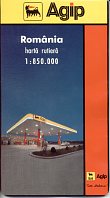
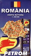
The source of the maps was reflected in their cost (as of May 2001): local generic issues (often by Amco Press) cost around Lei 35,000, with its Agip version costing Lei 49,900 and the slightly older Petrom one less than Lei 30,000. The Hungarian MOL map cost Lei 62,500, but the German Shell one Lei 119,000 from their Select shop. MOL also sell a Cartographia/Top-Gráf spiral bound atlas at 1:500,000.
|
|
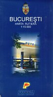
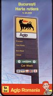
Agip and Petrom also commissioned Amco Press to prepare city maps of Bucharest, in each case showing the locations of their service stations. Petrom's came first, dating from 2001 at 1:15,000, extending to both sides of the paper, with a full street index booklet pasted into the card cover. The map included insets showing all bus, trolleybus and tram routes and the greater Bucharest region. Agip's edition was produced in 2003, and was printed on one side of the paper only at the scale of 1:25,000. |
 Bulgaria
Bulgaria also had a number of international brands operating before 1939. These included Socony-Vacuum, Socombel (Purfina), Astra Romana and Steaua Romana. In 1932 these four firms pooled their interests into S.A. Pétrole which had an 80% share of the market. It's not surprising then that the incoming communist regime nationalised the downstream oil industry in the late 1940s.
After the period of a state monopoly, international brands have only slowly moved back into Bulgaria, preferring the more robust economies of Central Europe to the Balkans. Even so, operators include Russia's Lukoil which bought the Bourgas refinery and has a chain of 200 service stations, Shell, which supplies about 105 sites, OMV acquired 25 outlets from Petrol AO in late 2000 and now has 95, Greece's EKO (which took over the 17 Opet locations Turkey's of Opet/Aygaz in 2008) and the Kazakh-owned Rompetrol, which now has 55 outlets. Petrol AD - the former monopoly - retains the largest chain with around 380 branded sites, and there are a number of smaller national names such as SNG (Synergom Petroleum) with 25 petrol stations. (Numbers quoted are from early 2013.)
|
|
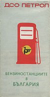
The map on the left is a rare example (only 50,000 copies were printed) showing the national Bulgarian brand DSO. Dating from 1975, cartography was by 'Glavno Uprevlenie po Geodezija i Kartografija,' which was then the Bulgarian national mapping agency. |
|
|
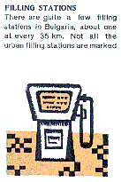
| All the images to the right are taken from an early 1970s map of Bulgaria for overseas tourists. Like the Romanian map described above it was printed on poor quality paper. The map is of a good standard at 1:800,000 with relief shading and marks all towns or villages with filling stations, identifying those open 24 hours in red. Note how filling stations were located around every 35km (22 miles) on main highways. |
|
||
I would welcome any information that you might have on post-1990 Bulgarian maps or pre-1939 ones from either of these two countries. Please send me an e-mail if you can tell me more.
Thanks to Michal Okonek for supplying the scans of the PECO and DSO maps.
All original copyrights in logos and map extracts and images are acknowledged and images are included on this site for identification purposes only.
