 CALTEX
Petrol Caltex
Brief History
By the 1930s, Texaco, a large US oil company, had built up a substantial downstream presence in much of the Eastern hemisphere, but was generally short of crude oil. In contrast, the Standard Oil Company of California (SOCAL) had found large quantities of oil in Saudi Arabia, but only sold products in the Americas. In 1936 the two companies agreed to consolidate Texaco's activities east of Suez with SOCAL's Bahrain refinery and for SOCAL to sell 50% of its stake in the Saudi production company that later became Aramco.
|
The new joint venture was called CALTEX and operated independently from its parents. It was also agreed that Texaco's European marketing should pass to Caltex, but by the start of the war in 1939 this had not happened and the agreement lapsed. However in 1947 it was revived and the CALTEX name rapidly replaced Texaco's on petrol pumps across Europe. (In Britain the Regent name was used instead of Caltex.) |
|
 Guide to Driving Abroad")
|
|
The map (left) has seen better days, but still shows a typical Caltex filling station from the early 1950s. It is printed on a card cover of a 1953 Caltex road map of "Belgium and Grand Duchy of Luxemburg" produced by De Rouck. Inside it carries adverts for Havoline Oil and Marfak greases, showing the continued use of Texaco brand names. |
|


Caltex had a relatively short life in Europe. As local markets grew in importance and new sources of Middle Eastern and North African oil came on stream, the interests of the partners began to differ, and in on 1st May 1967 Caltex was broken up into its constituent parts. Chevron took the largest share of downstream activities in Switzerland, Italy, Benelux and Denmark, although Texaco gained some outlets in each country. Chevron also took 821 outlets in West Germany to Texaco's 250, but around 350 sites kept the Caltex name under the ownership of Oest Tankstellen until 1973, when they switched to AVIA. Texaco obtained the larger chain in Britain, with under 150 outlets passing to Chevron. Elsewhere, including the rest of Scandinavia and Ireland, the entire Caltex operation moved across to Texaco. Caltex continues to be active East of Suez, in East Africa and in Australasia.
Maps
|
|
Caltex continued the pre-war Swedish tradition of spiral atlases of Sweden, folded in half to keep them to a manageable size. In 1950 (left) it folded to 14 x 22cm; by 1954 (right) it had grown to 17.5 x 24cm. Between the same two editions 7 double pages of maps had expanded to 10 with four new double pages of town plans (and a planning map of Scandinavia). |
|
|
|
||


 To reflect the larger volume of maps, the price also rose, but modestly enough from Kr 5:- to Kr 8:-. All ten pages of maps and five of town plans located Caltex stations with a red star, using cartography from Kartlitografen. This design remained in use as late as 1965, by which time the service station shown on the rear cover was looking considerably dated; oddly, though, the head of a smiling and saluting Caltex attendant was added to the front cover. The price remained fixed at 8:- Kr. over this 12year period.
|
|
The green striped background behind the Caltex banjo (left) is possibly unique to this mid-1950s map of Belgium and Luxembourg. H. de Rouck of Brussels provided the cartography and the reverse was dedicated to a map of Western Europe, in a manner similar to later standardised issues. |
|


|
This strange 1958 map of France (left) appears to be the normal Michelin 989 Grandes Routes issue overprinted for Caltex's use. The Michelin card cover (which is printed in blue and yellow) has been overprinted by Caltex in red and black, and the map itself has been overprinted in just black to mark the main stations in Caltex network. One reason for this unusual way of producing a map may be due to the relatively small size of the network; for example driving from Calais to Paris on N1 passed just two Caltex locations. |
|
|
Elsewhere, by 1958 a single large format design was used for most countries (above right), exemplified by this map of Europe, drawn by Kümmerly & Frey at 1:3,900,000. The reverse carries tourist information, including the now forgotten code used by hotels used for telex bookings. | |||


|
|
By the early 1960s most Caltex maps followed a single simple design, with a dark green background carrying a white outline of the country
covered. The Netherlands (left) comes from 1966 and unusually was for free issue (although a sister map of Europe sold for 75c). |
|
|
|
The 1955 Netherlands (left) has a most unusual silver cover, to celebrate 50 years of service. (It fails to mention that the first 42 years were under the Texaco name!) Dutch cities also often had non-standard Caltex maps, although some lack any sort of cover. The 1966 example (right) comes from Den Haag and was a joint production with City Parking, possibly by an independent jobber/distributor, H van der Heijden, which operated 25 Caltex stations. |
|


|
|
Hans König provided cartography to Caltex in West Germany; the sectional map of Germany (West) left dates from around 1960 and was one of five sections at a scale of 1:800,000. They also sold a hardback Städte-und Reiseatlas (town and travel atlas) that contained 44 large scale city plans and 14 special maps of tourist areas at 1:300,000. The third edition (right) was undated but included a loose-leaf map of Cologne showing the road changes after the opening of the Severin Bridge (built 1959-60). Most of the atlas's 266 pages were used for street indexes, although there were also numerous adverts, including a few Caltex stations. |

|
|
As noted above Caltex operated in SW Germany through Oest Caltex KG of Freudenstadt, who issued a mid-1960s map of their home region prepared by JRO. |
||

|
|
|
|
|


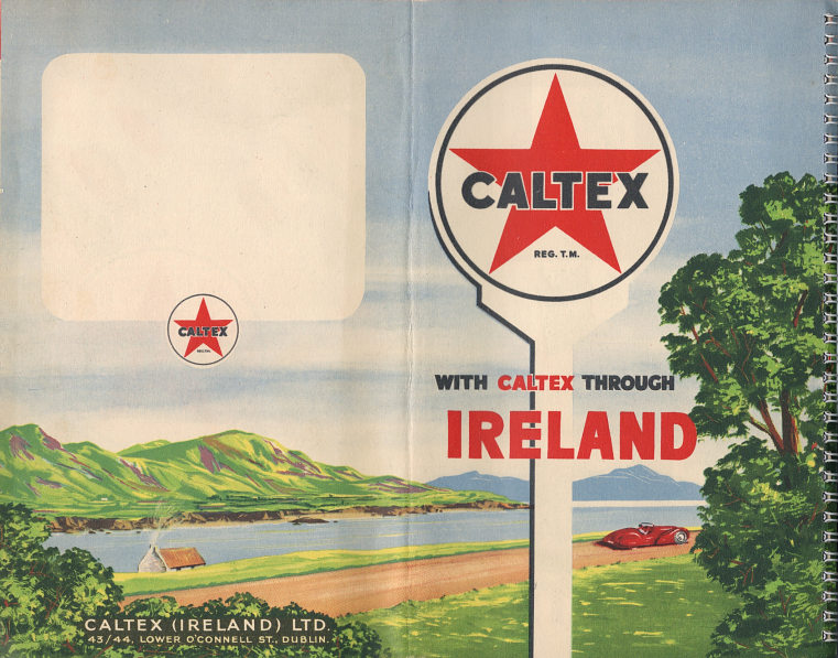
(L-R)The first known Caltex map of Ireland follows the standard European pattern of being a spiral bound atlas folded into two. This has 24 pages including 10 of maps each facing a gazetteer describing points of interest and a town plan and/or larger scale (1 inch to the mile) map of a tourist area. The main maps were fairly basic at 7.92 miles to the inch and marked places with a Caltex station by a red star. This shows that as well as being absent from Northern Ireland, Caltex had no service stations in Co. Donegal.
Later Caltex maps from the Republic of Ireland do not fall into the standard pattern, as they were produced jointly with the national tourist office. In 1958 the map was purely for use by Caltex, with cartography by Orell Füssli of Zurich. A dual branded Regent & Caltex version of this map also exists.
By 1959/1961 it also served as the official Irish Tourist Board (Bord Failte Eireann) map, but still with cartography by Orell Füssli.
The 1964 map was similar; both the latter designs carried Caltex advertising inside as well as on the cover. Maps do not appear to have been produced in intermediate years.
Although the Caltex name has been gone from Europe for more than 35 years, the partners in it continued to be intertwined. Caltex was never dissolved in the Far East, Southern & East Africa or Australasia, and continues in use there as a brand today under a modernised image. In Europe, Chevron never really acquired critical mass, so sold most of its operations back to Texaco in 1984. But an adverse Court decision in the USA left Texaco weakened, and in response to the mega-mergers of the late 1990s, it agreed to be bought by its old partner to form the inelegantly named ChevronTexaco in 2001.
Maps: Petrol Caltex
Caltex only owned 50% of its Italian refinery, and this was reflected in the service stations using a Petrol Caltex identity not used elsewhere in Europe. Several different designs of Petrol Caltex maps and atlases are known, with most dating from the 1950s.
|
|
|
|
|
|


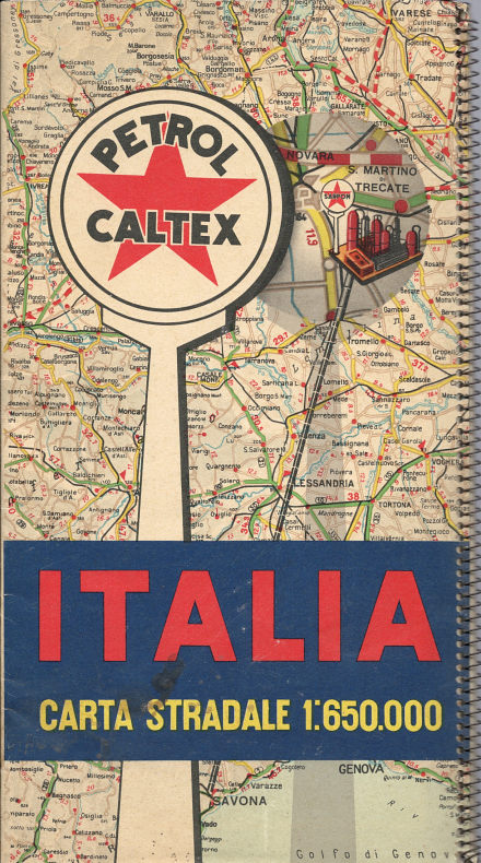
 The Petrol Caltex atlas (above left) dates from around 1952 (based on cars in the lubrication chart) and follows the same general style as examples from countries as diverse as Sweden, the Philippines and South Africa. The maps of Italy were drawn by Soc. Cartografica G. De Agostini to a scale of 1:650,000 and covered 13 pages that opened out to three times the folded size of the atlas.
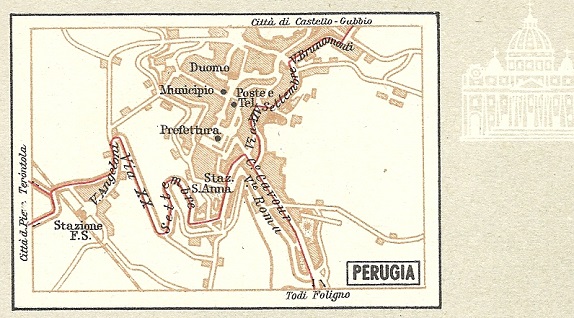
The next atlas dates from around 1956 or 1957, based on road construction. Although it uses the same cartography by IGDA as the earlier one, autostrade are now indicated by a solid red line rather than a dashed one, and the planning map and lubrication chart are omitted, replaced by 68 through plans of major towns, arranged over four pages from North to South. Perugia is shown right. My copy has the main map pages bound in the wrong order, so that pages 7 and 8 (Ancona and Roma) follow pages 9 and 10 (Napoli and Bari). Red Italic text on the cover proclaims that the atlas was free with the launch of new Caltex motor oils.
Next is a 64 page guide dating from 1954; it's not known what maps this contains. Petrol Caltex also issued some scenic map booklets in the early 1950s (not shown). The two remaining items are sheet maps at 1:1 million. Although the cartography is essentially the same, the older map again credits it to Soc. Cartografica F. de Agostini of Milan and the later one to Istituto per Ricerche Geografiche e Studi Cartografici SpA, also of Milan. Although the map is undated, the cowboy image is known to have been used in magazine adverts from 1959. A 1960 special map of Rome is shown on the Olympics page. Later in the 1960s, the Italian operation used, and issued maps under, the normal Caltex brand.
1954 Guide image courtesy Wilhelm Feuer

Text and layout © Ian Byrne, 1999-2019
All original copyrights in logos and map extracts and images are acknowledged and images are included on this site for identification purposes only.