 Q8
Q8
Brief History
|
The Kuwaiti Government decided in the early 1980s to add value to its oil activities by acquiring downstream operations
in it main markets of Europe. For some time the American Gulf Oil had been looking to sell, so in 1983-4 the Kuwait Petroleum Company
bought its chains in Benelux, Denmark, Sweden and Italy. In 1986 the Q8 brand was introduced - a pun on the country name in
English. Chevron's purchase of Gulf had stopped it UK outlets being sold to Q8, but the Q8 name was soon introduced on sites previouly
supplied by the independent brands Sadler, Pace and RP (Roberts Petroleum). Q8 continued to expand, buying Ultramar's
downstream operation and the Russian-owned Nafta in the UK in 1987, BP's Danish chain in 1986 and Mobil's Italian interests in 1990.
After a period of consolidation following the invasion of Kuwait, recent purchases have included the Belgian operations of both Aral
and BP in 1999. |
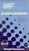 A transitional Gulf-Kuwait Petroleum design from around 1984. Card covers were attached to a typical Girault Gilbert map of Belgium. |
Maps: Q8
For such a recent arrival, there are a surprising number of Q8 maps to be found, especially from its Danish operation:
|
|
|
|
|
|
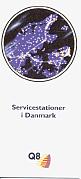
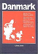
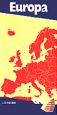
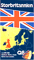
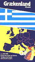
All the maps shown above have come in the 1990s from the Danish subsidiary of Q8. From the left, the first map is a small format booklet listing service stations with seven pages of maps at the back. Next is the standard Denmark map on sale in Q8 stations which, like the booklet, shows their locations on the map. Drawn by FoliaLegindkort at 1:500,000 this is unusual in that neither cover mentions Q8, although earlier versions of the same map (at 1:510,000) had a large logo on the rear and a small one on the front cover. Q8 has also produced a full series of 14 maps of Europe. The Europe and Great Britain maps both date from around 1996-7 from the road networks, but the Greek map is earlier, as Germany is shown before unification on the cover. There have never been Q8 filling stations in Greece or Albania. The non-local country maps were mainly drawn by the Budapest based firm, Cartographia.
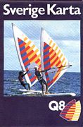
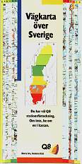
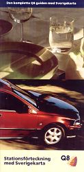
Q8 has also regularly issued maps in Sweden, although it is not known to have issued non-domestic maps.
 |
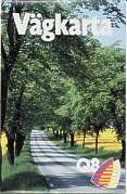 |
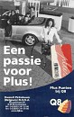
Top are a late 1980s and a 1993 A5 format map, possibly for free distribution. |
 |
 |
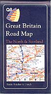 |
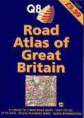
Q8's British subsidiary also issued a series of three maps in 1990. The country was split North-South at 8 miles to the inch, with the third section covering Greater London within the M25 motorway. There have been no sectional maps since 1990, although in 1998 Q8 did brand a hardback road atlas. This was given away with 5 litre packs of oil and not sold (the recommended retail price of £9.99 being wholly fictitious). Inside was a typical Automobile Association atlas with 79 pages of maps, mainly at 1:300,000. |
 Shown at 2/3rds relative scale |
 |
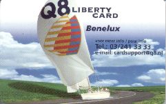
Q8's initial acquisitions in the UK mainly supplied small family-run filling stations. As these have suffered with competition from superstores and the huge investment of the Big 5 brands, Q8 found it hard to carve out a market niche, so sold its chain to investors who brought back the Pace name in 2005. One attempt was to import the concept of Automat (unmanned) stations from its Scandinavian affiliates, initially associated with food stores, and to develop payment card systems. The map shown left looks like a typical leaflet promoting fuel cards, but - again using the Scandinavian model - opens up to provide a map of Britain marking Q8 station locations. It was drawn by the AA in January 2002 at around 1:1,500,000. |
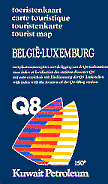 |
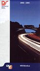
Q8's Belgian subsidiary has issued occasional maps, such as the 1987 one shown left. Most recently, in 1999, it produced a credit card sized map (shown actual size) which unfolded to give a simple map of the country, listing all Q8 sites before the Aral purchase on the reverse. |
 |
| Thanks to Michel Breugelmans for his help with these maps & the Gulf/Kuwait one above. | ||
|
|
|
|
|
|
|
|
|
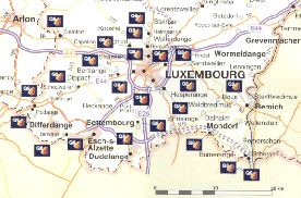
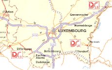
However on the following year's map (second left on top row), which uses the same Geocart design, all the Luxembourg stations have disappeared, possibly because they do not accept the Q8 Plus loyalty card shown on the cover. (Q8 still operates 43 sites in Luxembourg.) The other cover is in French.
Q8 has a strong diesel operation for truckers under the IDS (International Diesel Service) name, which has some refuelling points on countries without Q8 stations. The map shown centre top dates is a 2002/3 edition covering all of Benelux, so uses a smaller scale than the preceding one. IDS's Luxembourg outlets are also close to the border, and two of the three marked are not at Q8 service stations. The reverse side carries small locator maps for all 87 IDS sites in the three countries.
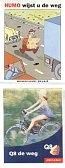
The final map (right and top right) is unusual as it was jointly promoted by Q8 and Humo, the leading Flemish humorous magazine. As such it is only in one language (not French) and, despite folding down to a tiny 10 x 8cm, manages to use a larger map scale by being printed on both sides of the paper. It also has a more traditional look, identifying wooded areas, but not locating Q8 stations - although Humo's offices in Brussels are marked.
Thanks to Kuwait Petroleum (Belgium) NV/SA for providing most of the maps in this section.
Q8 maps may also exist for Italy and the Netherlands.

Text and layout © Ian Byrne, 2000-6
All original copyrights in logos and map extracts and images are acknowledged and images are included on this site for identification purposes only.