New pages

New and improved pages on the
European Petrol Road Map Web Site

The webmaster's blog...2011

New in 2011:

This page shows the updates that were made to the PetrolMaps website during 2011; it gained another 88 map images and, like 2010, just 3 additional brands (Áfor, Super Penn and BZ) over the year. Over the passage of time some of the links may no longer work if I have moved images to a new location (for example through splitting large pages), although most of the content of this website is permanent and can still be found by using its search facility. In the autumn I was diverted to work on an exciting project to catalogue all known US oil company maps under the aegis of the Road Map Collectors Association, which now has a new and improved website, which led to a slow down in new pages on this site.

Olerex in Estonia
Most of the relatively recent European petrol maps have come from either Eastern Europe or Scandinavia, so it is not surprising that one of Estonia's leading petrol companies, Olerex, has issued a number of locator maps. Its most recent map is dated 1 June 2011 and marks all its service stations in the country. (Updated 27 December 2011)

A Total map of Beirut
The first known oil company map of Beirut, capital of the Lebanon, has now been added to the site. (Updated 10 December 2011)

A second Divinol map
During the autumn gap I was lucky enough to see some of the maps from the collection of Dave Leach, the map editor of Check The Oil! Magazine. He kindly allowed me to take a number of photographs for this website, and the maps will be appearing slowly over the next several months. Although I will attempt to scale them by the same factor as other maps (which are generally scanned on a flat bed scanner), there will be small differences, and in some cases the colour balance will not be quite as accurate. The first of these maps was the BZ map of Prague (below); the second is a Divinol motor oil map of Southern Germany dating from 1972-3. (Updated 10 December 2011)

BZ Maps from Czechoslovakia
BZ was the pre-war predecessor brand to Benzina. It is now known to have issued a series of 37 large scale maps of main tourist areas in the 1930s over a period of time. It also distributed a stock city map of Prague, which it modified to hide references to its competitors, and then pasted into stiff paper covers. (Updated 4 December 2011)

There's been a gap...
I try and keep a steady flow of updates to the website, but this autumn I have been just too busy on other activities, mainly related to my day job (it is an amateur site, after all). However I have also been helping out on a project to document all known North American oil company road maps being run by the Road Map Collectors Association. This will ultimately be made available online to members (and it's not expensive to join), but as a sneak preview, here are some US maps that were scanned for the project:
1953 Ace Products map of Minneapolis St Paul 1953 Aetna map of Kentucky/EUS 1963 Ashland map of Louisville 1951 Apco Challenge map of Central US 1933 Barnsdall map of Chicago and Century of Progress Exhibition 1959 Bay (Tenneco) map of Georgia and the Carolinas 1968 Bonded map of Ohio
1953 Ace Products map of Minneapolis St Paul 1953 Aetna map of Kentucky/ Eastern US 1963 Ashland map of Louisville 1951 Apco Challenge map of Central US 1933 Barnsdall map of Chicago & Century of Progress Exhibition 1959 Bay (Tenneco) map of Georgia and the Carolinas 1968 Bonded map of Ohio
The images above are taken from the draft A and B minor brand pages. Although none of the names represented ever sold petrol in Europe, Ashland owned Valvoline lubricants which were (and still are) widely distributed. Apco was acquired by France's Total, and Bonded by Marathon which operated a couple of chains in Europe in the 1960s. And Bay was owned by Tenneco which at one time owned various European petrol chains including those under the Butler, Globe/Golden and GB names.
And I have updated the swaplist, of maps that I have available to trade for other maps (but not to sell), as I have made quite a few trades involving UK maps. (Updated 26 November 2011)

A 1988 Esso Lubricare map of Great Britain
Esso's Lubricare arm was known to have produced road atlases of Britain in the 1990s, but a sheet map from 1988 has now been discovered. (Updated 30 September 2011)

Three National Benzole atlases
Three earlier National Benzole atlases are now shown, with two by Johnston & Bacon likely to date from the 1950s, and one from George Philip & Son from 1963. Additionally a summer 1953 brochure promoting events taking place across Britain in the Coronation year has been added to the section on National Heritage publications. (Updated 24 September 2011)

Kenning's first road map?
The Kenning Motor Group claimed to be England's largest chain of car dealerships in the 1950s and 60s, and also operated a substantial number of forecourts selling petrol. Up to now, the earliest known Kenning map came from the mid-60s, but a 1958 one has now been discovered and added to this website. (Updated 18 September 2011)

Super-Penn lubricants
The famously high quality of 100% Pennsylvanian crude oil when refined for lubricants meant that in the 1950s there were several independent companies using the name Penn as part of their branding, including Pennol-Aviol from Switzerland and Penna-Pura (Fuchs) of Germany. A road map of Belgium has now been found from a firm using the name Super-Penn. (Updated 18 September 2011)

A map from Áfor
Áfor was the monopoly petrol brand in Hungary during the communist era - except that it wasn't actually a monopoly as the New Economic Model permitted three Western companies - Shell, BP and Agip - to form limited joint ventures under their own brands. The map shown on the Hungarian country page dates from 1974 and marks Agip stations as well as those of Áfor, possibly because most Áfor stations also sold Agip F.1 motor oil. (Updated 12 August 2011)

More history updates
I have updated a number of pages to reflect recent changes in ownership; the most significant has been the agreed sale of Spain's Cepsa to IPIC, so I have removed it from the Elf page and created a new Cepsa page, taking the opportunity to add the 2011 Mapamax road atlas. While updating some information of Dutch companies, I add a photo of a dcb station (but no more maps). (Updated 11 August 2011)

A map of East Berlin
A city map from East Germany has been found - it was a very simple issue from Minol, dating from 1986 and listing its better quality service stations on the reverse. (Updated 1 August 2011)

Mobil in Portugal and Hungary
I am spring cleaning on the Portugal, Hungary and Mobil pages, and took the opportunity to add a 1985 Mobil map (that a friend kindly sent over an image of 4 years ago - they will all get added eventually, I hope) as well as another image of a Sphinx from Hungary. Sphinx Benzin was owned by Vacuum Oil Company, one of the two main precursors of Mobil, which tended to use local branding in Europe in the 1920s/30s - including Auto-Gazo in Portugal. (Updated 24 July 2011)

An Esso Folder, as selected by the Design Centre London
Around 1969 Esso's UK subsidiary sold a special plastic folder with pockets to store its sectional maps and an integral clear plastic folder on which users could temporarily mark routes using a chinagraph pencil (known as a grease pencil in North America). (Updated 14 July 2011)

A 1970s Shell motorway leaflet and a 1984 Cartoguide set from France
Shell continued to publish (and sell) sets of its renowned Cartoguides into the 1980s, and a later example than shown before has now been added to the site, dating from 1984. This is joined by a slightly earlier (1978-79) leaflet with a rudimentary map showing the location of Shell's 28 autoroute stations. (Updated 4 July 2011)

1930s BP-Olex Touring maps
Shell issued an extensive range of street plans and touring maps of German cities and holiday areas with graphic cover drawings that are quite widely seen. Until now, it was not thought that any equivalent maps were issued by BP-Olex, but a small number of sections have now been discovered. (Updated 3 July 2011)

Shell adverts on Falkplan street plans in Germany
Shell has been a regular advertiser on the rear covers of Falkplan street plans for German cities. These are widely found in Germany, so perhaps that's one reason that I have not shown any on the German map adverts page before. The example chosen is relatively late - a 1991 city map of Hannover. (Updated 12 June 2011)

Shell's Atlas of London for the Festival of Britain
It's 60 years ago this week that the Festival of Britain opened, bringing some much needed cheer to the austerity of post-war London. As no oil companies appear to have issued a special map for last week's Royal Wedding, I thought it would be fun to show the 1951 atlas here, as well as on the Shell Britain page.
1951 Shell Guide to London

Shell sold this spiral bound Motorists' Guide to London in 1951, designed for use by provincial motorists coming to see the Festival of Britain. Its 40 pages included two on "The Art of driving in London", four of "Difficult spots in London traffic" including perspective views of the eight most complex junctions, a gazetteer section illustrated with black & white photos and eight pages of colour maps from George Philip & Son at the back. The rear cover referred to the continuing monopoly of unbranded (pool) petrol with the rhyme: "THE FESTIVAL SPIRIT: Let's be gay/Goodbye to sorrow/Pool today -/But Shell tomorrow".

Esso also published a special map of the UK entitled "What do they talk about?" that's shown on the page devoted to Pratts and Esso pictorial maps. (Updated 2 May 2011)

A 2008 map of Belgium
Total has continued Fina's practice of producing good quality maps of Belgium for use by card holders, locating all Total branded stations. These do not appear to be produced every year, and the latest addition to the site is the 2008 edition. (Updated 2 May 2011)

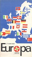
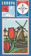
Two Shell Touring Service Guides to Holland
Shell's Touring Service sometimes supplied customised versions of third party brochures. Two examples have been added from the very early 1960s - both of Holland, but one in French and the other in German. (Updated 2 May 2011)

Two BP EPs, a French BP brochure of Germany and BP's Welcome to Great Britain
The BP Touring Service produced a diverse range of maps, guides and brochures in the 1950s. I have added to the selection shown by including a French language guide to West Germany containing 11 tours, two extended play records and a map booklet of Great Britain and Northern Ireland splitting points of interest into nine categories. (Updated 1 May 2011)

The Shell France page has been split into two: Cartoguides and other special Shell maps.
Although the site has shown a selection of Shell maps from France for many years, the occasional maps that accompanied the cartoguide series have not been fully described. A total of 10 new maps have been added to the newly created page, including a boating map, more city maps of Paris and Toulouse and more maps showing stations open at night. In addition the earlier 1950s series of small booklets Connaissez la France is shown for the first time. This has freed up more space on the main cartoguide page, which now includes the 1950 box and advert used when the series was first launched. (Updated 30 April 2011)

A 1927 Shell map booklet of Italy
Few oil company sheet maps of Italy are known from before 1945. However in the 1920s Shell jointly sponsored a map booklet with CIT (Compagnia Italiana Turismo) showing how to go "Through Italy by Motor", and the 1927 edition has been added to the site, along with more information about the 1930 edition. (Updated 29 April 2011)

A Caffyns booklet from 1929
Also in today's booklet theme, I have uploaded a 1929 map booklet from Caffyns, the Eastbourne-based garage chain that sold major brand petrol. As well as a map section by John Bartholomew & Son, this booklet included photographs of most of its service stations, and the one in Lewes has been selected to be shown. (Updated 29 April 2011)

A pre-war map of France showing Yacco stockists
Yacco, the "oil of champions", issued a booklet listing its stockists with colourful covers in 1939. This also had a basic map of the country pasted into the inside rear cover. (Updated 29 April 2011)

Shell's first post-war map of Portugal
Around 1948, Shell teamed up with its London map publisher Foldex to produce a map of Portugal in its trademark red card covers. This has now been added to the Portuguese maps page. (Updated 29 April 2011)

Total advertising on a camping map
The Total brand was introduced in France in 1954 by the country's largest refiner, Compagnie Française de Raffinage. As a new name competing with market leading brands such as Esso, Shell or Azur, it clearly needed to be promoted to leisure motorists, including those going on holiday. So in 1958, Total took the rear cover advert on a Camping Map of the country issued by the Fédération Française de Camping et Caravanning. (Updated 25 April 2011)

Avia's 2005 and 2008 maps of Belgium
The Avia co-operative brand has occasionally issued maps of Belgium, primarily for its cardholders that locate stations where their cards may be accepted - not just Avia, but also including Octa+ and Power. Two relatively modern examples are shown. There's a rather silly error on this map, where a ferry is shown as going to the port of 'Killing Home' and this has been added to the errors page. (Updated 22 April 2011)

An extra Agip map of Austria
Agip's Austrian subsidiary has possibly issued more maps than any other Agip marketing company, except for the home market of Italy. (Updated 18 April 2011)

The Shell Pilot to the English Channel
Although this website is largely about sheet maps, it does extend to other cartographical products sponsored by petrol and oil companies. One example is the Shell Pilot Guide to the English Channel. Originally issued under another name in 1939, it was first sponsored by Shell - as The Shell Pilot to the South Coast Harbours - in 1968, and numerous revised versions have been issued in the following 40 years. This new page shows examples ranging between 1968 and 2009, and charts the move from black and white photographs for identification to more comprehensive extracts from nautical charts being interspersed with the text. (Updated 17 April 2011)

Michelin maps as swaps
As noted on my Swap List page I am a collector and don't generally sell any maps, preferring to swap any duplicates on a one for one basis. Although I only collect petrol and oil company maps, I sometimes end up with other maps and know that there are collectors of early Michelin issues. I have therefore started listing a few 1914-34 British Michelin maps on my swap list - I will of course be looking for suitable oil company issues in exchange. (Updated 22 March 2011)

Six map covers on the Home Page
While reviewing the changes to the design of the website, it struck me that there were no actual map examples on the home page, so if you arrived at it via (say) Google you might not really know what the site was about. So I have added six images of maps of Europe from six of the largest companies active in the market. I'm not sure, though, that I will keep them there, not least because it's not practicable to describe them there. So in case they get removed, I have repeated them here, and added short descriptions:
1974 Aral Map of Europe ca1962 BP Map of Europe 1963 Caltex Map of Europe 1968 Esso Map of Europe ca1963 Fina Map of NW Europe 1964 Shell Map of Europe
The six images above are from typical petrol maps of Europe issued by Aral (1974), BP (ca1962), Caltex (1963), Esso (1968), Fina (NW only; ca1963) & Shell (1964).
Aral's is the only example from after the first oil price shock and is drawn from a set of sectional maps of West Germany; although sold mainly through Aral stations in that country, the map programme was essentially that of its cartographer, Busche. The other five are all from the 1960s, which was the heyday of petrol companies branding maps.
BP's is probably just the earliest, dating from around 1962. One side of the map displays the European heartland bounded by London, Berlin, Toulouse and Florence (Firenze) at the useful scale of 1:1,250,000; the reverse is a map of the main highways at 1:4 million, including all of Turkey as an inset. John Bartholomew & Son Ltd prepared this map in Edinburgh.
Caltex's issue is from 1963 and unusually describes it as "Motorway Maps", using a term that had only recently become popularised in Britain. Caltex had no branded service stations in Britain, but this map would have been available to customers of Regent petrol stations, operated by an affiliate controlled by Texaco. The map was printed in the USA but of a poor quality, at around 1:6 million, but backed with information on Caltex grades and a list of European capitals.
At one time Esso ran a large touring service but by 1968, when the map shown here was published, distributed its maps through local operations and service stations. The price of one shilling shows this copy came from Britain (or Ireland).
Belgium's Petrofina was a medium sized participant in most Western European markets. Despite this it too ran a touring service, and unusually split Europe across four undated maps at a slightly larger scale, using cartography by de Rouck. Fina's N-W Europe was largely the British Isles and Benelux, with the Northern third of France.
Finally, Shell has published more maps in Europe than any other company (although the total print runs of Esso maps may be higher). Its 1964 map had a classic cover and was prepared by Rotopress in Stuttgart on behalf of a Dutch Shell company for distribution by all subsidiaries. Inside the map was highly usable with reasonable detail, despite the relatively small scale of 1:5 million.
(Updated 13 March 2011)

Top of PageMore Regent Road Atlases
After approximately 80 years selling petrol in Britain, either under its own name or that of its Regent subsidiary, it has been announced that the Texaco operation is being sold to the US firm Valero. After a short lived - and pricey - series of sheet maps, Regent concentrated on selling spiral bound road atlases in the 1950s, with the latest known one dated 1960. Three more cover design variants have been added, including a special edition for the Queen's Coronation in 1953. (Updated 13 March 2011)

An earlier Optimol advert
Munich-based Optimol regularly advertised on maps from fellow Munich form JRO. The company was largely a specialist lubricant blender, although it did have at least one service station in the 1960s. An advert from a map dating to around 1952 has now been added to the site. (Updated 13 March 2011)

A new look for this website
I have commented before that it's increasingly hard to keep up to date on a website that is largely hard coded into HTML, while still allowing the pages to be visible on a wide range of monitors and browsers. (When the site was first created, most people used Netscape with a few using Internet Explorer. These days Netscape has long been replaced by Firefox, with Chrome and Opera preferred by some; all interpret coding slightly differently. Nonetheless, I have tried to update the site. The old, hand-drawn "map" background has been removed, but I have now placed the text onto an "island" of green, with a yellow sandy beach in a sea. I have kept the width quite narrow, to allow for pages to be printed without much loss of detail - there is now a separate style sheet for printing. I have used a lot more div statements in the code, the limit the reliance on tables (although most map images are still laid out in tables). It's 6 years since I introduced style sheets, and hopefully this update will last for at least as long. (Updated 6 March 2011)

A second map from Millers Pistoneeze
Millers Oils is a specialist supplier of lubricants that has operated for many years. In the 1950s it gave customers a map of England & Wales inside light card covers. A second version of this map has been discovered, with different cartography and the rear cover design from the first map now used as the front cover of the second map. (Updated 25 February 2011)

A pre-war Esso map of France
So far this site has shown a number of pre-war Standard (Esso) maps of France, plus some Esso Répertoires Kilométriques, but no purely Esso sheet maps. One has now been located, dating from around 1938, that carries a very similar design to its Standard equivalent from a couple of years earlier, featuring an Essolube oil can bursting through the road map. (Updated 18 February 2011)

Three more from Petrol Caltex
Caltex initially only own 50% of its Italian refinery, so used the branding "Petrol Caltex" until the early 1960s. Three more maps have been added to the Caltex page, including an early 1950s atlas and a late 1950s map featuring an emaciated cartoon cowboy. (Updated 11 February 2011)

An Advert for John Eccles British High Test Motor Oil
Adverts on maps in atlases can occasionally reveal glimpses from long lost companies, such as Blackburn-based John Eccles (Oils) Ltd, which advertised in a 1935 "R.A.C" County Road Map & Gazetteer of Lancashire and the Isle of Man. (Updated 8 February 2011)

An Interactive Petrol Map of Britain and Energy Saving Motoring
This new page embeds an interactive map of Britain that shows petrol stations by brand and recent prices for petrol, diesel and LPG. Of course, finding low price fuel is only one way of saving money, so it also provides ten eco-driving tips. (Updated 31 January 2011)

A later Yacco map of France
Yacco, L'huile des records du monde (the oil of world records) is a long established French lubricant brand acquired by Total in the early 1990s. Although no earlier maps are known, it has since produced at least two promotional maps, with the most recent dating from 2005. (Updated 10 January 2011)

An earlier Mobil map of Turkey
In the early 1960s Turkey's petrol market was dominated by 5 companies with just one American name - Mobil. A 1963 Mobil issue of Turkey, using local cartography, has now been added as the first update for the new year. (Updated 9 January 2011)

Top of Page

Latest Updates

Updates from 2015

Updates from 2014

Updates from 2013

Updates from 2012

Updates from 2010

Updates from 2009

Updates from 2008

Updates from 2007

Updates from 2006

Updates from 2005

Updates from 2004

Updates from 2003

Updates from 2002

Updates from 2001

Updates from 2000

Updates from 1999

Text, "new" icon and layout © Ian Byrne, 2004, 2011

All original copyrights in logos and map extracts and images are acknowledged and images are included on this site for identification purposes only.