ESSO
Other Esso Touring Service aids
This page looks at some of the other items distributed by the Esso Touring Service in its main operating period from 1952 to 1962.
Phrase books
|
|
|
|
|
|
|
|
This is a simple fold out card with 28 basic phrases. The smaller leaflet (left) has eight languages, including Swedish. The larger one has just six - Italian, Danish, German, English, Spanish and Dutch, plus French, the host language, repeated on both sides. A ninth panel gives traffic regulations in France in the six non-French languages. Different versions of this were produced for the main host languages; the Danish version (for example) is entitled PARLØR. |
Leaflets were also produced for specific countries. The three examples above were for British travellers in the mid-1950s and 1960s (right). All have 20 pages, but the older ones have a more extensive selection of phrases, although neither could replace a decent phrase book. They also have a page of "handy hints" (such as "Your picnic kettle and teapot may be useful" in France, but not Germany!!) and the older guides have a small scale map on the centre pages, and for France a list of Esso dealers at ferry ports. |
||||
|
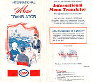
This Menu Translator dates from the late 1960s and was prepared in the USA by Christopher's Travel Discoveries of Milford, CT so may only have been for distribution in North America. It translated popular menu items from eight languages — English, Spanish, French, Italian, German, Swedish, Greek and Yugoslavian (Serbo-Croatian) [sic] — with a total of 5,000 words, claiming to end confusion and thus save time and money. It's rarely seen complete as users were encouraged to "cut along dashed lines to eliminate languages not needed on your immediate trip". |
 |
Other guides...
|
|
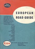
The European road guide was a full colour 72 page booklet with information on over 45,000 miles of roads in Europe. Around 150 strip maps were accompanied by very brief descriptions of places en route and an introductory page for each country. The guide originally came with a planning map of Europe, a route marker pen and a windscreen sticker, which would have shown the international road signs not then used in Britain. Versions were produced for sale in all Esso's main markets. |
|
...a giveaway at a border crossing...
|
|
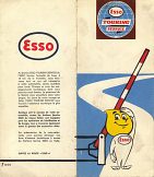
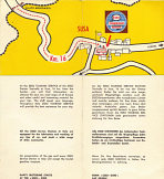
This little folder, measuring approx 190mm by 85mm was given away to show motorist where the first Esso Touring Service station could be found on the Italian side of the border with France. When published, which is likely to be the late 1950s or early 1960s, the nearest Esso station was in Susa, 16km from the border. It's likely that other versions were produced for Italian border crossings, as two other examples are known from the die-cut series below. |
|
|
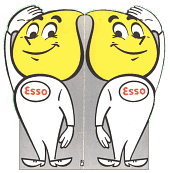
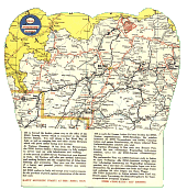
The unfolded outside of a light card "Happy" (the Esso oil drop character) is shown here. When opened it revealed a map of part of Northern Italy. At the top is the Brenner Pass, marking in red an Esso Touring Office where free maps of Italy can be obtained just 300 metres from the border. The text, in English and German, also promotes the Esso station in Vitipeno, 14km South and the network of stations in Italy, reminding motorists that they sell Atlas tires and accept petrol coupons. The item is 95mm x 200mm when folded and undated, but likely to be from around 1960. |
|
...a ferry timetable...and even a bag!
|
|
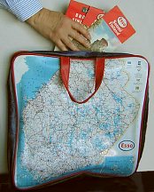
This PVC bag carries an Esso map of Finland, and is thought to have been created for sale by Esso stations in the country in the late 1960s. |
|
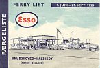
Until 1998, Denmark was still divided by the Great Belt, with a long ferry crossing between Funen (Fyn) and Zealand (Sjælland). For many years Esso operated a service station at the ferry crossing (until it was acquired by the independent firm Haahr), and innovations included mobile units refuelling waiting cars. This Ferry List covers the period 1 June to 27 September 1958 and is just one of many ephemeral items issued by Esso in the 50s and 60s. |
||
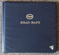
An English folder, selected for the Design Centre
 |
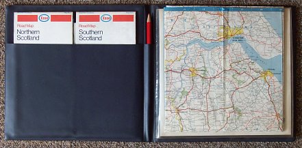 |
"Insert the appropriate map section in this clear pocket for easy reading while you drive.
The chinagraph pencil can be used for plotting your route. The markings can be wiped off when you have finished your journey."
As Esso maps were at five inches to the mile, and were readily refolded into sub-sections around 8 inches square, this gave a visible map panel that would typically take an average driver a good hour or so to cross before motorways or dual carriageways were common. Of course the way the map was folded sometimes produced apparently impassable barriers, such as the River Humber (as on map 4, folded in the photograph) which could only be crossed using the New Holland to Hull car ferry. (The first bridge is hidden over the fold near Goole.) The folder was produced for Esso by Crofton Ltd.
German items, outside the Touring Service - pre-War
 |
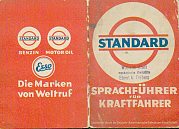
Finally, three items that pre-date the formal Touring Service. Left is a Wander-Winke dating from around 1935, printed on thin paper. This is described as being an overview map of the Weserbergland, but includes neither a proper map nor ties in to the main Standard map of the area (No. 16). One of 15 Wander-winke, it highlights places of interest on a circular tour, and has a number of monochrome photos. |
 |
|
The smaller format phrase book consists of 14 pages of phrases in German, English, French, Italian, Dutch, and Danish. The final two pages are in German and summarise driving laws in the various countries - including the note for Britain that the carrying of weapons is forbidden! The first two pages list the addresses of the Standard distribution companies in each country, including - unusually - the Lithuanian free port of Memel (Klaipeda). |
 |
German items, outside the Touring Service - post-War
 |
 |
 |
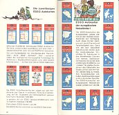 |
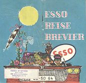
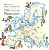
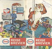
After the Paris-based touring service closed, Esso Germany maintained a similar service through its cartographers, Karl Thiemig. The illustrations above come from the 1964 and 1966 Reise Brevier (top L & R); each has a route planner as its centrefold (above). In 1964 there was a single route from the North Coast to Bavaria shown; in 1966 strip maps were included for bye-routes parallel to autobahns. |
  |
|
Each guide included basic phrases in main languages, rules of the road for 19 countries and a comprehensive checklist of items to take on holiday. They also promoted Esso's German and European maps, available from Esso dealers at 95pf (German sections) or DM1.35 (special maps and those for other countries). |
||
 |
Karl Thiemig also distributed Esso maps for countries outside Europe. A card slipped inside some German maps advertised 91 titles from North America, Asia, Latin America and Africa (and Iceland!) at DM2.50 each. Samples shown in colour included (left) New York City, Paraguay, Libya, part of Japan and Singapore. |
|
Thanks to Stan DeOrsey for the scan of the Standard phrasebook and the non-European maps on Karl Thiemig's card.
This concludes the section on Esso maps. I hope that you have found it interesting and informative!
Text and layout © Ian Byrne, 1999-2012
All original copyrights in logos and map extracts and images are acknowledged and images are included on this site for identification purposes only.


