Petrol Company Road Maps from the South East Mediterranean
Introduction
The South East Mediterranean may be close to Europe geographically, but - with the exception of Israel - economically and politically it looks as much East to Arabia, as to the West. Over the past 50 years this has manifested itself in a tendency for authoritarian Governments, often with only a limited commitment to supporting private enterprise, and an instinctive hostility to large, multinational companies based in the USA or Europe. Distrust of large oil companies, largely as a result of their upstream interests, has reduced their involvement downstream, with several countries in the region nationalising all or part of their oil industry, or else making it unattractive for them to stay. Political tensions (and wars) have also made it a less attractive region in which to invest, even when markets have been relatively open.
This page will look briefly at the downstream market in each of six countries running East then North from Libya to Syria, together with any known examples of petrol company maps.
Libya | Egypt | Palestine | Israel | Lebanon | Syria
 Libya
Libya
Market History
After being part of the Ottoman Empire until 1911, Libya became an Italian colony until the end of World War II, when it was administered by Britain and France until independence in 1951 as the United Kingdom of Libya. In 1969, Colonel Qaddafi led a military coup and proclaimed Libya a Republic, officially the Popular Socialist Libyan Arab Jamahiriya from 1977 until the overthrow of the regime in 2011.
In the 1960s vast reserves of oil and gas were discovered in the country and Libya became a leader in first negotiating favourable contracts with oil companies, and then nationalising them. The Libyan downstream market was also nationalised in 1970, leading to the ending of international brands of petrol. Perhaps ironically, Libya developed its own international marketing company, Tamoil, which sold petrol in Italy, the Netherlands and a number of other European and African countries. In 2007 the Tamoil operation was sold to a consortium of international investors, although Libyan interests in North and East Africa, using the Oilibya brand, have rapidly expanded and now supply over 1,250 service stations.
Maps
No other oil company maps are known from Libya. The Libyan monopoly (Brega Petroleum Marketing Co) still uses retrofitted Esso signs at some locations (left), although more recently a sign showing a white camel on a green square background has also been seen. |
|
 This Esso map of Libya dates from 1967, and was prepared in the usual house style using cartographic conventions from the General Drafting Co.

|

|
The map on the far left covers all of Libya at 1:2,000,000, in English. It is an accordion fold between two detached cardboard covers measuring 4.25 x 11 inches. There is no date or cartographer, just "Printed in The Netherlands", but from its style it would be 1958-61. Pasted inside back cover are city map foldouts of Tripoli, Benghazi, Beda, and an index of all cities. The map shows vegetation areas and elevation topography - it is an interesting map of the desert with oasis locations. The maps also locate numerous Shell stations. Near left is a 1959 Shell map of Tripoli. It is 1:10,000 and 1:5,000 downtown in accordion format measuring 4.75 x 10.75 inches. The map is in English, locates Shell stations and has a directory of streets and other facilities. Issued by Libya Shell N.V. and The Shell Company of Libya Ltd it explains why it is called provisional: "This plan was made by Shell Staff for their own use and we do not claim that it is complete or without errors. However, in the absence of a more comprehensive plan and in order to serve the Public and Shell customers, a limited number of extra copies have been made available for distribution, free of cost." Images and information courtesy Richard Horwitz |
 Egypt
Egypt
Market History
Egypt was held by the British from 1882 to 1922 before becoming an independent monarchy. This was abolished after a military coup in 1952, and since 1954, Egypt has been a democratic socialist republic. Shell (through Anglo-Egyptian Oilfields Ltd) struck oil at Hurghaba on the Red Sea in 1913 and soon became a dominant influence in Egypt's oil sector, with downstream activities managed through the Shell Company of Egypt. Inevitably, when Britain and France started military action against the country over the Suez Canal, Egypt responded by seizing all Shell's assets in the country in November 1956. Shell did regain some assets and obtain compensation but by 1964 the retailing assets had become part of the Egyptian General Petroleum Corp under the Misr ("state") brand.Mobil and Esso, being US rather than UK controlled, have continued to operate in the country and were the only international brands selling petrol in the 1970s and 80s. As well as Misr, another affiliate of EGPC (the Petroleum Co-operative Society, El Ta'awun) also retails petrol. In the 1990s, the market was liberalised, and Caltex - which had been in Egypt since 1937 - now operates 60 service stations. Shell has re-entered the market in a small way, and Total and Libya's Tamoil has also built a chain of filling stations. Privatisation of the EGPC affiliates remains slow, but two refiners have entered into a joint venture with the UAE's Emarat to develop a network of service stations.
Maps
|
In 1930 Shell promoted a pair of travel books from Egypt, both in English. The Road Maps (front and back shown left) have no date, and include regional maps of the country and by the Royal Automobile Club in cooperation with Shell. Shell has adverts, credit and the back cover. A contemporary Shell Motor Tours book (1st edition 1930) describes tours around Egypt, but for maps refers the motorist to the Road Maps book. |
|

")
 map of Egypt") |
Shell's asphalt operations were particularly important, and built a number of roads (and 60 aerodromes during the 1939-45 war). The image above right comes from a 32 page booklet, dating from about 1939 to commemorate the construction of the King Faoud Way (Cairo-Alexandria Desert Road). Although it does contain a simple map of the road, it is mainly a photographic souvenir, explaining the benefits of Shell's asphalt roads. (Image of frontispiece; the cover lacks the Shell symbol.) |
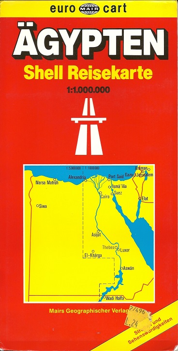
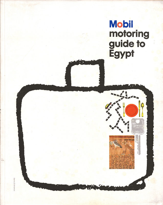
The only post-war map known dates from 1982 and is the Mobil motoring guide to Egypt, which is written entirely in English. Slightly larger than A4, it contains 33 pages of fairly basic maps of parts of the country and major towns. It also includes driving information, suggested tours (including day trips from Cairo, and a basic glossary of Arabic motoring terms. Mobil gained the information by travelling on "40,000 kms on about three-quarters of Egypt's roads by private car in 1980-81". Some of the advice sounds quite idiosyncratic, including "In all serious accidents...remember that you cannot protect yourself from the crowds. You must stay in your car and go quickly to a police station removed from the scene." As an antidote to others' bad driving habits, motorists are advised to "take lots of Vitamin B, relax and take care of Number One." Despite being published by Mobil, it refers several times to the low quality of Egyptian gasoline at 78 octane (which may be contaminated with dust or water). Hotels are rarely praised, but more often described as overpriced. |
 |
 Palestine
Market History
Palestine has the possibly the most troubled history of the six countries on this page. Part of the Ottoman Empire until 1918, it was occupied by Britain from 1917 and under a British Mandate from 1922-47. During this period it was unstable, with the British authorities barely in control; not the conditions to create a stable economy likely to print maps for leisure motoring. In 1948 it was divided into two when Israel formally declared independence, and from 1950 the West Bank formed part of Jordan, with the Gaza strip under the control of Egypt. Both areas were occupied by the Israelis following the 1967 war. Although there has been some autonomy, especially in Gaza since 1988 when the PLO declared the state independent again (and with Jordan and Egypt renouncing their claims), economically the country remains weak and unable to function as a modern state.
Prior to 1948, Shell, Esso and probably Mobil had a presence in the country, with the Shell Company of Palestine being formed in 1922. The current status of the downstream oil industry is unknown; in the late 1980s the West Bank had a monopoly supplier (transliterated approximately from the Arabic as Pashkov), except in Israeli settlements, where Israeli brands were active.
No petrol company maps are known from either the Palestine Mandate period or the country today under the control of the Palestinian Authority.
 Israel
Market History
Created in 1948 by the Zionists after the ending of the British Mandate in Palestine, Israel has developed rapidly into a prosperous and relatively free economy, with the strong financial support of the USA. Despite this, Israel made it impossible for the international oil companies to operate in the downstream market profitably.
Esso sold out to Delek, the Israel Fuel company; Mobil Oil Israel became Sonol in 1957, and the market leader, Shell, became the Paz Oil Company in 1958. Despite this, Sonol was for a period owned by a US corporation and Paz held through an Australian investment company. Until the late 1980s, these three brands controlled almost 99% of Israeli service stations (there were a handful under the OZ brand, thought to be connected to Paz). In 1989 the kibbutzim movement, in the shape of Alon entered the retail market, and rapidly became a significant force, with a share in excess of 20% after its purchase of Dor Energy (another late entrant). Ironically, Alon now supplies more service stations than exist in total in Israel through its US arm in Texas and adjacent states, which acquired the Fina chain. Delek has also expanded outside Israel, acquiring the Texaco outlets in Benelux in 2006, BP's French chain in 2010 and the Mapco and EastCoast chains in SE USA. A third Israeli concern operates over 100 Valero gas stations (FasMart/Shore Stop) centred on Virginia.
Maps
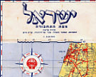
Paz lost no time in issuing a road map showing its locations. The example shown here dates from 1958 and already marks Paz locations; essentially it was a customised version of the Map of Communications produced by ZVI Friedlander. The map was pasted into a red linen cloth cover which opened in a book style to reveal the wholly Hebrew map inside. |
|

|
|
|
|


Friedlander's city maps published in the early to mid 1960s mark the location of Paz stations, as shown on the small map extract from Haifa. These city plans lacked any sort of cover or other promotion for the petrol company, but carried some other advertising, and also marked the location of all Bank Leumi branches.
Map of Communications images courtesy Richard Horwitz
|
|
|
|
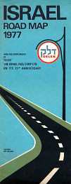
The four maps shown here are (L-R) a 1999 Paz road atlas of Israel, which is spiral bound, a 1977 Paz map; a 1960 Sonol map (showing how similar the typography was to that of Mobil) - the same design was used in 1964 - and a 1971 Sonol map. | |||


|
|
|
The far left map from Delek is undated, but shows the 1948-67 boundaries of Israel. The centre map is a 1969 commercial issue described as being "Amir's Pictorial Map of Jerusalem", but has overprinted in the box on the rear "With the Compliments of DELEK". The near left one dates from 1977 and carries the information "With the Compliments of "DELEK" the Israel Fuel Corp. Ltd. on its 25th Anniversary". |


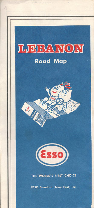
 Lebanon
Market History
As a French mandate from the end of World War I, Lebanon's downstream petrol industry attracted the usual mix of US brands, Shell and Total, in the guise of Mory. By 1971, the market was still dominated by the same brands - Total led the pack with 232 outlets, followed by Mobil (217), Shell (136), Caltex (125), Esso (50) and BP with just 5 service stations. In 1973 the Lebanese government nationalized the oil refinery at Tripoli, formerly owned by the Iraq Petroleum Company (IPC). However it was the escalating civil war in the 1970s that led some the international brands to withdraw; Shell-BP sold out to Coral Oil in 1976 which replaced the two British brands with Coral and Speed. Esso is believed to have sold its operations to Medco. Caltex's operations passed into a affiliate using the Phoenicia Caltex brand, although it continues to own the Mediterranean Refining Co at Az Zahrani jointly with ExxonMobil. Unable to operate after 1986 due to damage by the Israelis, it appears to have been operational again by 1998. Mobil is listed in Lebanese service station lists but not on the ExxonMobil website.In recent years the larger brands (which still include Total, although with a reduced market share) have been joined by a number of other local brands. SLP (Sinco Lebanese Petroleum) was founded in 1996 by Karim Wafic Sinno and distributes petrol throughout Lebanon. Levant Oil opened a storage terminal in 2001, and from 2005 Levant Oil started opening a chain of service stations under the retail name of LEO. Hypco and Daou Oil are other names now understood to be found in the market.
Maps
|
|
These Shell maps of the Lebanon date from the 1960s, and were prepared for the company by Offset Imp. Catholique of Beirut. Both are in card covers and contain the same map of the country at 1:200,000 divided into two sections, with one section pasted into each of the covers. (The smaller format of the later cover is simply due to narrower margins on the maps.) The reverse side of the earlier map's North part (1960, far left) carries a map of Beirut environs at 1:100,000, which has no more detail than the main map. By the mid-1960s, both internal maps had information printed on the reverse: North with an illustrated list of key sights, South with a street plan of Beirut. All information was in French only. |
|


The undated Esso map (above right) probably dates from the early 1960s. Although the way it was folded with the Esso title panel facing out indicates it was printed specially for the company, the rest of the map is the Tourist Map of Lebanon prepared by Boulos F. Boulos and printed by the National Lebanese Printing Press. The main map is at around 1:210,000 and marks all sources of water (springs, etc.) categorised into five flow rate bands. It also prominently marks ski slopes and archaeological centres split into six eras. The reverse consists of a large plan of Beirut, as well as a gazetteer using abbreviations to list each locality's agricultural produce and tourist sights. So Jebail, for example, is described thus "ad-ce. castle-to-columns (St John Baptist church) catacomb, ph remparts and temple. ro-théatre. or. ol. tc-orient. 3 bk. 2 sec-sc." Unlike all the other maps shown here, all text is (notionally) in English, but as the example shows, odd bits of French creep in!
|
The Caltex issue shown here was a joint venture with the US tyre company B.F. Goodrich, but the cover design was broadly similar to that of European (or Asian) Caltex maps from the 1960s. The map was reversible to display French or Arabic covers. |
|


 Syria
Syria
Market History
After the collapse of the Ottoman empire, Syria was under a French mandate from 1922 to 1946. A series of short-lived Governments and military coups followed, but has been relatively stable under the socialist Baathist regime of the Assads from 1970 until 2011, despite involvement in wars with Israel and in Lebanon. Syria's oil industry was nationalised before 1970, and retail distribution appears to be under the control of Mahrukat, an affiliate of the Syrian Company for the Storage and Distribution of Oil Products (SADCOP).
|
MapsThe Mobiloil map of Syria, Lebanon and Jordan on the left dates from the early 1950s and the Mobil version on the right from the first half of the 1960s. Both are in English and Arabic and were published by the Socony Vacuum Oil Company of Syria.
|
|


It is probable that the other international petrol companies, including BP, Mobil/Mobilgas and Total (and possibly earlier names such as CIP and Mory) would have issued maps in some of the countries; Shell, Esso and Caltex may have issued maps in more than those shown. Other brands named above, and yet others not known to me, may also have issued branded maps. If you have a map from one of these companies, or could send me a scan of such a map, or - better still - the map itself, or if you can fill in some of the gaps in the historical accounts above, then please send me an e-mail!

Text and layout © Ian Byrne, 2006-14
All original copyrights in logos and map extracts and images are acknowledged and images are included on this site for identification purposes only.