TOTAL group
Total, TotalFina
Shortcut to Total Home Page
Total outside France
The page concentrates on TOTAL maps outside its home market of France. As noted on the main TOTAL page, the company made a number of acquisitions in the 20 years from the mid-1950s that led it to become a significant force in European petrol retailing, still smaller than Esso, Shell, BP or Caltex, but on a par with Aral or Agip outside its home market. As a result relatively few maps are known from Total compared to its rivals. The merger with Fina in 1998 to form TotalFina and takeover of Elf in 1999 reinforced its position, pulling it into the top five brands in most major EU markets, although it is absent from Scandinavia and was less successful in moving into Eastern Europe, exchanging its stations there for a parcel of German Shell stations.
 |
 |
 |
 |
 |
 |
Next come two maps of Austria; a 1961 edition and a map from the late 1960s or early 1970s, both apparently issued by the main company. Total was represented in Southern Austria through Franz Rumwolf of Klagenfurt, which itself issued a map in 1969 showing its filling station locations - this is included on the OMV page as Total Austria later became an OMV subsidiary. Later image courtesy of Mark Greaves
Next is a 1964 sectional map of Germany, with a very similar cover design to the equivalent French maps. Only the mapping style is different, being drawn by Ravenstein.
Total's chains in many countries were quite small, and this presumably why for its 1967 Belgian maps it simply arranged for a stock Michelin map to be overprinted with the Total logo on front and rear covers. By using the normal map, it meant that two sections were needed to cover the country - numbered 2 (Ostend-Brussels-Liège) and 4 (although I have never seen a copy of the latter). It is not known whether the series extended to the Netherlands to Luxembourg (although a similarly overprinted Fina map of Luxembourg is known).
Finally the Dutch map is from 1979 and, as with many Dutch maps, has a card cover pasted onto a Falkplan/Bootsma design.
 |
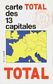 |
The two maps shown here are examples of Total maps "of European capitals" which in fact were of the bulk of Western Europe encompassing the number of capitals stated. First is an Italian version drawn by Michelin around 1964 at the surprisingly generous scale of 1:1,000,000 - as with the French maps it marks principal Total station locations in all countries covered (revealing that there were still none in Luxembourg at that date). The French version of 1965 has expanded to cover 13 capitals, but at only half the scale before and no longer marking Total pumps. Cartography was by the Austrian firm Freytag-Berndt. |
|
|

|
British maps
 |
|
 |
 |
 |
 |
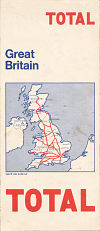
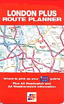
Total has also been a sporadic issuer of maps in Britain. The first two maps are of Great Britain by George Philip at 10 miles to inch, similar to a design used for maps given away with Practical Motorist and dating from 1964 and 1966 respectively. In 1970/1 Total switched to Map Productions Ltd for its first series of sectional maps, but returned to Philip's for the 1973 sectional map series with an unusually tall format. The same format and mapping was used for the 1976 series, described as "Regional maps of Great Britain". These three series covered Britain in 4 sections, plus London at 5½ inches to the mile. By 1981 a plainer cover was used and by ignoring Northern Scotland Britain needed just 3 sections (plus London) on these Geographia maps at 5 miles to inch. |
 |
 |
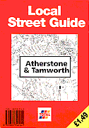
GEOprojects (UK) had previously in 1991 created a rare black & white map in association with the Milton Keynes Development Corporation given away by the four Total stations in the New Town of Milton Keynes which marked their locations. |
 |
 (front) |
 (rear) |
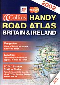
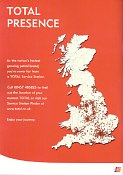
Between 2 and 29 October 2001, Total gave away this road atlas to customers spending £20 or more on petrol and paying by Mastercard. A5 in format, it has 50 pages of Collins' maps (mainly at 9 miles to the inch) and an index of towns. The addresses of the 1,285 Total, Fina or Elf stations in the UK are given and these sites are also marked by number on the maps. Garages selling Total's secondary brands - Butler and Power - are not listed. The maps were quite basic and printed on magazine-style paper, and rather similar to the booklet maps from Sainsbury's and Tesco but drawn to a slightly more generous scale. |
Total agreed to sell its British chain to a consortium headed by snax24 (the successor to Heron) in mid-2011, in a deal that also saw Shell acquiring most of the company owned sites in South & East England.
Maps: TOTALFINA, Total-Elf and TotalFinaElf
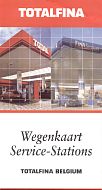
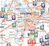
For a short period between the merger with Petrofina and the Elf takeover, it appeared as if the TOTALFINA name might be used as a replacement brand. The map shown below is the only one known to carry this name, although as can be seen from the cover photos and the map extract the service stations were still carrying the old brand. Once Elf was added, it became clear that TOTAL was the dominant partner, and in most countries the other names began to disappear, although in Italy Fina stations initially added TOTALFINA under the old Fina logo, as TOTAL had withdrawn from that market in 1987. In Belgium, Fina's old home market, both Total and Fina stations added TOTALFINA beneath the logo.
|
This 2000 TotalFina map from Belgium may then prove to be unique. It is basically an updated version of the Fina maps used in the 1990s and sent to FinaCard holders. Like the earlier maps, it marks Fina, de Smet & van Diest and Elrop stations with their logos (de Smet... outlets are in green/yellow), but now adds TOTAL ones, too. Carpress designed the map at 1:350,000. |
|

|
After the 1999 takeover, Elf was soon discontinued as a brand except in France (where there were monopoly issues due to the large number of Total, Fina and Elf stations) and Eastern Germany, where Elf was the largest brand following its own purchase of Minol. As a result maps for Total & Elf are very uncommon - indeed, this 2002 German issue may be unique. CartoTravel design the map at approximately 1:2mn, locating all towns with a Total or Elf station in red: their addresses (including the sole remaining Fina station) were on the reverse. Towns with fuel card partners (mainly Agip, Westfalen or Lomo) were marked in black, and all other towns in grey. Only 100,000 copies of this map were printed. |
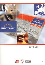
This inconsistent approach to branding is most obvious in an undated Eurotrafic atlas issued by TotalFinaElf around 2002. The front cover has to carry all three logos, although in the station listings Fina has been eliminated from France & Germany, Elf from Belgium and both from the Netherlands (and almost from the UK). Geosignal provided clear, but basic, mapping of most of Europe at 1:1,000,000, with a slightly larger scale in Benelux, and smaller in Southern Scandinavia and Morocco. At the rear some 6,000 locations from the three main brands plus partners are included, representing around half the sites accepting the Eurotrafic card, and the most suitable for trucks. Partner brands include Cepsa (Spain), Westfalen, SVG and Lomo/DEA (Germany), dcb (Netherlands) and ERG in Italy. Scandinavia is not well covered, with just a handful of Shell stations in Norway and Q8's IDS truck sites in Denmark & Sweden. |
|
Maps: Total (again)
In 2003, Total took a decision to phase out the remaining stations under the Fina and Elf brands, and instead to unify under an updated Total image.
|
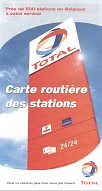
This 2003 or 2004 Total map from Belgium (near right) may be the first to use the new logo. All stations are now marked with a number on red disc rather than a logo, except for the remaining de Smet & van Diest sites where the disc is green. However, on the reverse stations are still identified as being either Total or Fina. Total returned to de Rouck for the cartography, but the scale remained at 1:350,000. |
|
|

|
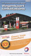
Total's Dutch subsidiary also produced a station locator map for free issue. This one came from a small station that, ironically, was still displaying the old logo in autumn 2007. The map was produced by EMK of Deventer in 2005, and is a perfectly usable map of the Netherlands at 1:425,000. All Total stations are marked by numbers, as well as 37 outlets from partners under the brands dcb, De Haan or Elan (Total's proprietary brand for use by jobbers). All stations are listed on the reverse, with facilities available, as well as inset maps of four main cities. In 2004 Total also sold a card-covered stock map of the country prepared by Wegener-Falkplan that carried the new logo. |
Text and layout © Ian Byrne, 2000-13
All original copyrights in logos and map extracts and images are acknowledged and images are included on this site for identification purposes only.

