BP Touring Kits
In the 1950s and 60s, the main European petrol companies - including Shell, Esso, Fina and BP - all ran touring services for motorists travelling on holiday in foreign countries. The companies regarded these services as a means of developing brand loyalty, especially for travellers who might be wary if using unfamiliar brands of petrol abroad, but sought to recover some of the costs from making a nominal charge.
|
|
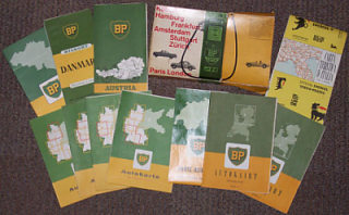
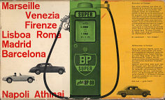
The first known BP touring kit dates from around 1957 or 58. It was supplied in a stout cardboard box, printed in Switzerland and showing a typically Swiss Beckmeter BP pump. On the yellow third of the box it said "Welcome to Europe!" in English, French and German. "To guide you on your way please accept the BP road maps as a token of our esteem and a useful keepsake. Useful too, will be the BP sign. You will see it on countless service stations...throughout 16 European countries. In Italy we recommend the AGIP service stations and products." My copy of this useful keepsake contained maps from a North-South route through Europe, starting with Denmark, and including 4 of the 5 German sections, the two Dutch sections, Belgium, Switzerland (on unusually glossy paper so reflecting in the above image), Austria and an AGIP map of Italy. None of the eleven maps were dated, but all were broadly from the 1955-8 range.
The card boxes were shortlived, and before long motorists wishing to use the BP touring service had to go to their local BP garage first. In Britain, for the sum of 5 shillings (25p) they could order a BP Touring Kit to enable them to plan a continental holiday. As there were still strict currency exchange rules, foreign travel was still quite uncommon and it is likely that many of the planned journeys never happened; people would have stayed instead in the UK and kept their BP Kit in the hope that they might be able to go abroad another year. |
|
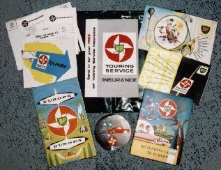
On 6th June 1959, a Mr Piper bought his BP Touring Kit from George Fitt Motors Ltd of Tankerton in Kent, but from the pristine condition of the contents almost 50 years later, it is highly unlikely that he ever used it. We know that his car registration was JGO 150 as that is written on the original invoice, but can only guess at what make of car it may have been. However we do know exactly what was in the green vinyl BP wallet that he took away that day:
- a road map of Europe
- a conversation guide
- a booklet "Where to find a BP Touring Service Station"
- a metric converter
- a leaflet advertising BP insurance
- a book of vouchers to exchange for country maps
- the BP touring guide to Europe
- a transfer showing continental road signs
- an update to the phrase book advising that it was now possible to buy BP in Italy
- a reply paid card to be returned to Social Surveys Gallup Ltd asking about users' perception of the BP Touring Kit, and
- a contents list.
|
Unlike, say Esso which sent out country maps from its touring service base in Paris, BP only provided one map - covering all of Europe at 1:4,000,000 with a relief map on the reverse. Country maps could only be obtained at BP stations in the countries themselves - hence the booklet of coupons (right) and list of Touring stations (below left). However as the Europe map is of such a small scale, it would fall to luck as to when the motorist came across a BP station after entering a country. As an additional incentive, though, BP stations in all countries except Italy would exchange the coupon for "a map of the country, other touring aids and a special gift souvenir". |
|
|
The conversation guide was however better than those from competing companies, as not only did it cover 12 languages (including such rarities as Norwegian, Portuguese and Turkish) but included cutaway drawings of a car engine, chassis and body, providing almost a mini-Duden. Its main drawbacks were the omission of Spanish (as Spain still had a Government petrol monopoly) and a lack of phonetic pronunciations. This was actually the 1957 edition, so had been printed at a time when there were no BP stations in Italy; consequently motorists were advised to ask for AGIP fuels instead. The erratum card explained that you could now "buy your favourite BP brands - but because the BP shield is so new in Italy, you may not always be able to find our stations." |
The insurance leaflet (centre of top photo) offered free personal accident cover of up to £1,000 for motorists (£250 for motorcyclists), with the option of purchasing additional cover, including worldwide baggage insurance. Underwritten by Blake & Marston, the free cover was valid to 1st April 1960. |
|
The main feature of the kit was the BP Touring Guide to Europe, a 288 page paperback giving advice on driving in 18 countries - amazingly including Russia, but not Ireland. Each country included information on motoring, post and telephones, food and a selection of main places to "Stop and See". Each section concluded with a Calendar of Events for 1959-60.
Even if our Mr Piper had no intention of taking his car onto the ferry from Dover, he may have agreed with the Gallup questionnaire that the kit was "useful, interesting and entertaining".
Items from a French Welcome Folder (Dossier d'Accueil)
|
|
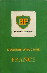
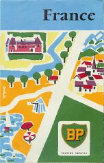
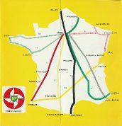
In the late 1950s BP appeared to be running a touring service that was aimed specifically at visitors to France. The map and cardboard wallet shown here are undated, but likely to come from 1958 as they were found with the Paris map shown below. The map is unusually large when folded, and opens out to reveal France spread between the two sides, but with a large overlap (Paris appears on both the North and South sides). Principal BP stations are marked, and there is also a diagram showing the exit routes from Paris, and a second small map of France identifying main tourist sights. |
|
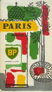
The pack included a 1958 leaflet about Paris, printed in three languages and including two small scale maps by Blondel la Rougery, parking information, and lists of main sights and consulates. |
|
Examples of other BP Touring service items
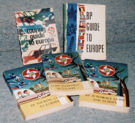
Some of the items in the English Touring Service pack were multi-lingual, although the road signs transfer, insurance and metric converter were probably unique to the UK. A few BP Touring Service publications, including the touring guide, were published in several languages, including Danish and French, as shown in the photograph (right) and example (below left) from Denmark which is dated 1959. BP kept the service for a number of years; the English guides in the back row are dated 1964 and 1966. |
|
|
Some BP Touring Service items were printed with parallel texts in the three main languages: English, French and German. Probably dating from 1958, the Touring Service published a 48-page brochure called "Welcome to the Netherlands", with separate sections in each of the three languages, illustrated with attractive line drawings, but only a tiny planning map. |
|
 |
 |
 |
 |
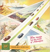
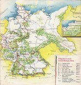
The four images above come from items distributed by the BP Touring Service in Paris in the late 1950s. The first two come a French language booklet, printed on cheap paper, entitled Bon Voyage sur les routes d'Allemagne (loosely, Have a good trip on German roads). It contained descriptions for 11 routes, labelled A to L, generally around 1,000km in length, and shown in outline on the rear cover: note that although this was published after 1 January 1958 it still shows the old pre-1939 borders. Each route was split into between 5 and 8 stages, and gave main points of interest. Each was also accompanied by a b/w map and line drawing. The booklet was put together for BP by the German tourist office in Frankfurt, so is unlikely to be part of a wider series.
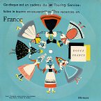
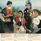
To its right are two EPs (extended play records), given to BP Touring Service customers to act as a souvenir of their holidays in France and Switzerland, respectively. The side shown was engraved with the playing surface in the language(s) of the country described; the rear had information about the BP Touring Service in 4 main languages. Because of the unusual format, these EPs were printed in the USA.
This booklet, in card covers, was called "Welcome to Great Britain and Northern Ireland" and dates from the mid-1950s. Unlike most such booklets it does not provide any tourist information, but simply consists of 11 pages of two colour maps, in most cases opposite a place name index split into 9 categories. These are indicated by symbols for castles, yachting, horse racing, fishing, churches, historic buildings, car racing, universities and scenic centres, and are listed on the third page in 9 languages, including all three Scandinavian tongues, but not Finnish. | 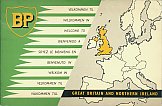 |
|
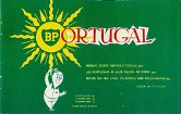
BP operated in most countries of Europe, and even remoter destinations such as Portugal were covered by the Touring Service. 10,000 copies of this 40 page booklet to Portugal in English, French and Portuguese were printed in 1959. It included no maps, but numerous humorous drawings by Fernando Bento and was described not as a guidebook, but as "Notes on the land, its people and peculiarities". |
A BP map sent to a Canadian customer
|
The BP map shown here was sent a BP customer in Canada, probably in 1959 or 1960. This particular customer wrote to a number of BP companies world-wide, so it probably came from their London Head Office, rather than via their newly established Canadian subsidiary. |
Swiss Alpine Roads
|
|
|
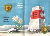
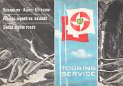
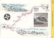
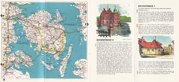
In 1952 BP's Swiss subsidiary commissioned Verlag A. Vetter to produce a 16 page booklet in English, French and German under the (English) title "Swiss Alpine Roads" (above left). In its 14 pages of map, some 16 Alpine passes were mapped, using a simple red line for the road; no gradients were shown, and there was a lack of other useful information such as periods of likely closure in winter. There were however two attractive panoramic views identifying the main mountains shown for most of the passes. The rear cover contained some very basic advice about "climbing alpine roads" including the rather oddly worded suggestion upon "Descent: Shut the radiator screen. Gear up as if you were driving uphill." Despite this, the booklet was deemed successful enough to be reprinted at the end of the decade with the newer BP logo (centre). The maps were unchanged, except that the BP compass roses showing North were replaced by the BP touring service logo (above right).
A BP Welcome to Denmark
|
|
BP's Danish arm also published a "Welcome to Denmark" booklet in various languages produced by Winther & Winther - the cover of the English version is shown above, but the map comes from a German edition "willkommen in Dänemark". Each booklet was 24 pages long and included reasonable maps of the country at the scale of 1:610,000 facing illustrated text arranged into recommended touring routes. As only 7 pages were needed for the maps, two pages were given over to full page watercolour illustrations of BP service stations, and a third showed BP's motel near Roskilde. There were also two introductory pages about the country and two pages of very basic travel information.
English cover courtesy of Richard Horwitz
An Irish Touring Service Wallet
The wallets were also used for other touring service products.
|
Although the Irish Republic was omitted from the main guide, a BP Touring Kit for Ireland has been found that contained a 1960 BP map of Ireland, a 1962 official Bord Failte Eireann guide to hotels and guest houses, plus eight small BP Touring Guide to Ireland booklets. All the 24-page booklets carried a cover price of 1/- (5p) and contained 10 suggested trips, each illustrated by a sketch map and six small two colour drawings. Between them the eight booklets covered the entire Irish Republic, although the were each named after a centrally placed town: Athlone, Bundoran, Cork, Dublin, Dundalk, Galway, Killarney and Wexford. |
1964 changes
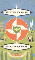
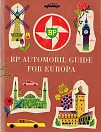
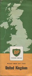
In 1964 BP introduced a new cover design on its sheet map of Europe (below), although it kept the same George Philip map inside at 1:4 million.
|
|
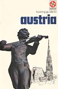
BP also produced a series of sixteen national country booklets of 20 pages printed in English on glossy paper with light card covers. Each showed a b/w photo of a statue and a line drawing of a building or monument from the country covered - Austria's shows the Johann Strauss memorial and St Stephen's cathedral. Inside there was key visitor information for motorists, a very brief description of the major tourist regions, a small phrase section and a selection of road signs. It appears that these were only printed in 1964, although they can be quite commonly found. |
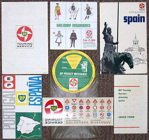
In September 2012 I was lucky enough to find a BP kit for Spain that was still in an unopened vinyl pocket and contained materials carrying 1964 and 1965 dates. The content was not just the 1964 booklet, but included a 1964 map of Spain & Portugal, an order form for more country packs at 2/6d each; a pre-holiday checklist that also served as the back of the pack and advised where you could buy goods with less customs duty - some were most unlikely with the only product listed for Yugoslavia being "cookery books" and Holland starting with "Uncut diamonds"; a holiday insurance application form; a transfer of continental road signs and the "BP pocket mechanic" - a rotary card device which "can help to point out where the fault probably lies". There was no separate phrase book, although there were 3 pages of key sentences were in the Spain guide, including En la Estacio de Servicio BP (despite noting elsewhere that there were no BP stations in Spain)! |
|
Text and layout © Ian Byrne, 2005-14
All original copyrights in logos and map extracts and images are acknowledged and images are included on this site for identification purposes only.

