SHELL
Special Shell maps from France since 1950
Although Shell is best known for its regional Cartoguides dividing the country into 13 or 14 sections they have been accompanied by a number of other maps at various times.
Before Cartoguides: "Connaissez la France"
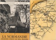
In the mid 1950s, Shell started publishing a series of small format guides, under the collective title of "Connaissez la France" (Know France). Each contained 16 pages in light card covers, well illustrated with black & white photographs, and with the rear cover folding out to double width to reveal a simple map of the area covered. Initially the final page listed company operated Shell stations in the area, but later they just advised to stop at Shell stations in their réseau classé, identifiable by wide red and yellow bands. The series grew to contain 19 sections, starting with Normandy and ending with Corsica (which uniquely had just 8 pages).
|
|
At much the same time Shell gave away 5 simple sheet maps (right) showing and listing where their main stations were, and noted ones open at night. Both these series were discontinued when the Cartoguides were launched in 1958. |

|
Additional Maps in Cartoguide Sets
|
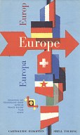
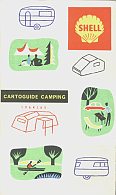
Some years, Shell provided additional maps with its full set of cartoguides, including the four examples shown here, and the commonly found Paris maps. |
|
|
|
The first map shown above is a 1960 map of South-Eastern Europe, covering an area bounded by Paris to the NW, Budapest to the NE and Barcelona to the SW. This strange layout allowed all of Switzerland and Austria to be on the map, most of Italy and Yugoslavia, Southeast France and Southern Germany, as around 1:2.2 million. Stylistically it was an exact match with the sectional cartoguides, with the reverse given over to a gazetteer of the principal towns of interest. Despite the cover, the guide was only written in French. The matching Northern Europe guide has a grey background, and claims to cover 9 countries, include Grande-Bretagne. However the only part of Britain shown is East of Brighton and Cambridge, and South of the Humber, with only a few towns in the gazetteer.
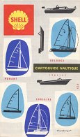
The next two maps cover France and date from 1964. One showed main camping and caravanning sites, and the other - described as a cartoguide nautique - boating centres. This includes a panel of nautical signs, nautical terms (and parts of a yacht) and legal advice. The covers showed in outline some of the main classes of pleasure boats.
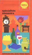
The final map was added to the sets in 1969 to 1971, and is called "Spécialités Souvenirs". This describes 152 locations famous for food or crafts, and includes a small wine map of France on the reverse.
Paris and other cities
|
|
|

|
|
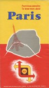
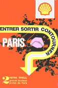
The first map of Paris is dated October 1956. It opens out only to four times the folded map's width, and contains two small maps by Blondel la Rougery, as well as a list of Shell Berre stations open day and night, and very brief tourist information about markets, names of main sights and places suitable for weekend excursions. Despite the English title on the cover "To know more about Paris", all other content is in French only.
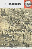
The next map is the most commonly found one of Paris, being issued in several slight variants between at least 1963 and 1971, and again later in the 1970s with the new Shell pecten. The map is well detailed and covers the area bounded by the Boulevard Péripherique; the reverse includes a full index of streets. This map was supplemented for a period by the one with a red cover, as shown here dated 1972. This consists of two maps: one side shows the greater Paris conurbation at 1:100,000, with the other the main exits (portes de Paris) at 1:50,000. Both these were available alongside the cartoguides, and like them were produced by Foldex France.
The fourth Paris map is much more recent, dating from February 2001. Printed on semi-gloss paper its main function is to locate Shell stations, which are listed on the reverse. The map was created by norDesign.
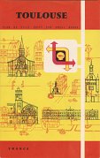
The final map is of Toulouse, from an undated series, that might have been used to supplement cartoguides with local maps. Each edition contains 3 small full colour maps (central city, city and suburbs) and lists Shell Berre stations and principal points of interest. They were assembled by Léonard Danel of Loos, and I have seen just four cities - Lille, Nantes, Nice and Toulouse, but suspect that there would be several more available, but all would have only been printed in small quantities.
All Night Service Stations
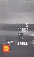
(L-R) The first map shown here dates from June 1954, and looks very much like US Shell maps of the era. Internally, Blondel la Rougery provided a simple map at 1:500,000 marking main roads and Shell stations by red, blue or black discs, depending on whether they were open seasonally, by ringing a night bell, or permanently 24 hours. By 1958 the map was much smaller, but freed up the reverse side for town plans. No addresses were given outside urban areas. By 1971, a standard Foldex France map with much more detail was used, numbering (and listing) the 332 stations open 24 hours. |

|

|
|
Relais Routiers for truck drivers
|
|
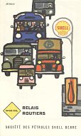
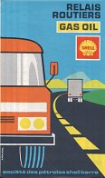
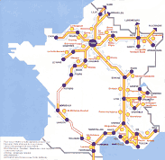
Shell occasionally issued maps showing truck diesel (Relais Routiers - Gasoil) locations. The two examples shown here date from 1960 and 1971 and both use a Foldex France map as the base, although the former one is only in two colours and has less detail. The earlier map names all suitable sites on the map, but by 1971 the most important locations were numbered. Both maps also listed station addresses on the reverse. The 1971 map also highlights mountain passes closed in winter. |
A small autoroute leaflet map
This leaflet Bonne Autoroute avec Shell is dated 1978/79 and marks the 28 Shell stations on the French autoroutes (motorways). It was folded into two, opening out to measure 215x210mm, with the rear cover listing the locations and phone numbers. Editions Publicis Conseil RC of Paris produced the leaflet which contained a most rudimentary map (far right) of the autoroute network, much less useful than those from the rival firm Total. |
 |
 |
Shell has continued to issue maps in France from time to time, including a thematic series in the 1990s.
Text and layout © Ian Byrne, 2011-3
All original copyrights in logos and map extracts and images are acknowledged and images are included on this site for identification purposes only.

