Special Oil Company Maps for the Olympic Games
Nine summer and nine winter Olympics have been held in Europe since 1930. For several of these games, leading petrol companies produced special maps to help their customers get to the Olympic venues.
Berlin (1936)
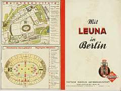 |
This city plan of Berlin was produced by Leuna, the largest German oil refiner in the 1930s. It was the normal street map given away by the company but was adapted for use in the 1936 Olympic games by pasting a plan of the stadium over the previous rear cover (shown opened out left). |
Helsinki (1952)
|
|
In 1952 Helsinki hosted the Olympic games, and this map from that year shows part of the Olympic stadium complex. Internally, it was a normal map of the country at a scale of 1:1,500,000, created for Esso by Maanmittaushallitus. There were no special inserts of the immediate area of the Olympic Games, and although on the regular inset map of Helsinki the outline of the stadium can just be seen, the nearby Esso service station is given greater prominence. |
|
Shell Image courtesy of Richard Horwitz.
Rome (1960)
Esso chose to issue several special maps for the Rome Olympics in 1960. Four new maps were produced including a version of the Western Europe map that had Northern Italy on the reverse and illustrated an Esso station on the autostrada del sole. Both the Roma (Rome) and Sardegna (Sardinia) maps were described as having been newly drawn for the year: it seems that the Italian authorities were trying to encourage tourism in the rest of Italy as well as in Rome, and examples are not known from other years. |
|
|
|
|
|
|
|
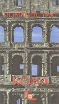
The BP map is entirely in English and is headed Games of the XVII Olympiad, 25th August - 11th September 1960. As it predates BP's entry into Italian petrol retailing it was probably prepared for the London-based BP Touring Service. Another version of this map is known in German; it is possible that a French edition - and maybe other languages - will also exist. In contrast Petrol Caltex was actively involved in the market. Its graphic cover uses five circles rather than the official Olympic rings, as at this stage it was still possible for firms to produce Olympic souvenirs without formal approval. Inside the map highlighted games venues in red. Unlike the other companies, Shell already had a map of Rome, produced by IGA (Agostini) and the Olympiade edition is similar internally, although has a striking cover of part of the Coliseum. The reverse lists the 15 main venues (14 of which are marked by number on the map) in four main languages, with brief descriptions of places to visit "between events" and of Italian gastronomy.
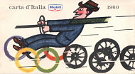
Mobil also produced a map with an Olympic themed cover, although it was subtly done with a motorist driving the Olympic rings. The rear cover advertised the Mobil Economy Run 1960. Unusually the covers were printed on light card pasted to a bespoke Mobil map produced at 1:1,250,000 by IGDA, Novara. The map made no reference to the Olympic Games or venues, although it did carry a tyre pressure chart for Alfa Romeo, Auto Bianchi, FIAT, Lancia and Moretti cars. |
 |
Tokyo (1964)
|
|
Although the 1964 Olympics were not in Europe, Shell produced this card "calendar" showing the Olympic record holders and time for most events since 1896. Two slides, each folded in half, permitted the results from 152 events to be shown in four windows in the card. Designed by Scanpublic and produced in Denmark, it was printed in English and featured 4 cartoons, probably by Mel Calman. |
Munich (1972)
|
|
Eight years later, BP also created a sliding guide instead of a conventional map for the Munich Olympics. Unlike Shell's it gave no event dates or locations, but contained spaces for each main event in which users could fill in the names of the Gold, Silver and Bronze medal winners, above the 1968 Olympic champion, the World Record Holder and the Olympic Record Holder's name and times. |
|
|
|
|
|
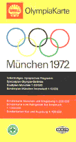
For the ill-fated 1972 Olympics at Munich (München), it appears that Shell gained the main rights to use the Olympic logo. On the left is a 1971 map centred on Munich from the Deutsche Generalkarte series. It may have been a special title since, as well as displaying a small Olympic logo, it covered most of the area normally on 4 Generalkarte sheets (22-3 & 25-6). The 1972 map was undeniably a special edition with a large logo and described as an OlympiaKarte in three languages. As well as normal Mairs maps, it had a large plan of the Olympiapark, and a calendar of sporting events. |
||
|
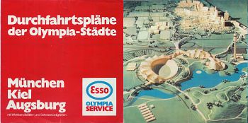
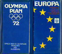
Munich, Kiel and Augsburg also featured on the vinyl wallet for this map set produced by Elf. There was space for two maps inside the wallet, and the example shown here has two unbranded maps. One is a folding map of the Olympics venues, city and region by Heinz Fleischmann of Munich. The other is an atlas booklet of Central Europe by Kümmerly & Frey, Bern. Their owner believes that these would have been the original contents, but it is possible that there may instead have been a map of Germany matching the Olympia Plan. |

|
|
Moscow (1980)

|
|
|
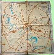
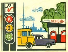
The images above are taken from a 1980 Goskomnefteprodukt (State Committee for Petroleum Products) map of Moscow. However as the image of the actual map shows, it was not really a practical road map, even though it did locate, by number, all the filling stations in Moscow, as only the main arterial routes were shown. The cover features Misha the bear mascot of the 1980 Olympic Games as well as the official logo of the Games and the Goskomnefteprodukt logo under the two large Cyrillic script words which can be translated as Auto Filling Stands (ie. petrol stations), a phrase that is often abbreviated in Russian to AZS (which looks a little like A3C when written). Inside, there was also a drawing of a filling station. After the Soviet Union collapsed, Goskomnefteprodukt was broken up with its retail operations going to a number of regionally based companies, including Lukoil.
Images courtesy of Richard Horwitz
Barcelona (1992)
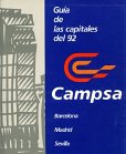 |
Campsa, the former monopoly brand of petrol in Spain, produced a free supplement to its annual guide, printed on gloss paper in rather garish colours, giving limited practical information for visitors to Barcelona as well as Sevilla and Madrid. It included 6 fold-out maps/plans - one for each city (lacking most street names and drawn in perspective), plus plans of the Olympic stadium, the route of the Olympic torch and Expo 92 grounds in Sevilla. The Olympic rings symbol was not used at all in the book. |
London (2012)
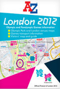 |
By 2012, the Olympic Organising Committees were keeping very strict control over which companies could use Olympic symbology. For the most recent London games, the sole right to publish maps of venues or incorporating the logo was acquired by Geographers' A-Z Map Company, and an example of their maps is shown here. Despite BP being an official sponsor of the Games, they were not permitted to issue branded maps and sold A-Z maps in their filling stations, as did most other UK petrol companies. |
No maps are known from any of the other summer or winter Olympic Games in Europe, although they may exist. A Shell map of London is known to have been given away to a customer in Uruguay for the 1948 Games, but this does not appear to have been done more widely. Outside Europe, maps are known for the 1956 Melbourne Olympiad (Mobil), the 1968 Mexico City games (from the US companies Conoco and Mobil), the 1984 Los Angeles games (from Union 76) and from the 1960 Squaw Valley Winter Olympics (Shell and Flying A) among others.
Once again, if you have an oil company map from one of these European Olympic events not shown above, please send me an e-mail!
Text and layout © Ian Byrne, 2000-12
All original copyrights in logos and map extracts and images are acknowledged and images are included on this site for identification purposes only.


