Petrol company road maps from Italy |
Before the Second World War
In the early years of the twentieth century the Italian petrol market soon became dominated by Standard Oil (using the local brand name Lampo) and the Russian Nafta, but before long there were a fair number of other international and local competitors. In 1926 the Government set up Azienda Generale Italiana Petroli (AGIP) to provide a strong nationally owned firm, and in the next decade Esso (as Lampo had become), Shell (which had acquired Nafta) and AGIP (which had taken over SNOM's Victoria-branded assets) dominated the market. The Fascist Government of the 1920s & 30s gave preference to local oil refineries, and so in the 1930s large numbers of independently owned refineries were established around the Italian coast - or even inland, as at Fiorenzuola d'Arda (Piacenza) where Petroli d'Italia operated a small unit and a handful of service stations as late as the 1960s.
Very few petrol company branded road maps are known from this period; most of the time firms preferred to advertise on commercial maps sold through the two main motoring clubs, the Touring Club d'Italia (T.C.I.) and the Reale Automobile Club d'Italia (RACI, which after the war became simply the Automobile Club d'Italia - ACI).
 |
|
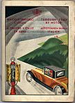 |
This little Shell booklet of Italy dates from 1930. It consists of 20 pages of fairly low-grade paper inside a stiffer paper cover which, as well as showing a Shell pump and speedster, says "THROUGH ITALY BY MOTOR" in four languages. About half the pages are text and the other half not very detailed sectional maps of Italy in red and black. It includes pictures of road signs, and mentions the Fascist Road Militia. There are Shell logos on every page and inside the back cover is a folded map of Europe showing major roads.
|
1950s maps
After the war, the large number of independent refineries led to an equally large number of domestically owned chains of petrol stations. However this does not appear to be relected in road maps, with very few of these mid-size distributors known to have issued maps. By the end of the decade the international majors were beginning to take a renewed interest in Italy, with companies such as Petrofina buying ABC and Permolio, Total acquiring Aquila, OZO and CIF Petroli and BP purchasing Sarom.
|

|

|
|
|
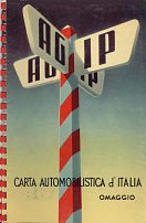
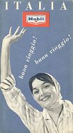
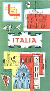
At the start of the 1950s AGIP issued spiral bound atlases of the country; the example shown above dates from 1954 and has Agostini cartography at 1:1,000,000 - the same scale as on the single sheet maps issued later in the decade. The Texaco-Chevron joint venture used a slightly different identity in Italy until the early 1960s, trading under the brand "Petrol Caltex". Esso - as in most countries - was among the most regular of map issuers, and uniquely used the German firm of Karl Thiemig to prepare its maps based on General Drafting Co designs. Mobil's 1958 issue and Shell's from the end of the decade also used Agostini cartography.
|
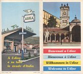
In 1958-9 Aquila published a series of town plans, that also included a basic small map of the surrounding area, showing locations of their service stations. This example is a 1959 map of the North-eastern city of Udine, drawn at a typically large scale of around 1:8,000 by Agostini. Eight local landmarks were shown, with text in four languages including English. As well as describing the city, it advised "filling up at [Aquila] stations is speedy and the operation is effected scrupulously in an unreproachable manner". |
1960s maps
High domestic petrol prices meant that the Government sold coupons to the growing number of domestic tourists that could be exchanged for fuel at most Italian service stations. The same high prices, of course, encouraged Italians to drive motor scooters such as the Vespa, and cars with very small engines, including the FIAT 500. And lower taxes on gas as a road fuel meant that Italy began to develop a wide network of "Gas Auto" sales points.
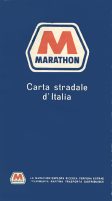
Despite these adverse factors, international companies continued to enter the Italian market with names such as Amoco, Marathon and Gulf - which acquired APIR - being seen for the first time. Some were attracted to the country by its closeness to newly discovered sources of crude oil in Libya, but found it hard to make money from the typically small Italian filling stations; so Marathon, for example, which had only started selling petrol in Northern Italy in 1964 sold out to Conoco in 1968.
|
|
|
|
|
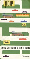
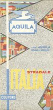
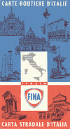
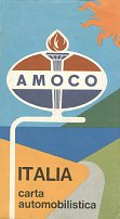
The maps above are all single sheet maps of Italy dating from the 1960s. The Agip map comes from 1961, the Aquila 1962, the Fina and Amoco 1964 and the Marathon is undated but probably from 1966. The first three were produced by Istituto Geografico Agostini (Novara) and the latter two by Vallardi. The scales vary only slightly between 1:1 million and 1:1,250,000.
|

|
|

|

|
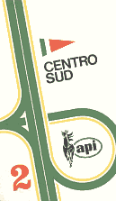
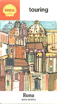
The larger companies also sold, or gave away, other maps. API, covered the country in just two sections in 1965, but BP had 37 small format maps covering the country at 1:300,000 and including selected city plans. Shell produced maps for most of the main cities (as well as a series of 7 sectional maps) - the example shown here is from Rome in 1965. Aquila also issued a large number of city maps, which lack any branding on the front cover.
As well as producing sectional maps with IGA cartography, Total produced a version of its Michelin-based map of the heartland of Europe with specifically Italian covers. This map, also sold in France and elsewhere, marked principal Total locations on a large map at the scale of 1:1,000,000.
A few maps were produced for special events. Several firms produced special maps for the Rome Olympics in 1960, but the Esso map for the International Fishing Festival at Ancona in May of the same year, 1960, is much rarer. (Image courtesy of Stan DeOrsey.)
1970s maps
Italy had always been a hard market to make a profit in, and strict price controls combined with large retail networks meant that after the first oil price shocks it became increasingly unattractive. BP were the first to go, selling out to a newly formed local company Mach in 1973. Shell were soon to follow, selling in the following year to another new name - IP - but one which was controlled by Agip.

|

|
|
The German firm Aral worked closely with is part-owner Mobil in Italy and only supplied service stations in the North and centre of the country. They were marked on this 1970-1 sectional map with German Busche cartography; Aral eventually sold its stations to Mobil. |
|
|
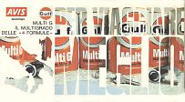
In 1976, after the oil crisis had eased, Gulf and Avis rentacar collaborated on this map of Italy, prepared by Vallardi in Milan. All the advertising on the map is for Gulf, not Avis - the oil cans are framed in the words PER VIAGGIARE MEGLIO (for better journeys). |
1980s maps
Several more petrol station chains changed hands in the 1980s. Amoco was one of the first to sell, to a new concern called Tamoil, which soon ran into financial problems and had to be rescued by the Libyans, keen to secure outlets for their oil. Later in the decade Tamoil added the Texaco outlets. Gulf sold out to Q8. In a less expected move, Shell returned to the market, initially buying out Jet (Conoco) before creating a JV with local interests under the brand name MonteShell, and expanding greatly by acquiring Total Italiana. Chevron also left the market, selling to another local firm ERG, which had operated a refinery since 1938 but had never supplied many stations under its own name.

|
Fewer maps were issued in the 1980s and, significantly, none of those shown here were produced by IGA (Agostini) which had moved its main focus towards magazine publishing. The Esso map from 1980 followed a format first used in the 1960s, dividing the country into three sections at 1:500,000, using designs in the Esso house style and Prof. Esposito as the cartographer. |

|

|
Most recent maps
The decade started with one final withdrawal - Mobil left the market, selling out to Q8. Thereafter there were numerous deals between companies, as they sought to concentrate networks into areas closer to supply points, and Agip/IP slimmed down prior to privatisation, with the IP branded outlets being sold to API in 2005 . The MonteShell venture became wholly owned by Shell, although a while there were a number of Montedison branded service stations from the other partner.
|

|
|
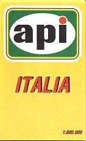
1990s maps are even rarer than those from the 1980s. EGM (EuroGeoGrafiche Mencattini) of Arezzo produced a fine single sheet map for API - the lone survivor of the post-war independents - in 1993 at 1:1,000,000. The Shell map, with an English title, seems to have been produced with international truckers in mind as much as Italian motorists. It dates from 1999 and was again produced by Agostini at the same scale as the API map. |
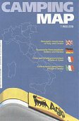
The Agip Camping Map (again with an English title) dates from the same year, but was freely given away not just in Italy, but also at Agip stations in neighbouring countries. It benefits from a most unusual style, with graphic representation of mountain ranges, drawn by Renzo Matino. No maps are known since 2000 from any oil company, and Agostini - the most frequent cartographer on earlier maps - appears to have stopped publishing road maps, concentrating instead on its magazine and part work business. |
|||
Italy remains the country with the most petrol stations in Europe, with over 22,000 locations. It is also the last bastion of the kerbside station - a row of pumps on the pavement (sidewalk) with just a small hut for the attendant, and in 2005 there are still a few thousand such outlets. One possible reason for this is that Italian supermarkets do not sell fuel, unlike those in France or Britain. Surprisingly, given the low investment in stations, a higher proportion are directly owned by oil companies than in any other major European market, and this - with a lack of price wars - may also have helped retain large numbers of stations. But these factors combine to give a low penetration of service station shops, and a relatively low proportion of locations selling maps of any kind. In turn, this may have meant that once the free (omaggio) maps of the 1960s had ended, there was little incentive to produce branded maps for sale, as few motorists ventured into the service station itself.
As well as the examples shown above, maps may have been produced for many of the brands that disappeared in the 1950s/60s, including ABC, APIR, CIF Petroli, CLASA, Mach, Petrolea, Permolio and Sarom 99. Smaller names known to have been operating in the early 1960s include BPM, Carmagnani, DICA, Nilo, Sanquirico, Spica and Zenit Italiana. No domestic Italian maps are known from the subsidiaries (or franchisees) of the international companies Conoco/Jet, Kendall, OZO, Q8 or Tamoil.
There are over 50 other images of, or from, Italian maps on this website. They include more maps from Esso, Shell, Agip, API, Aquila, BP, and Mobil. There are also several maps from the 1960 Olympics and of commercial maps carrying advertising from petrol or oil companies.
Please send me an e-mail if you can help me with more pre-war petrol company maps of Italy or from one of the missing brands.
Text and layout © Ian Byrne, 2005-10
All original copyrights in logos and map extracts and images are acknowledged and images are included on this site for identification purposes only.
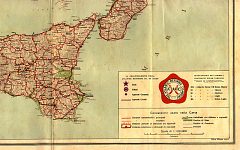 Early maps were sometimes quite complex affairs. The T.C.I. sheet 1 of Northern Italy was published by L.V. Bertarelli at 1:650,000 (but printed by Vallardi). Main roads were identified by width and gradients, although few secondary routes were shown. The map was mounted on stiff linen and slipped into a cardboard pocket pasted inside cloth board covers. These carried adverts for three oil companies: Oleoblitz (Lubrificanti Reinach, of Milano) on the front cover, with Touring Oil (E. Foltzer of Genova) and Globoil (F. Matter of Mestre) inside. A 48 page booklet of town plans was also pasted inside.