 Crimean road maps issued by petrol companies
In March 2014, a short period of unrest in Crimea was followed by a referendum on independence, and a couple of days later by the absorption of the newly established Republic of Crimea into the Russian Federation. Whatever the rights or wrongs of this process, which was still being disputed at the time this page was created, it is interesting to see how Crimea has appeared on a few maps published by petrol companies since the break-up of the Soviet Union. All the maps that I have access to date from the 2002-2005 period and, apart from the bottom three showing Simferopol, the extracts are shown at the same relative scale (approximately 75% of original size if viewed at 72 dpi).

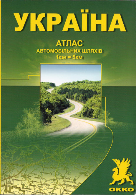
The map shown above comes from a 2004 atlas of Ukraine at the scale of 1,000,000 issued for the large domestic petrol company ANP. At the time it was issued, ANP had 358 petrol stations, mainly in Western and Central Ukraine, although with 12 in Crimea, in the vicinity of Sebastopol. ANP's atlas was careful to recognise the slightly different status of Crimea; the Legend showed internal boundaries with the description "Boundary of Autonomous Republic of Crimea and boundaries of oblasts". The maps were prepared by GIPP "Kartographia" and appear to be of a good standard, although detail is sometimes lost behind the ANP or Ukrprobank logos on the map. The ANP logo varied depending on whether or not the site acted as a host to a Ukrprobank smart card terminal; the bank was also ANP's partner in a payment card. The fate of ANP's operations in Crimea since its absorption into Russia is unknown.
 Cover of 2004 ANP atlas of Ukraine |
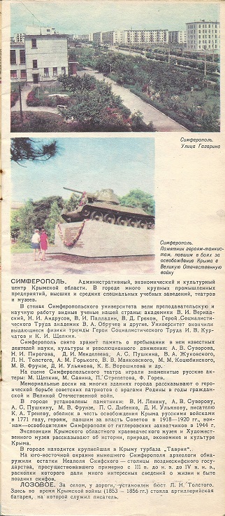
28 cities were shown at two levels of detail, including two in Crimea - Sebastopol and Simferopol. |
 |
|
 |
 Another Ukrainian company, OKKO, also published an atlas in the mid-2000s. Unlike the example from ANP above, it did not mark their petrol stations, but from a contemporary sheet map it is known that OKKO was only found in North and West Ukraine, with no operations in Crimea. OKKO's atlas was at the larger scale of 1:500,000, which meant that Crimea needed eight pages, rather than being split rather uncomfortably over two double pages in the ANP atlas.
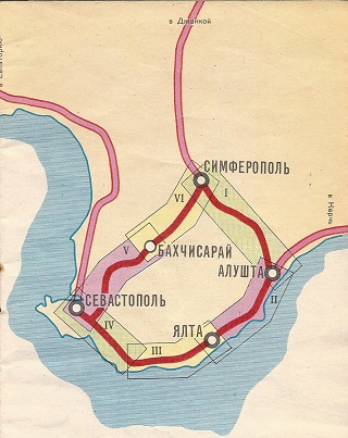
  The extract shown here (right) is of the SW tip of Crimea, including Sebastopol, taken from the OKKO atlas. Note how the map uses the old Soviet style of marking every petrol station with a small generic pump symbol.
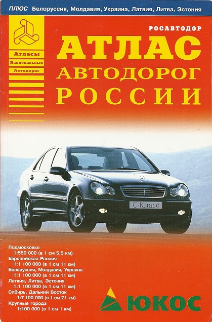
This atlas covered all of European Russia, Belarus and Ukraine at a common scale of 1:1,100,000; East of the Urals Russia was mapped at 1:7.1 million. However the Ukrainian pages were sidelined in pale blue to distinguish them from the main Russian pages sidelined in burgundy. Although Yukos was the cover sponsor, the map carried advertising from several companies, and was one of a number put out by Argo Press, using cartography from Euro Atlas GmbH and sponsorship arranged by Atlas-Media. If the recent problems between Ukraine and Russia can be linked to the leadership having fallen out with the Russian President leading to the dismemberment of the country, there's a strong irony that much the same happened to the leader of Yukos (Mikhail Khodorkovsky) leading to the dismemberment of the company and its partial takeover by the Russian State.
 |
 |
 |
Ukrainian and Russian are similar, though not identical, languages both using the Cyrillic script. However in the three extracts of Simferopol above, the ANP (left) and Yukos (right) atlases both use Russian spellings in Crimea, probably following what would be seen on road signs in an area with a strongly Russian-speaking majority. In contrast Okko (centre) uses Ukrainian spellings, including the use of the letter "I" instead of the Cyrillic "И" as the second letter of Simferopol, and removes the "o" towards the end of the place name Molodizhne. Incidentally, the symbol for the airport on the ANP map is in a very misleading place; it should be at the top of the extract, not the bottom.
No petrol or oil company maps that solely cover Crimea are known, but as always, if you have one, then please tell me!
A Soviet era map of Ukraine
|
   |
 |
![]()

All original copyrights in logos and map extracts and images are acknowledged and images are included on this site for identification purposes only.