Petrol Company Road Maps from Ukraine |
Soviet era Ukraine
Ukraine was part of the Russian Empire from 1653 until 1991 when it gained its independence from the former Soviet Union. Although Ukraine has a small indigenous oil industry, it provides under 10% of the country's needs, and most crude oil comes from Russia.
|
|
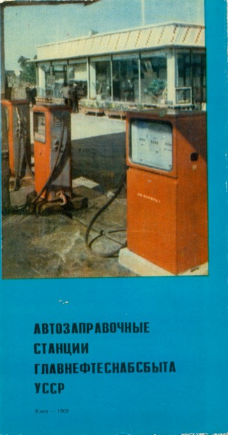
Only one map is known from the Soviet era, dating from 1969. It was issued by "Glavneftesnab sales of UkrSSR" (General Directorate of Supply and marketing of oil and oil products of the Ukrainian Soviet Socialist Republic), the state-owned monopoly company. The map lacks any detail and does little more than show towns with service stations, linked by straight line roads. Printing was of a low quality, like many Soviet-era maps and brochures. |
|


Post-1991 Maps
This reliance on Russia was initially reflected in the post-independence downstream petrol industry, with Russian controlled companies supplying a significant proportion of filling stations. However this is changing as Ukrainian petrol companies have started to consolidate, with the state controlled Ukrnafta leading the way with over 450 outlets. Simultaneously, the Russian firms are looking to invest in better quality company-owned outlets, but to reduce numbers of smaller private stations supplied. The main Russian names are TNK (which operates through its joint venture with Britain's BP) - which at one time had over 1200 stations, Lukoil and (possibly) Yukos. More recently, a Ukrainian company has licensed the use of the Shell brand in the country. With the de facto division of the country in 2015 the situation is likely to change further - a page on this site shows maps of Crimea while part of Ukraine.
ANPThe local petrol company ANP issued this A5 format atlas of the country in July 2004. The entire country is covered on 37 map pages at the scale of 1:1,000,000 using base maps from GIPP "Kartografia", the main successor to the former state monopoly cartographer. Additional maps show the areas around the 28 main cities at 1:200,000 and town plans of the same cities. All the maps mark ANP service stations (distinguishing between those with and without smart card terminals) and also show the locations of Ukrprombank branches. The addresses and phone numbers of the 358 ANP stations are listed at the front of the atlas. |
|

OKKO
OKKO is one of largest Ukrainian brands of petrol, owned by Galnaftogaz. Initially operating a chain of Western-style filling stations mainly in the SW of the country, it expanded into Kiev and the Crimea and by 2016 had 399 outlets.
|
|
|
|
|
|


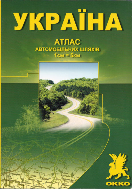
The OKKO sheet map shown here dates from 2005, and is wholly branded for the company on its front cover. It covers the whole of the country at the scale of 1:1,250,000. An atlas of the country from the same year runs to 124 pages of maps, plus a 40 page index to towns and villages. Both were produced by Kartografia; neither mark OKKO station locations.
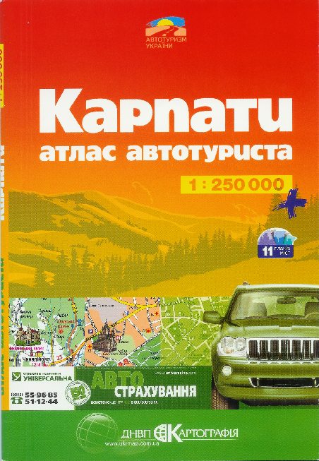
However, OKKO also sponsored a number of maps or atlases of those parts of Ukraine in which is was most active. In January 2005, OKKO started selling an atlas of the Carpathian region (slightly South of the company's bases in Stryi and Lviv). This ran to 104 A5 pages in total, with the first half given over to high quality maps of the region at 1:250,000. Each page also includes limited tourist information about the localities covered and marks OKKO filling station locations. The 11 largest towns in the region have large scale town plans (typically at 1:15,000). Although the company's branding is not shown on the front cover, OKKO-specific information is included throughout the atlas, which was compiled for them by DIVL Kartografia (Ukrmap).
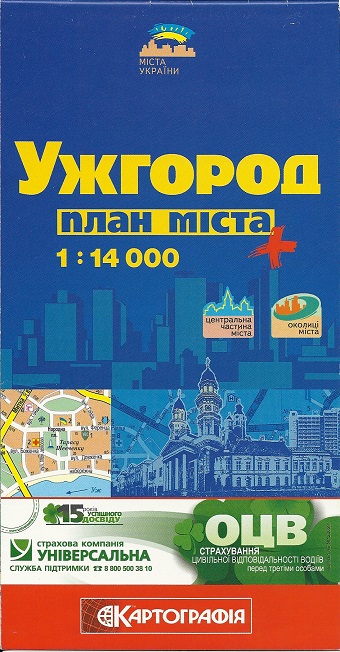
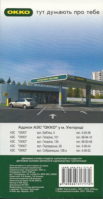
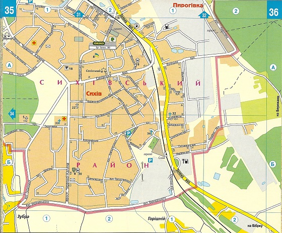
The next two images are taken from a 2006 street map of Uzhgorod. Although the front cover doesn't mention OKKO and carries a small advert for the Universalva Insurance Company, the rear cover (also shown) is given over to an OKKO advert, and inside all OKKO stations are marked on the map, but no other businesses identified. OKKO's stations are also listed with the facilities available at each one. Drawn again by Kartografia at the large scale of 1:14,000, only 4,000 copies were printed.
|
|
In the following year, 2007, the same team produced 10,000 copies of a small format (slightly less than A6) atlas of Lviv at 1:17,000. It contained 48 map pages, places of interest, a street index and again listed and marked all OKKO locations as can be seen from the map extract. |
|


Lubricant suppliers
|
|
Although Elf petrol has never been sold in Ukraine, Elf oils are promoted by reference to the their success with the Renault Formula 1 team. This atlas of Ukraine dates from 2002 and was one of a number produced by Vidavnictvo "Mapa" (founded 1991) for leading oil companies around the millennium. 12 pages of maps at 1:1,500,000 are supplemented by four pages of advertising for Elf oils, all printed on fairly low grade paper.
|

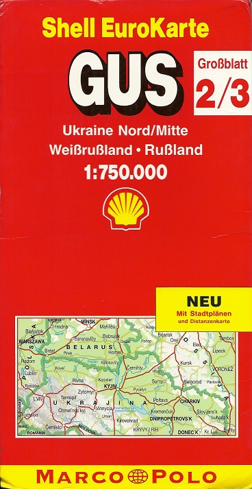
Western European IssuesWell removed from the main tourist routes for visitors from Western Europe, no cross-border issues are known specifically of Ukraine. However the map here, entitled (in German) GUS Ukraine Nord/Mitte · Weißrußland · Rußland [N & C Ukraine, Belarus and Western Russia] is the combined second and third sections from five covering the Western part of the (then) Commonwealth of Independent States (CIS = GUS). Produced by Mairs of Stuttgart in 1994 under the mixed branding of Shell EuroKarte/Marco Polo, the Southern part of Ukraine was on section 4, along with Moldavia and Crimea. Section one covered Russia from St Petersburg to Moscow and section 5 the Black Sea coasts and Caucasus. Mairs' standard cartography was used at a quite generous scale of 1:750,000; these maps were available through bookshops across Europe as well as in German Shell filling stations. |
|
")
Most of the 2000s-era maps came from a contact in the country at the time they were first issued; since then I have had no active contacts, so am unsure whether more maps have been issued over the ensuing decade. No maps are known from any of the other major players, such as TNK, Ukrnafta, Lukoil or Yukos, nor from smaller regional names such as Ukrtatnafta, Paralleli or Gefest. But please send me an e-mail if you have a map from one of these firms in the Ukraine, any maps issued since 2008, or if you have a copy of the Visco-BP, Shell or Baltia-Khort atlases referred to above.
The oil industry in Ukraine remains highly politicised, and is likely to change significantly again in the next few years, once the border disputes with Russia have been resolved.

All original copyrights in logos and map extracts and images are acknowledged and images are included on this site for identification purposes only.