SHELL
Shell Atlases from Germany
The Shell name has been used since 1950 to market atlases (and other road maps) produced by Mairs Geographischer Verlag of Stuttgart. Over this period there has been a surprising variety of atlases reflecting the way that they have been sold through book stores as well as Shell filling stations and, surprisingly often, service stations from other companies, too.
|
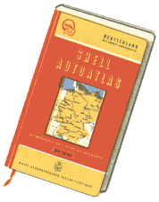
By the early 1950s, the pattern for the Große Shell Atlas of Germany had been set (see here in a contemporary advert on a sheet map). It was of medium sized format, but a thick hardback volume. Germany (East and West) was covered at 1:500,000 scale, with additional city maps, and smaller scale maps (1:4,500,000) covering the rest of Europe. There was a complete register of all towns and villages, and hotels and camping sites were also listed. |
Shell atlases have one feature that is unique: the actual maps are only printed on one side of the paper, which is then folded back onto itself before being bound, so that the page edges are of folded paper, not cut. This permits a bleed across the page turns, making it easier to follow East-West routes.
|
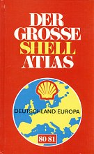
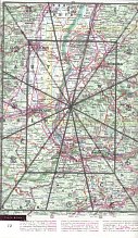
The cover design shown here was used from 1972, when the simplified Shell pecten was first introduced. By 1980 the atlas had over 300 pages of maps (although to make it easier to find sections travelling North-South, some page numbers were omitted so that page 8 was immediately North of page 18, etc.). Mairs/Shell do not print a grid onto each page, but instead use a clock face system to divide each page into 12 wedges; a clear plastic key can be placed over the page to help find towns (as shown right). The sections are numbered clockwise with 12 at the top - exactly as on a clock face. |
 |
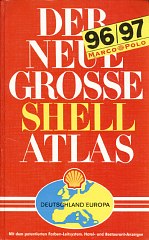 |
After unification, the format was expanded slightly to permit a larger scale of 1:400,000 and the pages were numbered sequentially without gaps. Densely populated areas had enlarged scale maps at 1:200,000; conurbations were enlarged further at 1:100,000 in a much simpler style (right), and then - as before - there were street plans of the major cities. Much of Europe was covered at 1:750,000, with more outlying parts (including the UK, Spain and Scandinavia) at 1:1,500,000. These many overlapping maps meant that they took up 506 pages out of a stunning 881 pages in all. |
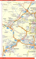 |
![]() Shell and Mairs continue to publish the Große Shell Atlas annually, and it now comes complete with a CD-ROM.
Shell and Mairs continue to publish the Große Shell Atlas annually, and it now comes complete with a CD-ROM.
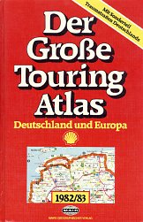 |
Shell has however also published a second hardback atlas under either the Touring Atlas or Reiseatlas (travel atlas) name. |
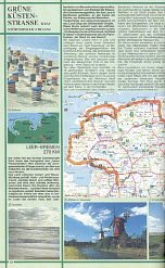 |
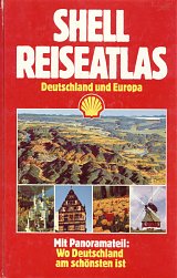 |
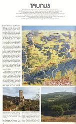
By 1988 the name had changed to Shell Reiseatlas, and the beautiful routes had been replaced by a series of features of tourist areas including aerial panorama maps (such as of the Taunus, right). This atlas retained the colour advertising section, as well as a comprehensive register of communities. |
 |
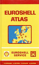 |
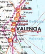
The same partnership of Shell Deutschland and Mairs also created the Euroshell truckers' atlas. The 4th edition, from 1979, had almost 100 pages of European maps at 1:1,500,000. Unlike the versions for private motorists, these were overprinted with principal Shell sites and a list of Euroshell service stations was included. The 6 Euroshell locations in Valencia (Spain) are surprising as in 1979 they would have still sold fuel from the Spanish monopoly brand, Campsa. However, the map extract clearly shows Mairs' cartographic style, common to all the atlases on this page. |
 |
|
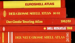
That the Shell atlases are substantial volumes can best be shown from the image here, which is taken of the five atlases described above. These atlases, which sold between DM12,80 in the 1950s and €29,50 now, as about as far as you can go away from the idea of a cheap giveaway oil company map, popularised in the USA. |
 |
 |
1990 was the fortieth anniversary of Shell road atlases. In addition to normal editions, this version was produced for promotional use by Lord Cigarettes. It's worth noting that the Mairs (or Marco Polo, or EuroCart) names were completely left off the cover of this edition, showing how the Shell brand is seen as being more important in marketing the atlases. Despite the unusual cover, it was basically the same as the standard atlas inside. |
|
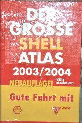
Shell greatly enhanced its market position in Germany by acquiring DEA in 2002. Although DEA had effectively abandoned its map programme a few years earlier, Shell produced a special cover edition of the Grosse Shell Atlas for 2003-4, to allow an appropriately branded version to be sold in DEA stations, seen here still in its shrink wrapping. This cover will remain unique as an example of a joint Shell/DEA map, for it was decided to phase out the DEA name by late autumn 2003. It is perhaps ironic that the "old" DEA logo, which is only rarely found on sheet maps, can also be found on a transitional map, but with Texaco from 1968, the first time the name was discontinued. |
|
|
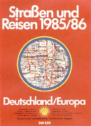
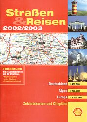
Shell has also published thinner larger format (A4) paperback atlases at a lower price for over 20 years, although using similar cartography by Mairs, under the title Straßen und Reisen (Roads and Travel). The 1985 edition was one of the earliest and carried maps of Germany at 1:400,000, Alpine countries at 1:750,000 and Europe "from North Cape to Istanbul" at 1:4,000,000. This example was competitively priced at DM9,80; recent editions have been sold for €9,95. |
|
|
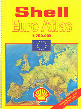
The Shell Euro Atlas shown here was also prepared for Shell by Mairs in Germany, but sold more widely - indeed the only example I recall seeing in a petrol station was in Norway, but it was also sold in the UK. Produced in a large format (almost A3) it ran to 248 pages including 18 city plans and a detailed Legend in 28 languages stretching across 7 full pages. Maps at 1:750,000 covered all of Europe except Iceland, Russia, Belarus, Ukraine and (surprisingly) Cyprus, although most of Turkey was included. Unusually, Shell stations open "day and night" were marked. The atlas is undated, but as Czechoslovakia was still united, yet Bosnia, Croatia and Slovenia had seceded from the rump Yugoslavia and Estonia and Latvia are present, it must date to around 1992. |
|
Text and layout © Ian Byrne, 2002-12
All original copyrights in logos and map extracts and images are acknowledged and images are included on this site for identification purposes only.

