Petrol company road maps from Switzerland |
Before the Second World War
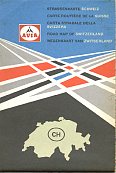
Switzerland's petrol industry was always relatively open to international companies, so by the 1920s leading names such as Shell, BP, Gulf and Esso had already become established. Independent domestic suppliers clubbed together in 1931 to form AVIA, a distributor's cooperative that became a major force in the Swiss market and, after World War II, across Europe. However this choice of petrol brands did not result in a large number of oil company road maps: Switzerland's strong cartographic tradition meant that most road maps were sold by the two big firms (Hallwag and Kümmerley & Frey) or under the insignia of the Swiss Automobile Club (ACS-TCS).
|
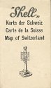
These early Shell maps are rare exceptions to the rule that all pre-war maps were under cartographers' imprints. The earlier map (left) possibly dates from the 1920s, and appears to have originally been pasted into the back of a book or tour guide. Measuring just 6in. tall when folded, the map itself is quite basic at 1:500,000 marking all towns and villages with Shell pumps. The later map (right) is believed to come from the mid 1930s. |
 |
Tourism restarts in the late 1940s
|
|
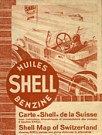
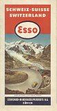
Older Swiss maps are relatively widely found in other countries, due to its position as the leading location for wealthy tourists before the advent of air travel. After the war, the Swiss tourist infrastructure was still in place, and visitors started returning to the country as early as 1948, when both these maps were printed. Esso's is in the style of its North American maps, and Shell's, although being distributed by Foldex with its trademark covers and double sheet folding system, actually used a colourful map drawn by Kümmerley & Frey. This copy was sold in an English bookshop. |
1950s maps
|
|
|
|
|
|
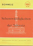
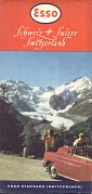
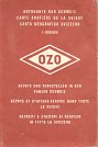
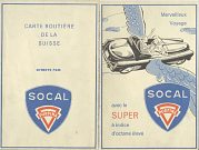
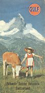
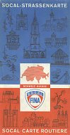
Shell and Esso continued to be the most commonly found maps from the 1950s, although BP ones are also seen. The Shell example is entitled "Sehenwurdigkeiten der Schweiz", and is also available in French and English versions: the latter as "Picturesque Switzerland". Esso's 1956 map uses the cartographic design of the General Drafting Co, but like all the maps here was prepared locally by Kümmerley & Frey. It is at the larger scale of 1:1,460,000 - the final three maps on the top row are all at 1:600,000. They represent some of the other names that could be found on Swiss service stations: OZO (later absorbed into Total), Socal Purfina (a joint venture between Belgium's Petrofina and France's Antar) and Gulf. |
1960s maps
The 1960s saw more mass market tourism, with Europe's middle classes increasingly travelling to destinations once reserved for rich. Increasingly these tourists brought their tents or caravans with them as Swiss hotels still had a reputation for high prices, and this meant that driving to Switzerland was the only possible way of holidaying there. Switzerland's dense network of service stations welcomed them with a variety of brands, and maps can be found from most of the main names.
|
|
|
|
|
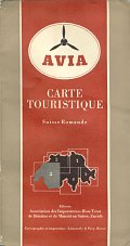
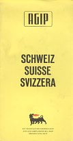
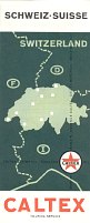
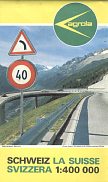
Among the brands of petrol available as shown by their maps were Total (1961), Agip (1962), Caltex (1964) and two Swiss firms: Migrol (1967) and Agrola (1968). Migrol petrol stations were cut-price outlets affiliated to the Migros co-operative store chain, although many of their locations were at traditional service stations. Agrola stations were generally small filling stations attached to agricultural co-op depots, often off main roads. All five maps above were again produced by Kümmerley & Frey, although at a variety of scales between 1:400,000 (Agrola and Migros) and 1:650,000 (Caltex). The Caltex and Migros/Migrol maps marked their service station locations.
Sectional and city maps
|
|

|
|
|
|
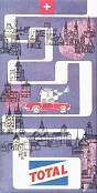
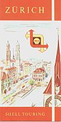
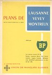
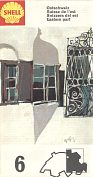
As well as national maps of Switzerland, some firms sold sectional or city/regional maps, and these used a variety of different cartographers. Shell's 1950s city plans, including Zurich (top left) were prepared by the local firm of Orell Füssli, whose only other known petrol maps were prepared for Caltex in Ireland. There were nine sheets in BP's 1959 city plans series produced as a joint venture with the UBS/SBG bank and carrying substantial third party advertising; Publicité Routière Bolze of Geneva compiled the maps. These were available free from BP service stations in nine main cities (including Lausanne, which was grouped with nearby Vevey and Montreux). The later BP issue of Lausanne was also by Orell Füssli and focused on the city itself as it was the host of the 1964 Swiss National Exposition.
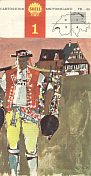
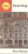
By 1961 Shell had started a series of four cartoguides along the French model. These were still supplemented by city plans such as the 1965 Bern/Berne issue shown. By 1967-9 the series had expanded to six cartoguides backed with the same city plans for the six largest cities. All these 1960s Shell maps used cartography by Hallwag.
1970s and 1980s maps
As elsewhere in Europe the oil supply crises of the early 1970s ended the expansion of the service station network in Switzerland and started a period of consolidation. Chevron sold its chain to Gulf in the late 1970s, but in 1983 Gulf was in turn bought out by Shell. Later that same year BP bought Fina's operation and in the following year a middle Eastern investor acquired the Total chain and switched it the Gatoil 24 name. Gatoil bought Texaco's chain in 1987, but had to be rescued from bankruptcy by Libya's Tamoil just three years later. In parallel with these changes, there was a move to unmanned self service outlets, pioneered by Avia and a number of smaller independent firms. Maps from this era are less commonly seen, possibly because international tourism had moved on from Switzerland with the rich favouring more exotic locations and the middle classes taking cheap air package tours.
|
|
|
|
|
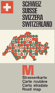
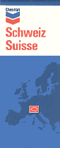
By 1971 Avia had switched to using Hallwag for its maps, generally at 1:500,000. Chevron and Socal Fina, in 1971 and 1972 respectively, stayed with Kümmerley & Frey: soon after the "Socal" part of the name was dropped in favour of the simple Fina used elsewhere. Aral had been a major player in the Swiss market since the mid-1960s when it consolidated the Erpag brand, but its maps are usually produced by Busche in Germany. As in other countries they locate all Aral service stations, as does the final Migros (Migrol) map, part of a series of four sold in a vinyl wallet. This basic design was used for many years, although the example shown (courtesy William Phillips) dates from 1985.
From 1990 to date
The changes in the retail market of the previous decade continued; Tamoil acquired Elf's chain in 1992, Mobil's remaining outlets were sold, Avia continued to incorporate smaller independent names and Migrol entered into a strategic joint venture with Germany's DEA. But this last deal was spectacularly reversed when Migros bought back DEA's interest before acquiring Aral's operations in 1998, bringing Migrol into the top five brands for the first time. More recently (2008), Migrol and Shell entered into a limited joint venture that meant some Migrol stations started selling Shell fuels. At the other end of the scale, a local trading company consolidated several independents into a group using brands such as Ruedi Rüssel, Miniprix and Charmettes. Switzerland continues to have more small - and often unmanned stations - than almost any other European market.
|
|
|
|
|
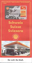
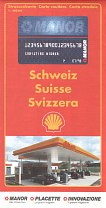
The first two maps show how Shell shared the cost of producing its 1997 edition with Manor Warenhaus, a clothing store chain. It exists in two formats; a standard one for Shell advertising the Shell credit card, and a second one with Manor's card. Hallwag's map - at 1:303,000 - shows all Shell locations in both versions, but additionally marks Manor's stores (including chains such as Jeans & Co) on their customised map. Oddly, perhaps, a Shell service station is shown on the front cover of both maps; a Ferrari racing car graces the alternate cover of the Shell map but the back of the Manor map is given over to a store address list.
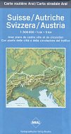
There were a handful of DEA branded stations during the joint venture with Migrol and these sold a German DEA map of Switzerland. The 1998 edition was produced by RV/Geodata at 1:300,000, using a stock map pasted into card covers. In contrast, Aral's map, as always by Busche, was a special edition for the company marking Aral service station locations. By 1998 it had Austria on the reverse side, as the map was most widely available in a boxed set sold in German Aral stations.
The youngest map shown here is a 2001 Migrol, designed primarily to accompany a service station locator booklet, into which it was pasted. Unlike the earlier Migros/Migrol maps shown, this map was specific to Migrol filling stations.
As well as the examples shown above, maps are believed to have been produced for Mobil and Texaco.
There are around 15 other images of, or from, Swiss maps on this website. They include more maps from Aral, BP, Caltex, Esso (1950s scenics), Migrol, Shell (1960s) and Sinclair.
Please send me an e-mail if you can help me with more pre-war petrol company maps of Switzerland, or with a map of the country from Elf, Erpag, pre-1970 DEA, OK Coop, Gatoil, Ruedi Rüssel, Tamoil, Texaco, Mobil or any other brand.

Text and layout © Ian Byrne, 2004-11
All original copyrights in logos and map extracts and images are acknowledged and images are included on this site for identification purposes only.