Oil Company Maps for the Winter Olympic Games
Nine summer and twelve winter Olympics have been held in Europe since 1930. This page looks at maps produced for the Winter Olympics. Please follow this link to the page for the main Summer Olympics.
1964 Winter Olympics at Innsbruck
|
|
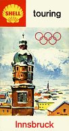
These maps for the 1964 Winter Olympics are the only known post-war oil company maps of Innsbruck. Esso's cover includes a sketch of an Innsbruck landmark and makes no use of the Olympic rings. A Freytag-Berndt map of the city at 1:15,000 locates the seven main Olympic sites (and seven Esso stations, by coincidence). The reverse includes a regional map, and 1:75,000 district maps of Seefeld and Innsbruck/Lizum/Igls. Shell's map does include the Olympic rings, is copyrighted 1963 and marks the Olympic venues (Olympische Kampfstätten). |
|
1968 Winter Olympics at Grenoble (France)
|
|
Esso issued another special map for the next Winter Olympics. The design is closer to US maps of the era than most European Esso maps, featuring the Esso tiger in an "action shot". One side was devoted to a relatively simple map of the region by Blondel la Rougery at 1:150,000, marking main roads, Olympic venues and Esso stations. The reverse side comprised a street plan of Grenoble, a small panoramic view of the area and panels for each of the six locations, listing events with space for the user's notes. The event listings were enhanced by attractive drawings of participants in the events at each location. A kilometre distance chart reveals that Grenoble is 950km from London, but 9,700 from Mexico (where the summer Olympics were held that year). |
|
|
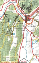
In contrast the Total issue was quite simple featuring the official logo of the winter games, and printed only in red and black by Brunétoile of Paris. This map is described as being a "Dépliant Officiel" (official map) and focused more on Grenoble itself, with only a small sketch map of the region. The text including listings for the theatre, cinema, concerts and music hall - at which the artists Manfred Man and Jimmy Hendricks (sic) were performing in a Soirée anglaise. It also had a full calendar of Olympic events including admission prices. Total stations in Grenoble were listed, along with all banks, post offices, medical centres, churches and main car dealers. |
|
|
However Total also sponsored a second map, also described as being official, and produced by EREP. This covered an area extending North to Geneva and West to Lyon at 1:400,000, marking 6 information centres operated by Total on the approaches to Grenoble. Side panels included adverts from other businesses including Air France and Air Inter (heliports was clearly marked on the map), Le Phoque ski boots and Sotravia, which offered aerial advertising (banners towed behind light aircraft).the was a patent site location system involving rolling the map over, to create a virtual grid of 100 rows and 350 columns. |
|
No maps are known from any of the other winter Olympic Games, although they may exist. For the record the other post-war European Winter Games were St Moritz (1948), Oslo (1952), Cortina d'Ampezzo (1956), Innsbruck (1976), Sarajevo (1984), Albertville (1992), Lillehammer (1994), Torino (2006), and Sochi (2014). Once again, if you have an oil company map from one of these Olympic events, please send me an e-mail!
Text and layout © Ian Byrne, 2000-20
All original copyrights in logos and map extracts and images are acknowledged and images are included on this site for identification purposes only.


