 Road maps of Scotland issued by petrol companies
In September 2014 Scotland held a referendum on independence from the rest of the United Kingdom. Had the Scots voted "yes", I would have needed to create a new country page for maps from Scotland. Although they chose to stay within the UK, I still thought it might be interesting to have a page devoted to maps of Scotland. It is notable that with the partial exception of the ZIP map below and a Shell map that is reported to have had just 700 copies printed in 1939 that no-one has ever seen, all known petrol company maps of Scotland are part of a wider series of maps of the rest of the UK; no firms have issued a non-series map of the country.
Maps are shown on this page in five groups. The first are from smaller UK series, typically of five map sections, where a single section covers all of Scotland. The second, third and fourth groups are from larger map series, needing between 7 and 10 sections to cover the British Isles, where Scotland is spread over two or three sections. All these examples use cartography from companies within the George Philip group: firstly Esso/Cleveland, then Shell and finally BP/National. The final group pulls together maps with rather different sectional arrangements.
Scotland on a single sheet
|
|
|
|
|
|


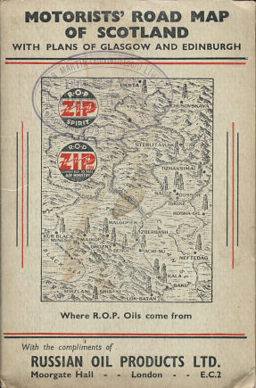
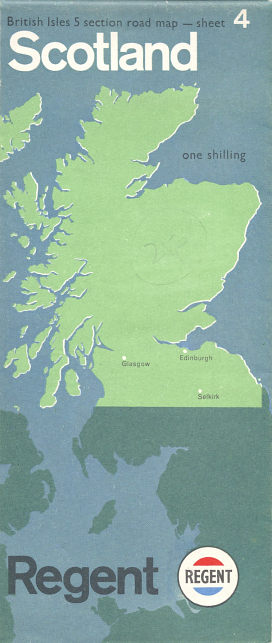
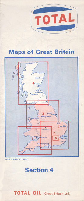
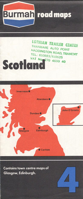
From left to right, above:
1938 Russian Oil Products (R.O.P./ZIP) map of Scotland. Apparently produced as a tie-in to the 1938 Glasgow Empire Exhibition, the map by Geographia is pasted into card covers; the rear of the map has street plans of Glasgow and Edinburgh marking R.O.P. garages and filling stations.
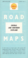
Undated (ca1963 from road construction) Regent map by Geographia at 5 miles to 1 inch. Sheet 4 from a series of 5.
1977 Texaco map by Geographia at 5 miles to 1 inch. Apart from road updates, essentially the same as the earlier Regent map.
Undated ca1971 Total map by Map Productions Ltd at 5 miles to 1 inch. Note this Total series has no titles, just sectional numbers.
Undated ca1973 Burmah map by Map Productions Ltd at 5 miles to 1 inch. Apart from road updates, essentially the same as the Total map; Map Productions is understood to have been an affiliate of George Philip, but these use a different cartographic style later associated with RAC maps. Burmah's series had 6 sheets including Ireland; Total's just five.
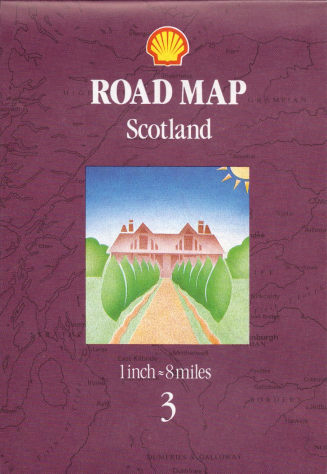
1991 Shell map By George Philip Ltd at 8 miles to 1 inch. Britain was covered in just 3 sheets in this series.
Scotland on multiple sheets
|
|
|
|
|
|


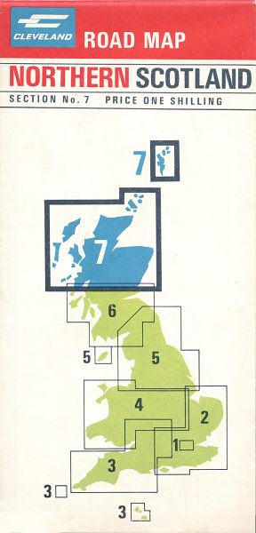
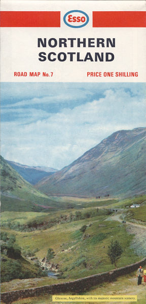
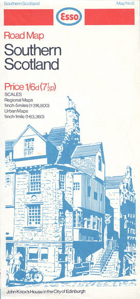
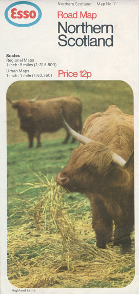
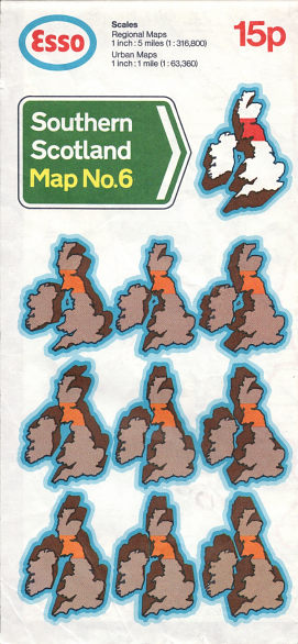
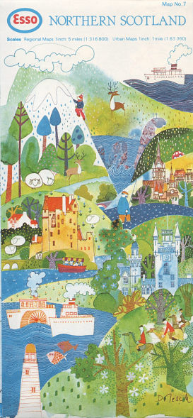
Esso (and its subsidiary, Cleveland) used a series of maps prepared for them by George Philip Printers, although until 1966 it was recorded on the maps as Edward Stanford Ltd. Mainly using a scale of 5 miles to the inch, The UK and Ireland were covered by 8 sections; no.6 was Southern Scotland and no.7 Northern Scotland which was at the slightly smaller scale of six miles to the inch. From left to right, above:
1967 Cleveland Map of Northern Scotland
1967 Esso Map of Northern Scotland - Glencoe, Argyllshire
1970 Esso Map of Southern Scotland - John Knox's House in the City of Edinburgh
1971 Esso Map of Northern Scotland - Highland Cattle
1974 Esso Map of Southern Scotland
1977 Esso Map of Northern Scotland - various landmarks (including Nessie) by Susanne Dolesch
The two earliest Esso designs are shown on the page devoted to 1950s Esso maps.
|
|
|
|
|
|


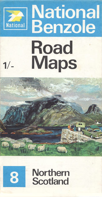
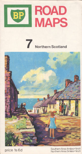
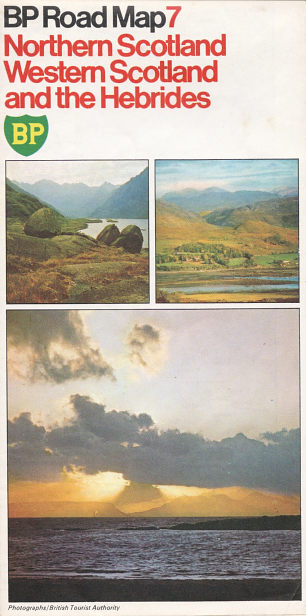
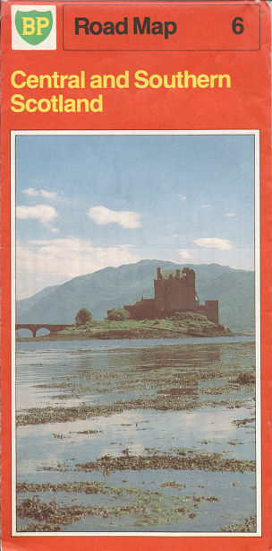
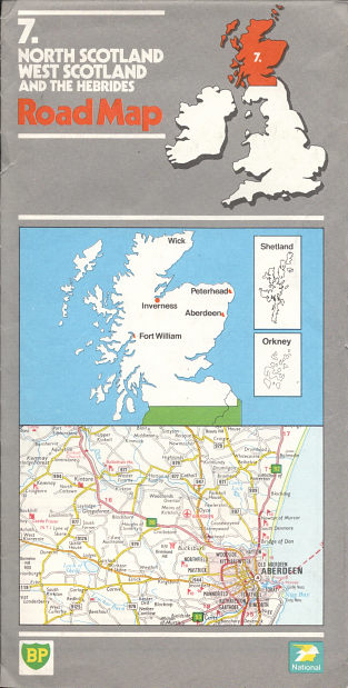
BP and National (which became its subsidiary in 1976, having been part of the Shellmex-BP group since the 1950s consistently used maps from George Philip & Son, until BP defected to the AA in the late 1980s. Philip's maps changes with the times; initially at 5 miles to the inch, they had become 4 miles to the inch in the mid-1960s, requiring a layout change and increase from 6 to 9 sections (though National, without Ireland, had one fewer); in the late 1960s they were shuffled again to produce a Western Scotland and the Hebrides section avoiding a split between Central and Southern Scotland along the heavily populated central lowlands. After metrification in the early 1970s, the set contained just 9 maps including Ireland, partly by reducing Northern Scotland to a scale of 1:300,000, compared to 1:200,000 for the other British sections. From left to right, above:
1965 National Benzole map of Northern Scotland
1968 National map of Western Scotland and the Hebrides
1968 BP map of Northern Scotland
1985 BP map of Northern Scotland, Western Scotland and the Hebrides
1981 BP map of Central and Southern Scotland
1985 BP/National map of North Scotland, West Scotland and the Hebrides
|
|
|
|
|
|


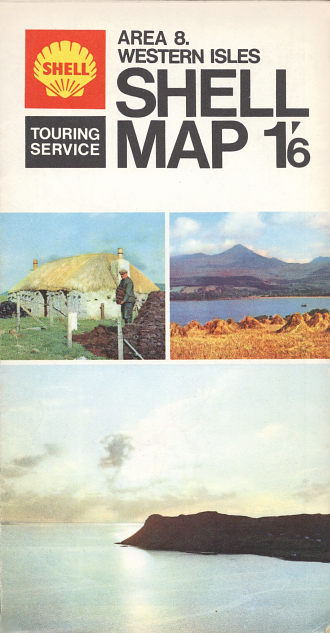
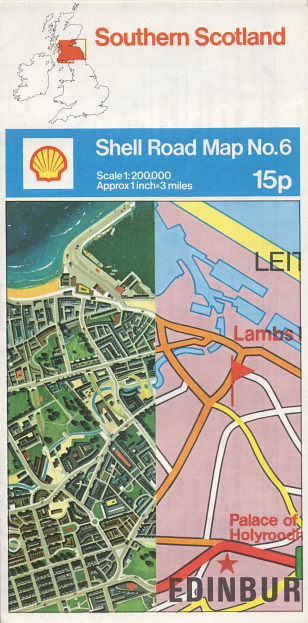
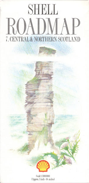
Shell's cartographic history with George Philip & Son mirrored that of BP, with the same sectional arrangements, including Ireland. There were some minor differences in sheet titles, so that the BP or National "Western Scotland and the Hebrides" became "Western Isles" with Shell. And at the end of the main map issuing period, Shell issued a final set of George Philip maps in 1987, when BP had moved to the AA. From left to right, above:
1961 Shell Map of Central and Northern Scotland
1968 Shell Map of Western Isles
1974 Shell Map of Southern Scotland
1981 Shell Map of Central & Northern Scotland - Inverlochy Castle and Shirrapburn Loch (National Gallery of Scotland)
1985 Shell Map of Southern Scotland
1987 Shell Map of Central & Northern Scotland - Old Man of Hoy, Orkneys
More miscellaneous sections
|
|
|
|
|
|


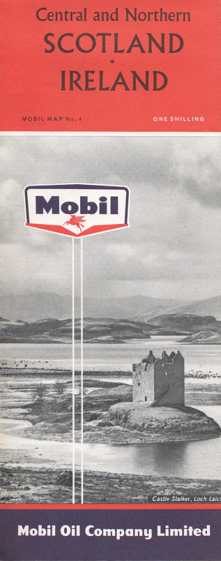
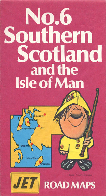
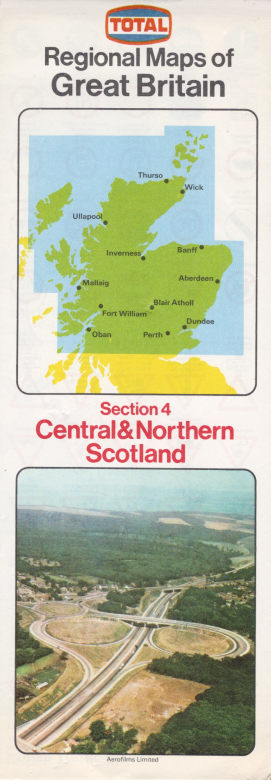
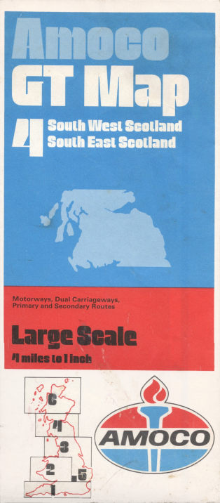
From left to right, above:
ca1956 Shell Map of Central and Northern Scotland by George Philip at 5 miles to inch. This was the first series of Shell (and BP) maps, and used a quite different cartographic style to the later maps, as well as being in a much larger format when folded. Shell also produced Foldex maps in the 1950s, in a bewildering array of combinations, some of which covered Scotland.
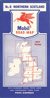
ca1954 Mobil Map of Northern Scotland by Roadfinder maps at about 10.5 miles to the inch, printed with white roads on black landmass; part of a series of 9 maps. The rear included town plans of Aberdeen, Dundee, Elgin, Inverness, Perth and St Andrews. This is the only town plan of Elgin known on a petrol map...
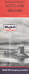
1961 Mobil Map of Scotland/Ireland by A.W. Gatrell at 10 miles to the inch. Scotland was backed with Ireland in a series of 5 maps; inset town plans as above (without Elgin). This layout and cartography continued to be used by Mobil, through various named publishers, until the mid 1980s.
1971 Jet Map of S Scotland by George Philip & Son at 4 inches to the mile - essentially the same maps as for Shell/BP but with the old arrangement of sheets. This was the only year that Jet produced sectional sheet maps.
1973 Total Map of C/N Scotland by George Philip & Son at 5½ inches to the mile - another reduced cartography allowing Britain to be fitted onto 5 maps.
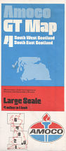
1973 Amoco Map of South West and South East Scotland by John Bartholomew & Son at 4 miles to the inch. Amoco were the only oil company to use Bart's larger scale cartography, which although a little old fashioned in style, contained greater detail that Philip's usually added to maps. Although this is section 4, it's noteworthy that Northern Scotland was Sheet 6, as London slotted in between them. (Most other series had London as the highest numbered section). The actual sheets are also oddly numbered; South West Scotland is labelled Sheet 7 inside the map, and South East Scotland is Sheet 8, suggesting that Bart's usually sold them singly rather than paired up.
As well as the examples shown, Fina and Gulf published sectional maps of Britain, which included at least one of Scotland. Fina's varied over time, but included a series by Map Productions similar to the Burmah and Total examples on the top row. Gulf used a recued scale version of the main George Philip cartography, getting Britain onto just 4 sections at 6½ miles to the inch - as with Fina, section 4 broadly covered Scotland.
![]()

All original copyrights in logos and map extracts and images are acknowledged and images are included on this site for identification purposes only.