SHELL
German Shell Maps from the 1930s
In the 1930s Shell's German subsidiary, Rhenania-Ossag Mineralölwerke AG, issued a vast range of maps, unsurpassed in number by any other petrol company globally. These can broadly be divided into regional maps, city maps, tour maps, river and tourist area maps, and a few miscellaneous maps. Most of these series appear to have been in production from around 1934 to 1939, with several editions for some types, including the regional maps which from 1937 to 1939 seemed to run to several editions in a single year. Dating all the slight variants is difficult, although it usually possible to place them in order of publication by reference to printers codes, which usually take the form of ZRK followed by 4 numbers, and sometimes a letter and year indicator. Some maps also have text inside referring to the total investment made by Shell since 1924, and this figure (in Reichmarks) can also be used to sequence otherwise similar maps.
Regional maps
 |
 |
 |
 |
 |
 |
The six maps above can be tentatively dated as spanning 1932 to 1938. The first two maps, possibly from 1932 and 1933 are much smaller than the others, and were drawn simply at 1:1,250,000 opening out only to double the size of the cover. (The pump cover is thought to be older than the map cover, but it is not certain.) The simple coat of arms style encloses a map at 1:725,000, now with relief shading and opening out to six times the cover size. Later maps opened out to eight times their cover size and were four colour productions at 1:470,000. All versions distinguished between towns with and without Shell stations. (In fact all towns with a population over 20,000 inhabitants were assumed to have Shell stations!) The number of coats of arms can vary from one to three, depending on how many states were encompassed by the map. Starting around 1935 ink wash scenes were placed behind the smaller shields; the division of Germany into sheets changed again halfway through the life of this cover design and some covers had to be redrawn with new local scenes. The next series had pen and ink backgrounds; section 11 for 1937 covers Thüringen-Mitteldeutschland and the scene is described as "Im Harz (am Brocken)". The pastel cover scenes on the yellow covers used for 1938 are also named; section 7 (Hannover) features Lüneberger Heide. The same front cover design appears to have been used for earlier 1939 issues.
|
Unlike most oil companies, Shell produced several updated versions of the later maps, usually reflecting minor changes to the roads or the extension of the maps to cover Austria on the key plan. The first issue of the yellow cover design carries a code 60xx/8 where xx was the section number: 6017/8 is an early Franken-Oberpfalz-Sachsen map. Later editions inserted a lowercase letter before the slash; 6017d/8 is a later 1938 issue, and differs principally by including the names of the autobahn junctions. It is beyond the scope of this website to try and identify all the variations and it is not known if all letters in the a,b,c,d.. sequence were used on each section, but some got up to at least the letter "n" on some 1938 editions. The yellow cover pictures did not generally change between 1938 and 1939 editions, although section 20 (right) was an exception to this rule with 1938's snowy scene of "Die Waxensteine" being replaced by "Weißes Rössl" on the Danube. |

|

|

 |
Later maps include a description of the area and information about Shell. The watercolour image of a country Shell tankstelle dates from 1938 (above left); below it is the key to sections showing how they failed to cover recently annexed Austria. |
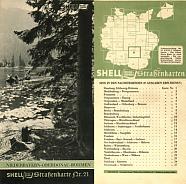 |
Closer examination reveals that the 1939 maps with photo covers also went through a number of editions. Initially there were 26 sections, with two covering the annexed parts of Czechoslovakia - 25: Ost Sudetenland - Schlesien & 26: Böhmen - Mähren. At this stage section 5 (Ostpreußen) didn't cover the Southern tip of the exclave. Later in the year, section 13 was extended to include Nordböhmen, allowing the series to drop back to 25 maps: section numbers from 18 to 24 were increased by one, with the former section 25 becoming the new section 18. Finally, section 5 was renamed Ostpreußen - Memelland. On the very late sections the Shell Reise=Dienst logo on the front cover was switched from light green to black and on some sections moved in location. It is not known how many versions were printed of each section.
City maps
The maps below are a representative sample from the extensive series of city maps produced for Shell (Rhenania-OSSAG) in the 1930s. Although most maps kept to a single cover design, Hamburg is exceptional with a new ship cover being drawn in 1937 to commemorate the launch of the new liner named after the city. The "REISE=DIENST" flag between SHELL and Stadtkarte was added on 1937 and later maps. In most cases there are two versions with the initial cover design (ie. without the "REISE=DIENST" flag) - a smaller and a larger one. The smaller one typically opens out to four panels and pre-dates the larger one that typically opens out to 6 panels.
 |
 |
 |
 |
 |
|
Hamburg (1939) mv Hamburg |
Leipzig Völkerschlachtdenkmal |
Essen Deutschlandhaus |
Bochum Rathaus |
Solingen Der Waffenschmied |
|
|
|
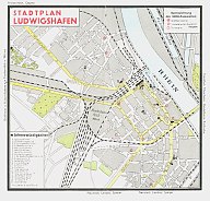
The maps of the cities were relatively simple, with main streets and built up areas marked. A numbered key showed the locations of major sights or public buildings, and Shell stations were indicated by various types of red circle dependent upon the facilities available. As a reminder of the political situation almost every city had a street named after the Führer: on the map below Adolf-Hitler-Strasse runs from the Hindenburg Park in the NW corner. The political sensibilities are to some extent also reflected in the choice of covers: it is hard to imagine someone today choosing the smokestacks of Harburg for a map cover design.
 |
 |
 |
 |
|
|
Harburg Harburg |
Ludwigshafen Neue Friedenskirche |
Ludwigshafen am Rhein Map showing 10 Shell locations |
Osnabrück (1938) Vitischanze |
|
|
|
|
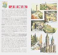
The artists are not generally credited (although the Hamburg picture is signed by Leopold), but there are a number of slightly different styles. Possibly the greatest contrast is between the draughtsman accuracy of Ulm and the impressionist wash of Trier in the sequence below (although the small scale does not show it too clearly). Inside, each map had two full panels of local scenes: one is shown next to the text page for Jena. The city's coat of arms was also always included, as was a panel promoting Shell products. Most maps opened out to 4 panels, but the larger cities ran to eight, with an environs map also included.
 |
 |
 |
 |
|
|
Trier Porta Nigra |
Ulm Münster |
Jena (section 70) Interior guide |
Göttingen Marktplatz |
|
|
|
|
In 1939 Shell added the Austrian cities of Wien (89), Graz (90), Linz (91), Innsbruck (92) and Salzburg (93) to the series.
Touring maps
 |
 |
 |
 |
 |
| 296/7 | Nach Mecklensburg-Schwerin/Nachmittags-Seenfahrt (centred on Hamburg) |
|
| 336/7 | In die Altmark/Rund um die Elbe (centred on Magdeburg) |
|
| 338/9 | Rund um die Elbe/Anhalt, historisch gesehen (centred on Magdeburg) |
|
| 372/3 | An den Main/Fahrt durch historisches Land (centred on Nürnberg) |
|
| 388/9 | Über Baden-Baden in die Hochschwarzwald Über die Schwarzwald-Hochstraße (route to Stuttgart) |
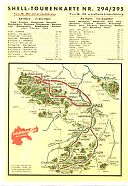
Shell recycled most of the images from the single tours into the double touring maps, but sometimes in a way that meant motorists would not have seen the image before. Thus the dramatic tower shown as 372/3 on the top row for tours centred on Nürnberg is actually in Dinkesbühl on the famous Romantisches Straße and had previously been used on the Tour No.25, based on Stuttgart but extending to Ansbach.
After the annexation of Austria (Ostmark) in 1938, Shell's publicity material announced that the tours would be extended from 404/5 to 448/9. This was later revised down to a maximum of 438/9, but it is not known if any of these extra sections were produced. Jupp Wiertz, the artist who had provided all the cover watercolours, had retired due to ill-health in early 1938 and died in January 1939, which would have meant finding a new illustrator for the extra titles.
 |
 |
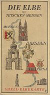
The maps shown here are examples of the 9 Flußgebietskarten - river basin maps such as the one covering from the Elbe from the Polish border to Meissen and the 18 Gebirgskarten - mountain or tourist region maps such as the Schwarzwald (Black Forest) North sheet (both shown left). These generally folded out into long narrow maps pasted into fawn, light card covers. The rear included a description of points of interest. The maps appear to have been drawn for Shell by the Düsseldorf-based artist Werner Peiner (1897-1984). The same maps were also available printed onto foldout pages a uniform 297mm high, then bound into white calf covers as a numbered limited edition Deutschland ist Schön. This volume carried the same text descriptions printed in fraktur text. |
In 1937, the Shell touring map programme ran to 20 Straßenkarten (sectional maps), 88 Stadtkarten (city plans), 27 Flußgebietskarten or Gebirgskarten and 101 Doppeltourenkarten - double touring maps. That made a total of 236 maps in all and by 1939, with additional Austrian sections and a Berlin Gebirgskarte, the total exceeded 250 maps!
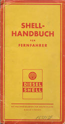
In 1937 Shell published a Shell-Handbuch für Fernfahrer. This consisted of a larger format road atlas in light card covers, split into 14 maps at 1:940,000 - exactly half the scale used on the regional maps. Each page folded out to double the atlas's width, in a manner rather similar to that used on Leuna or Uniti maps of the era. Although these continued to show all towns and villages with Shell stations, those with Diesel Shell available were clearly marked in bold black text. The front of the atlas contained a calendar for 1937 & 1938, plus space to keep records of diesel and oil purchases. A slip pocket inside the front cover contained a 16 page booklet listing names, addresses, telephone numbers and opening hours of all Shell diesel stations. |
|
 |
 |
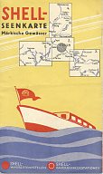
Diesel stations for boats are also separately identified on the Seenkarte, shown right, which had four small cruising maps centred on Berlin following the Havel and Spree rivers. The cover suggests that it was clearly targetted at the pleasure boat market, and not commercial barges. This map was prepared by Wüsten & Co. of Frankfurt am Main, who are also credited with the earliest (1932/3?) sectional maps at the top of this page and as being the printer on the later 1939 sectional maps. |
 |
Although Shell continued to produce many West German regional and city maps into the 1950s, their photographic covers lack the charm of the pre-war series. Around 14 West German cities that were included in the 1930s were were omitted from the post-war series, although two (Bamberg & Bayreuth) were added to the list in the mid-1950s and a third (Pforzheim) in the final series.
In Silesia and Pomerania (now part of Poland), Shell has started selling branded maps of not only those cities covered in the 1930s, but also of several smaller towns such as Jelenia Góra (Hirschberg) and Opole (Oppeln).
Thanks to Jon Roma for helping me with the list of city maps and providing the 1935 & 1939 sectional images.
Text and layout © Ian Byrne, 2000-14
All original copyrights in logos and map extracts and images are acknowledged and images are included on this site for identification purposes only.


