MOBIL - France
CIP, Mobilgas
Please follow this link to the main Mobil page.
Brief History
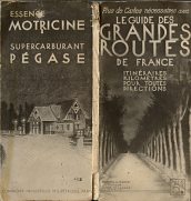
In 1899 the Vacuum Oil Company established a subsidiary in France; the following year, the Compagnie Industrielle des Pétroles (CIP) was formed to build an oil refinery at Frontingnan, near Sète - this was not closed until 1986. Initially CIP used "Motricine" as its petrol brand, and sometime around the 1920s introduced Pégase as its super grade, reflecting its affiliation with another US company, Socony. In 1931 Vacuum and CIP merged (in line with the merger of their US parents), although the CIP-Pégase identity continued to be used on French filling stations for most of the 1930s; the exact date of the introduction of Mobilgas as a fuel is not known.
In 1955, the company formally became Mobil Oil Française, and for most of the post-war period, Mobil operated the seventh largest petrol station network in France. It opened the first self-service outlet in 1964, and in the 1980s/90s invested heavily in upgrading its stations to meet the ever growing competition from discount outlets attached to hypermarkets. In 1996 BP and Mobil merged their European downstream operations, leading to the loss of Mobil branded service stations; BP acquired full ownership of the chain a few years later following the Exxon-Mobil merger.
Maps: Mobil

|

|
 |

|
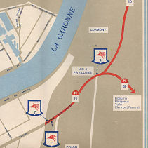
These four issues are all based on the Michelin sections 998/999 with Mobil card covers and overprinted to show Mobil locations. The first is from 1954, when the Michelin number was still just 99. The following year a new cover was needed with the new number. The 1958 edition shows the new logo and by 1963 a photo was used instead of a card cover, but the image of Notre Dame is more appropriate to France Nord! |
 |
 |
 |
 |
|
Michelin also published occasional maps of the areas around main cities with basic cartography. From left is an undated Mobilgas "Tablette du Tourisme" of the Nice-Cannes region, probably printed by Diffusex in the 1930s. It contains a rudimentary map, and opens out to a list of the main sights printed in French and English, with a bilingual list of Spécialités Gastronomiques on the back. The next map is a 1954 "Carte des Sorties de Bordeaux" (exits from Bordeaux; the reverse was described as a map of the Region of Bordeaux). Despite folding to the same size as the Michelin 998/999 maps above, these were produced by Blondel la Rougery and had disappointingly crude cartography, only marking Mobil stations prominently. No landmarks were shown, and only a few major streets named - the regional side failed even to include road numbers. The 1955 covers were the same, but a slightly more graphic design was used for 1956, as on the Marseilles example. It is not known how many city were covered, although Paris was also available.
|
|
In the mid 60s Mobil moved to sectional maps of tourist areas. Initially these shared a clear plastic folder with a Mobil branded 16 page tourist booklet. The Provence map dates from 1964 and the Cote d'Azur one from 1967. The front and rear maps covers were identical with neither indicating any connection with Mobil (a bit like the later Shell Cartoguides). Inside the maps, by IGN, were at the large scale of 1:250,000 and included a list of the Mobil sales locations in the area covered. |
|
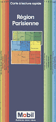
Finally there is a 1990 sectional Mobil map (Carte à lecture rapide) of the Région Parisienne. This was produced by Recta-Foldex (by then part of Kümmerley & Frey) using the QuickMap system widely used in Scandinavia at an even larger scale (1:150,000). | |||
This was complemented by four regional maps at 1:600,000 covering all of France. Additionally, Mobil sold a series of Cartes guides that did not quite cover all of France, concentrating on the main tourist regions. These looked almost identical (with a dark grey, not blue, main cover panel), but were at the larger scale of 1:250,000 with information on the reverse summarising the main tourist sights, regional history, gastronomy and an agenda of festivals.
CIP
The Cie Industrielle des Pétroles - Paris, initially sold petrol under the Motricine brand but after it was acquired by the US Mobilgas introduced a new supercarburant Pégase, to tie in with Mobilgas's flying horse, Pegasus. CIP also operated in North Africa, and it is thought that the name was replaced by Mobilgas in the late 1930s. |
|
|
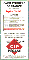
Both maps shown here apparently date from 1934, although the one on the left is thought to be a little earlier, as it does not mention Pégase. It was prepared by Blondel la Rougery at 1:1,000,000 and covered SW France, marking CIP stations with super-carburant in blue. The right map was based on the 1934 Michelin "Priorité" map of France and covered the South-East. Despite its Michelin base, it is described as being edited by, and was printed by, Gaston Maillet of St. Ouen. The front cover was basically just a simplified legend, but the map was in three colours with the location of CIP stations marked in red.
A later example looks very similar externally, but uses conventional Michelin cartography at the same scale, still locating CIP stations. |
|
Fully zoomable CIP Map of NE France
Please note that this feature may not be compatible with all browsers
The map above is the 1934 sectional map of NE France, and can be viewed down to the equivalent of 300dpi. Like the SE France above, it uses a Michelin base map at 1:1,000,000 and shows CIP locations with a red tick mark.
To zoom in or out use the + or - buttons, or the scroll wheel on your mouse. To pan the image, click anywhere on the map and drag with the mouse.
This map was scanned with the support of the Delft University of Technology (TU Delft).
Text and layout © Ian Byrne, 1999-2020
All original copyrights in logos and map extracts and images are acknowledged and images are included on this site for identification purposes only.


