ESSO
Esso Cruising and Navigation Guides
There is one known pre-war example for the roads and waterways in the area around Berlin; this is now shown on the Luftbildkarte page.
|
|
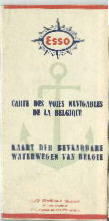
The "Cartes des voies navigable de la Belgique" shown left is the earliest known post-war European navigation guide from Esso. Undated, it comes from around 1950 based upon the number of oil refineries at Antwerp and the general style of the map (including an Esso logo in a compass rose). |
|
|
|
|
|
|
|
Four English Cruising guides from (L-R) ca 1953, ca1956, 1963 and 1965. The Norfolk Broads are wholly inland, but the Thames Estuary forms one end of a sequence of 4 guides along the English Channel, before a 5th turns up the Thames as far as Lechlade. The most westerly map is Land's End to Swanage, shown immediately left; uniquely on British maps this shows an Esso refuelling point - in Torbay. |
In 1965 Esso also issued a smaller scale map of the entire English Channel that included both the English South and French North coasts. Except for the Norfolk Broads map, they are only found in the smaller top fold format with black on blue line drawings. Norfolk Broads has five cover styles using two basic pictures, the first three of which are side folded and the earliest of which has slightly different cartography. A 1966 Esso brochure shows the six maps with the later white top/narrow red strip style of cover, but none have ever been found. If you have one, then please let me know!
|
|
|
|
|
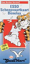
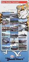
Left is a 1960 "scheepvaartkaart" of the Netherlands, at 1:387,000 from Topografische Dienst, marking all Esso bunkering locations and distinguishing navigation channels by maximum tonnage. |
|
|
Esso Bunker Maps
|
|
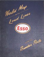
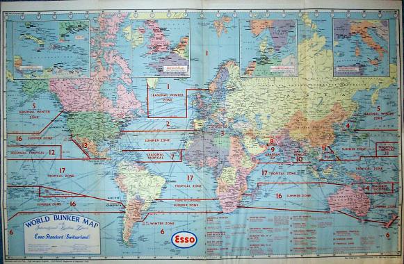
Shell and Esso have periodically produced world "bunker maps", showing locations where ocean-going ships can refuel. The Esso World Map with Load Lines shown here is not dated, but from the mid-1950s (so Ghana is still the Gold Coast). Produced by Geographia for Esso Standard (Switzerland), the map is backed by cloth and uses Mercator's projection. Ports with bunker facilities are in capitals, and those selling Essomarine lubricants are underlined in red. The map is pasted into a stiff blue card (leatherette) cover for durability, along with a booklet produced by Cook, Hammond & Kell that lists the ports with the same two facilities. The supplying company for bunker fuels is listed for most locations, not only where it is an Esso group company but sometimes for other suppliers, including Petroleos Mexicanos, Vacuum (Mobil) and Standard Oil of California. |
The next (and final) page of this Esso sequence looks at some of the other leaflets and brochures issued in the heyday of the Esso Touring Service.
Thanks to Michel Breugelmans for some of the images on this page.
Text and layout © Ian Byrne, 1999-2012
All original copyrights in logos and map extracts and images are acknowledged and images are included on this site for identification purposes only.



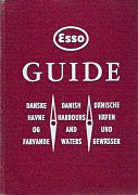
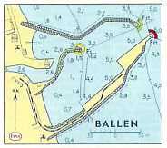 In 1964 Dansk Esso A/S published a 215 page hardback atlas of the waters around Denmark. After a lengthy introductory section, there are 41 pages of area maps, 143 pages of harbours of all sizes (such as the small port of Ballen, right) and many pages at the end covering everything from weather to radios, etc. All text is in Danish, English and German in triplicate on each page: for example the Ballen information notes that Esso gas-oil is available on the quay, but that in strong NE winds the outer harbour may become choppy.

