ESSO

Road Maps from Germany
Pre-1939 Road Maps
Esso appears to have started issuing sectional maps in Germany around 1930, when the first Standard maps were issued:
|
|
|
|
|
|

")
 map of Germany")


Deutsche-Amerikanische Petroleum was the local Standard company and it issued a series of 30 sectional "Luftbildkarten". All were printed on a semi-gloss paper, although only earlier editions have the white borders. Standard also issued a single sheet map of Germany (centre) with simpler clearer cartography.
By the late 1930s the Esso name took prominence over Standard (top centre right), and immediately before the second World War it was dropped in favour of Esso. This ca1939 sectional map (top right) showed how Austria has been incorporated following the Anschluß, with Czechoslovakia also within greater Germany. Pre-war cartography was generally by Bruckmann of Munich.
Pre=1939 maps are shown in greater detail, including a schema for dating the maps and the complete sectional map 1 from 1934 that can be zoomed and panned, on the page dedicated to Luftbildkarten.
Post war Esso maps to 1961
Esso appears to have started issuing maps of occupied Germany as early as 1949, possibly to help people visiting war graves.
|
|
|
|
|
|


In the late 1940s, Esso issued both small format sectional maps at 1:500,000 with slightly different cover images and a national map of Germany, showing the new boundaries without East Prussia, but identifying the Soviet zone of East Germany in the same manner as the three Allied zones. Cartography on these early post-war maps was still by F Bruckmann of München. The second map was also issued tucked into in a grey stiff paper folder, with a booklet listing all Esso diesel stations stapled to the folder. The map itself was overprinted in light blue to mark locations of towns and villages with diesel stations; towns already on the map were enclosed in a blue box, with smaller locations printed in the same blue.
A larger format series was issued for 1951 and kept for the first version of maps issued in 1952 (coded "j"). Sheet 1 has a busy scene in the Port of Hamburg: the ship (right) is the "Esso Baltic". The single sheet of Germany ("Fernfahrkarte") was used with both the later 1952 and 1953/4 series shown below. These are only credited to Esso AG, and are based upon General Drafting Co designs.
|
|
|
|
|
|


Later in 1952 (coded "t") a third series of covers was introduced, and the maps now bore a cover price of 25 pfennig. As before the maps were at a scale of 1:500,000.
|
|
|
The two Panorama maps (left) are undated but probably from around 1952/3 and were drawn by the usual team of Thiemig-Wenschow. The Hannover map (right) is dated 1956, but was probably first produced at much the same time based on the style. |
|


With the introduction of more common styles and standards in the early 1950s, Esso moved to a three section approach, sometimes augmented by more local maps, as well as a single map of Germany. Reducing overlaps required the slightly smaller scale of 1:550,000 to be used.
|
|
|
|
|
|
|
|
|
|
|
The nine images here cover all designs used from 1953 to 1960. The three on the top left date from 1953-4 and carry a price of 35pf and credit Thiemig-Wenschow with the cartography . The three designs to the right were used in 1955-7 and those on this row from 1958-60. Both sets are attributed to Kart Thiemig and General Drafting Co. Only the slogan on the bottom of the front cover changes with each year. |
||
|
|
|
|
|
|
|
")
")
")
")
")
")
")
")
")


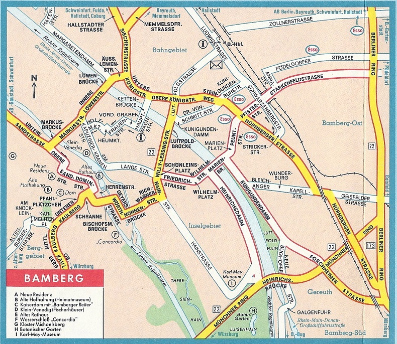
A small number of city maps, and a larger scale map of the Moselle Valley (Moseltal) with Trier, are known from 1958 (Frankfurt & München) or 1959 (Frankfurt, Hamburg, Hannover & Mosel). The Stuttgart map is undated and - as the extract shows - uses a non-standard cartography locating all Esso stations (which are also listed on the rear cover).
Stuttgart images courtesy Richard Horwitz.
|
|
|
|
|
|


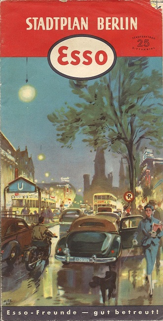
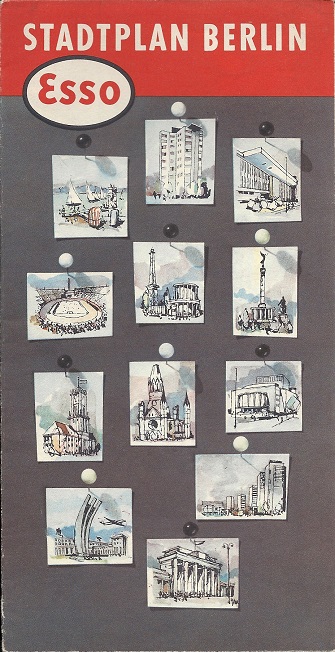
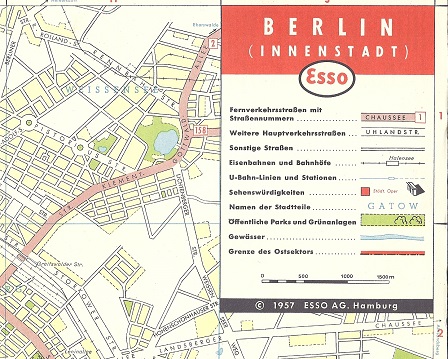
Esso's occasional maps of Berlin followed a slightly different pattern from the other cities and folded to a slightly larger size. Its first issue matches the 1952/3 sectional maps and contained a large plan of the city at around 1:30,000 backed by a smaller environs map, a route planning map showing the main links across the Soviet sector (East German) to the West, and an index to major streets and interesting sights in West Berlin. The next issue is the only one with a date (1957) and is broadly similar to the earlier one, but with a cover matching the Ruhr regional issue - the map extract is taken from this edition. By the early 1960s the format was much reduced in size. The final item is a curiosity: not a map at all, but a leaflet from the Esso Touring Service in Paris providing information on motoring to Berlin - the enlargement includes the English text page; there were also pages in German, Italian, French and Dutch.
ca1962 image courtesy Stan DeOrsey.
|
|
|
Each set also included a single sheet of Germany. For 1958 an additional sheet of the Ruhr industrial area was produced (near left), but at other times this backed on to the West sheet. The 1959 map (right) still showed pre-war boundaries on the rear, with red hatching used for areas under Soviet or Polish administration. |
|
|
|
|
|
The Esso Touring Service also produced German language versions of key items such as the planning map of Western Europe. As with the English version (and indeed, the sectional maps of Germany) it included a pictorial guide to Happy Motoring in Europe on the reverse. Oddly, only a small proportion of the landmarks shown had their descriptions translated from English into German. |
||||


Esso maps from 1961
|
Germany was not immune from the trend to replace scenic maps with plainer covers. At the same time as the cartographic style was updated, moving away from the General Drafting design to a more European look, again drawn by Karl Thiemig KG. Shown below left are typical sectional maps in the new style dating from 1961 (West) and 1970 (South). West Germany was again covered by five sheets at a scale of 1:500,000. The two panorama maps below left are from 1967 and 1966, and the simple cover design has been allowed to become a bit more pictorial. |
|
|


|
|
|
These cover the areas around Hamburg and the Black Forest (Schwarzwald) - other titles included the Frankfurt area and Ruhrgebiet. A large scale (typically 1:200,000) regular map was backed by a panorama map of the area - such as the extract (actual size) of the Freiburg area from the Schwarzwald map. |
|


|
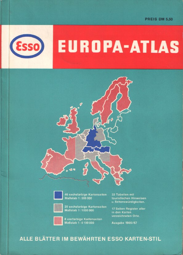
Esso also produced road atlases from the 1950s, initially in plain red plastic covers embossed with the Esso oval. Its 1966 atlas (enlarge cover) was sold for DM5,50 and billed as being of Europe, although the large scale maps at 1:500,000 only covered West Germany, Austria and Switzerland, with marginal descriptions of places of interest. Benelux, Eastern France, Northern Italy, Denmark and part of Yugoslavia were at an intermediate scale of 1:1 million, with the rest of Europe at the very small scale of 1:4.1 million (65 miles to the inch). Karl Thiemig produced most of the maps, although the small-scale ones were credited to Esso's US cartographer, General Drafting Co.
|
|

|
|
|
|


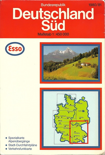
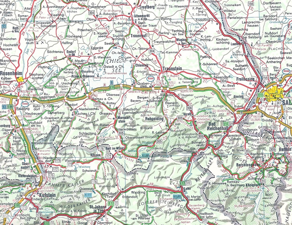
The three images above are all taken from what appears to have been the final bespoke series of maps for Esso, shown here in their 1980-1 edition. As before, there were four sections (N, W, SW and S) although the scale of the Southern map had increased slightly to 1:450,000. Cartography was still essentially that introduced in 1962 with its distinctive hill shading, but although Esso AG retained the copyright, the note stated (in translation) "Original cartography Karl Thiemig AG, Munich; Cartographic development Joh. Roth sel. Ww Munich; further driver and manufacture Hallwag AG Bern". The larger sheet size allowed for an increase to 11 town plans now spotted with Esso stations, as well as an Alpine pass map, two maps showing traffic radio frequencies, a map showing two routes bypassing Munich and three small maps showing access to the auto-rail loading points. However the earlier suggested tour maps were no longer part of the package. As well as the sectional maps, there was a series of seven national maps (including one of Austria).
|
The map shown right is a 1997 edition of Europe to a scale of 1:3,600,000. An Esso cover has been pasted onto a stock Hallwag map, but it is the rear cover that is most interesting. This contains a "Distoguide" which allows users to find the distances between major European centres by sliding in a mileage card. The actual kilometre figures are revealed in small holes in the cover at the appropriate location. Note also the Exxon logo on the top of the rear cover. As well as various European countries, Esso also sold sectional maps of the - now unified - Germany. |
|
|


|
|
|
|
|
")
")
")
")
In recent years Esso appears to have cut back on sheet maps, but instead to have occasionally issued softback atlases, sold for less than the price of a single sheet map. The examples here (L-R) date from 1996, 2000 and 2002, although the latter is undated: the map extract of the Freiburg area comes from the 1996 edition. All are at the traditional Esso map scale of 1:550,000 and mark service stations with a full list at the back. The latter two maps use essentially identical cartography, but it is credited to Ravenstein in 2000 and Carto Travel in 2002. No cartographer was named in 1996, which uses a slightly different style, and numbers the Esso locations as it lacks a grid on the maps. This version lacks a place name index and does not mark Esso stations in neighbouring countries; the more recent ones do so. The three atlases are of slightly different dimensions: the 1996 is smallest, but the 2002 atlas is 5mm narrower than the 2000 edition.
Esso Germany also produced regular issues of a summer travel guide (Reisebrevier) and intermittently sold phrase books. Examples of these can be found on the Esso touring page. The next page looks at maps from Italy.

Text and layout © Ian Byrne, 1999-2020
All original copyrights in logos and map extracts and images are acknowledged and images are included on this site for identification purposes only.