Petrol Company Road Maps from Algeria |
Algeria differs from its Maghreb neighbours in that it was officially an integral part of France from 1848 to 1962, although from 1954 suffered a bloody war of independence. This led to a much stronger form of nationalism, and a lower participation by multinational companies in all sectors after independence. Algeria's discovery of large gas and oil reserves in the 1950s and economic dependence on energy exports has also contributed to a strong desire to keep assets under state control: the oil industry was nationalised in 1971 and the state company Sonatrach remains the monopoly supplier of fuel.
All known petrol company maps relate to period before final independence from France.
Maps
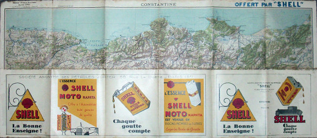
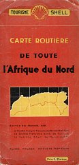
The earliest known maps were created by EPOC using high quality cartography by the (French) Service Géographique de l'Armée: it is one of the very few oil company sponsored maps to include contours as well as hill shading. The reverse carries a graphic six panel advert for Shell (SA des Pétroles JUPITER, Paris had the left 4 panels, and SA Française des Pétroles Shell, Alger the right two) on the reverse as well as advertising from other Société Generale and Dunlop. However Shell's sponsorship extended to giving away copies of the maps to the few Algerian motorists, as they state OFFERT PAR "SHELL" in bold letters above the map itself, and (in French) the statement "This map must not be sold". The example shown covers the Department of Constantine at 1:500,000, extending as far South as Biskra. The map is dated January 1930 and one panel lists the 10 similar tourist area maps of mainland France produced by EPOC in 1928&9. The link to mainland France is underlined by an advert for packet steamers - between Dieppe and Newhaven! It's likely that at least two versions exist: those overprinted for Shell, and ones for general sale, as I have a copy of the Alger section without the OFFERT PAR "SHELL" statement.
 |
 |
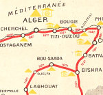 |
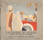
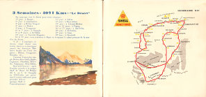
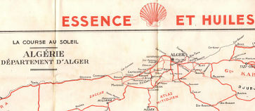 Shell's next effort was a guide to tourism in Algeria, called "La Course au Soleil", but sub-titled in English "How to Enjoy Algeria" although all text inside was in French. This was a small format booklet of 40 pages, printed in colour throughout on low quality thick paper. Undated, it probably comes from the mid-1930s, and does not go far enough South to determine whether the boundary with Libya follows its 1934 revision. Each double page consisted of a brief description of an itinerary, illustrated by Dormay, facing a simple map showing the route. It started with a half day trip of 61km to Sidi-Ferruch and back, but led up to Itinerary 16 - shown above, which was a 3 week tour into the desert covering some 4071km. This warned of the need to obtain authorisation from the local state military authorities. As can be seen from the map extract (above right), localities selling Shell fuels were marked by a yellow triangle. A slip pocket pasted to the rear cover contained 3 basic maps of the Départements of Alger, Constantine and Oran - right. These were printed on extremely thin paper and, as can be seen from the extract at the end of the page introduction, lacked details such as distances. The booklet included a bookmark on a blue cord advertising Shell oils and was sold for 20Fr.
|
Shell was a market leader across the Maghreb since the first filling stations were opened. This map from Foldex (France) SARL is dated 1938 and similar to those being sold by Shell's French operation at the time. It consisted of two sheets printed on thin paper, and glued and folded so as to open out into 10 folds. One sheet was dedicated to Algeria at 1:1,000,000; the other to Morocco (at a smaller scale) and Tunisia. Each sheet had inset maps, described as "cartouches", and showing the areas around the four main cities of Algiers, Oran, Casablanca, Rabat and Tunis (but not Tangiers) at a larger scale - 1:300,000 for Algeria, but 1:500,000 elsewhere. Although printed in France (and the copy shown here was sold in Britain for 5/-), the three Shell companies in the region were credited with having edited the map, to prove local knowledge. |
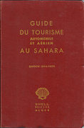
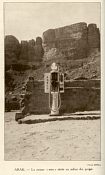
Shell also regularly sponsored a guide book in French with red board covers for automobile and air tourists visiting the Sahara. The earliest known version dates from the 1934-5 season, published on 30 September 1934, as the tourist season is of course winter. This had 136 pages and simple line maps of Saharan settlements and their air strips, as well as 32 photographs of points of interest or Shell desert pumps. By the 1938 edition it had grown to about 450 pages of maps of cities and airports and routes. Both had a pasted in Shell photo-map of the region. After the War, the guides continued in a very similar format, still produced by Shell (but lacking the logo on the cover). The 1955 edition had 345 pages, and a slip pocket in the rear cover containing Michelin map No. 152 Sahara. |
|
|
|
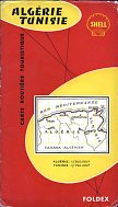
After the war Shell continued to sell maps created for it by Foldex, as in this 1957 map of Algeria and Tunisia. Algeria was at a slightly smaller scale 1:900,000 (vs 1:750,000), and there were larger scale inserts of the most populous region around each capital city. |
|
Adventurers continued to cross the Sahara in the period between the War and Algerian independence. Meeting the need for at least reasonably reliable information, the four Shell companies on either side of the Sahara (Algérie, l'Afrique Équatoriale, l'Afrique Occidentale & West Africa) jointly published a book of African Itineraries, probably in the mid-1950s from the design. Measuring approximately 325 by 240mm, it contained 25 pages of b/w strip maps, with a brief commentary on either side (French on the left, English on the right) indicating road conditions (including gutters) and track junctions, the availability of hotels, water and petrol, and notable sights. Distances were in both miles and kilometres and directions assumed travel was from North to South. The routes described started at Oran and Algiers, and ran South across the Sahara to Kano in Nigeria, from where a single route continued SE to Bangassou on the border of the Belgian Congo. |
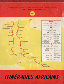 |
 Bambari - Bangassou from Shell Itineraries |
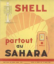
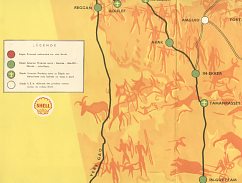
Shell produced a basic map of the main Sahara routes in 1959, which was updated in 1960 and 1961 (the edition shown here). It showed places in the desert where Shell or other fuels could be bought on a very simple map, against a background of cave paintings. |
|
|
|
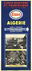
Esso was a significant player in the Algerian market prior to its nationalisation. The maps shown here date from 1948 (left) and 1956 respectively. The earlier map was locally printed, and credited to Editions Esso Alger, with cover photos of Oran and Constantine. It was at a scale of 1:1,500,000 and had insets maps of the Algiers environs and Sahara routes. The later map was printed in France by Blondel la Rougery, to designs created by General Drafting Co. One side had a map of the country at 1:1,800,000 with two insets for each Algiers and Oran to show both the town and environs. The reverse showed the three Maghreb countries at 1:4,000,000, including thumbnail sketches of main points of interest on the map. Motorists planning a journey in North Africa were advised to write to the Esso Touring Service in Paris for route information. The front cover shows a dry river bed, described as Bou Saada, La Rivière. |
|
|
BP and Mobil were also active in the Algerian market, with BP entering soon after the Second World War, and Mobil acquiring the CIP (Compagnie Industrielle des Pétroles de l'Afrique du Nord) interests. Both maps shown here are based on a Michelin edition and cover both Algeria and Tunisia; the Mobil map has reversible covers (with the other side shown on the Tunisia page). The Mobil map is dated 1958 and the BP map is from a couple of years later. |
|
|
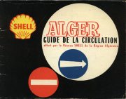
This booklet was published in 1961 by Alger-Guide and was the 37th edition of its guide to the city and surrounding area. Its 132 pages included addresses for many services and businesses, including lists of the Shell, Esso and Mobil service stations in the city and Department of Algiers. The three brands had 35, 49 and 45 outlets respectively. It contained two fold out maps, printed on thin paper and carrying numerous adverts (but not for petrol) - one a street plan of the city, and the other showing the environs at 1:200,000. |
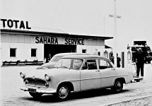
It is probable that the other international petrol companies, including Total (which had acquired the Société Algéienne des Pétroles Mory) and possibly earlier CIP would have issued road maps. Sonatrach may also have published maps after nationalisation. If you have a map from one of these companies, or could send me a scan of such a map, or - better still - the map itself, then please send me an e-mail! |
|
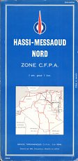
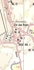
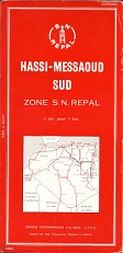
Total did publish a map of the Hassi-Messaoud oil field area with its joint venture partner SN Repal (Société nationale de recherche et d'exploitation de pétrole en Algérie). Dating from 1960, it shows oil pipelines as well as roads and wells. The cover for the Northern zone was blue for Total; the reverse side had a red cover for SN Repal, which became part of the UFP group in 1960 and subsequently part of Elf-Erap. |
|
|
|
Text and layout © Ian Byrne, 2006-16
All original copyrights in logos and map extracts and images are acknowledged and images are included on this site for identification purposes only.
