 The M1 on maps
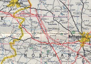
The M1 was opened over 50 years ago on 3rd November 1959. Initially it ran from North London to Crick; it was later extended North to Leeds and more recently the Northern end was diverted to meet the Great North Road near Micklefield. The M1 was not Britain's first official motorway; that distinction belongs to the Preston bypass opened a year earlier as the first part of the M6. But the M1 was the first intercity route, and although it was Britain's first motorway, it was opened more than 20 years after the first autobahns in Germany and autostrade in Italy.
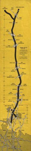
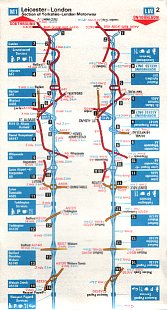
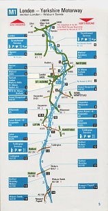
The Shell and BP maps
 |
|
Such a momentous event for British motorists could not pass unmarked by the petrol companies. Shell and BP each issued a strip map of the motorway, identical except for the covers. Both companies were represented at the first service areas, although they typically carried four or five brands, almost always including Shell and Esso. The map was prepared in co-operation with the two main civil contactors, John Laing & Son and Tarmac.
|
 | ||
 |
For an error on this map, see the errors page.
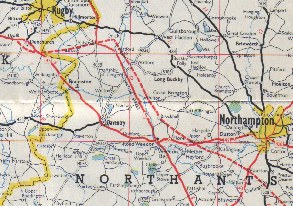
 Other maps
 |
 |
 |
 |
In 1975 Shell and BP both sold (for 36p) a book of British Motorways. The Shell example (far left) was slightly wider and taller, and had motorways marked twice - once for Northbound and once for Southbound travel, keeping them to a straight line. The booklet needed to be inverted to change directions. |
![]()

All original copyrights in logos and map extracts and images are acknowledged and images are included on this site for identification purposes only.