Esso Maps from the Nordic Countries

1950s Scenic Covers
Denmark and Norway
Denmark and Norway concentrated on photographic maps, which makes them marginally less attractive than the watercolours used in Finland and Sweden.

|
|
|
|
|

|
|
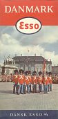
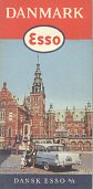
In 1955 Esso's Danish map showed the road/rail bridge across the Little Belt near Middelfart, and by 1957 it had switched to the changing of the Royal guard in Købnhavn (Copenhagen). An earlier map, probably from 1956, showed Fredriksborg Castle. |
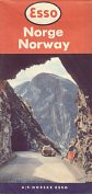
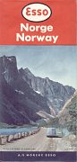
Reflecting the greater importance of tourists in Norway, these maps have the country name in both Norwegian and English. The map on the left comes from 1956 and the other one from 1959. Both maps are at 1:1,950,000. |
||||
Sweden and Finland
|
|

|

|
|
|
|
|
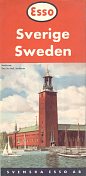
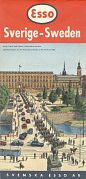
The first General Drafting Company based design (1953) for Sweden showed the Stockholm City Hall; by 1955 it had been replaced by the Royal Palace with the horse guards on Norrbro Bridge, and in 1957 the newly built Slussen cloverleaf with the old town of Stockholm behind. Unusually for any map cover, the scene depicted on the 1959 map (right) is not in the country covered by the map. It's a fountain for the Metropolitan Museum in New York, by the Swedish designer Carl Milles. Although all of Sweden is kept to one side of the map, the Northern half is drawn to a smaller scale than the South. |
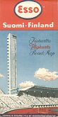
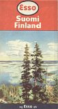
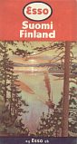
In 1952 Helsinki hosted the Olympic games, and this map from that year shows part of the Olympic stadium complex. The reverse of the map showed small plans for 50 towns, marking the location of Esso stations. Later issues showed typical Finnish country scenes as in these 1956 (left) and 1957 examples. All three maps were drawn for Esso by Maanmittaushallitus at a scale of 1:1,500,000, although the cover sizes vary slightly and the earliest map does not use General Drafting Co designs. |
|||||
Rear covers
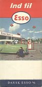
This website generally concentrates on the front covers and the maps inside. However Esso maps often have graphic rear covers, as evidenced below, with only those from Denmark keeping to photographs of Esso service stations.
 Denmark, 1956 |
 Norway, 1956 |
 Sweden, 1955 |
 Sweden, 1957 |
 Finland, 1957 |
..and the maps inside
Esso maps of the period were distinguished by a number of special features. Except for the 1952 Finland map, which predated the rigid standards imposed by the Esso touring Service, all were designed to a common pattern. One side was devoted to map of the country, using the graphic style developed for Esso by the General Drafting Co of New Jersey. The actual cartographer was sometimes a local company: Geodætisk Institut in Denmark or Maanmittaushallitus in Finland. In Norway, the credit is to Norsk Lithografisk only as the producer of the map, and in Sweden the only credits are for General Drafting Co and Svensk Esso itself.
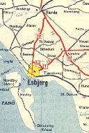
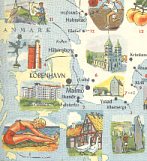
The rear comprised a large pictorial plan of the country, often keyed in to a list of places of interest, as well as larger scale maps of major cities and a small relief map of the country. The features on the pictorial plan could vary between editions: for example they were completely replaced between the 1957 and 1959 Swedish maps shown here. Only the non-standard 1952 map of Finland located Esso service stations, by showing them on 50 small town plans on the reverse.
 Denmark, 1957 |
 Sweden 1957 (75% scale) |
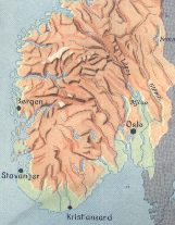 Norway, 1956 |
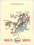 Jyväskylä, Finland, 1952 |
The next page looks at some scenic maps from Benelux and Switzerland.

Text and layout © Ian Byrne, 1999-2007
All original copyrights in logos and map extracts and images are acknowledged and images are included on this site for identification purposes only.